
Table of Contents
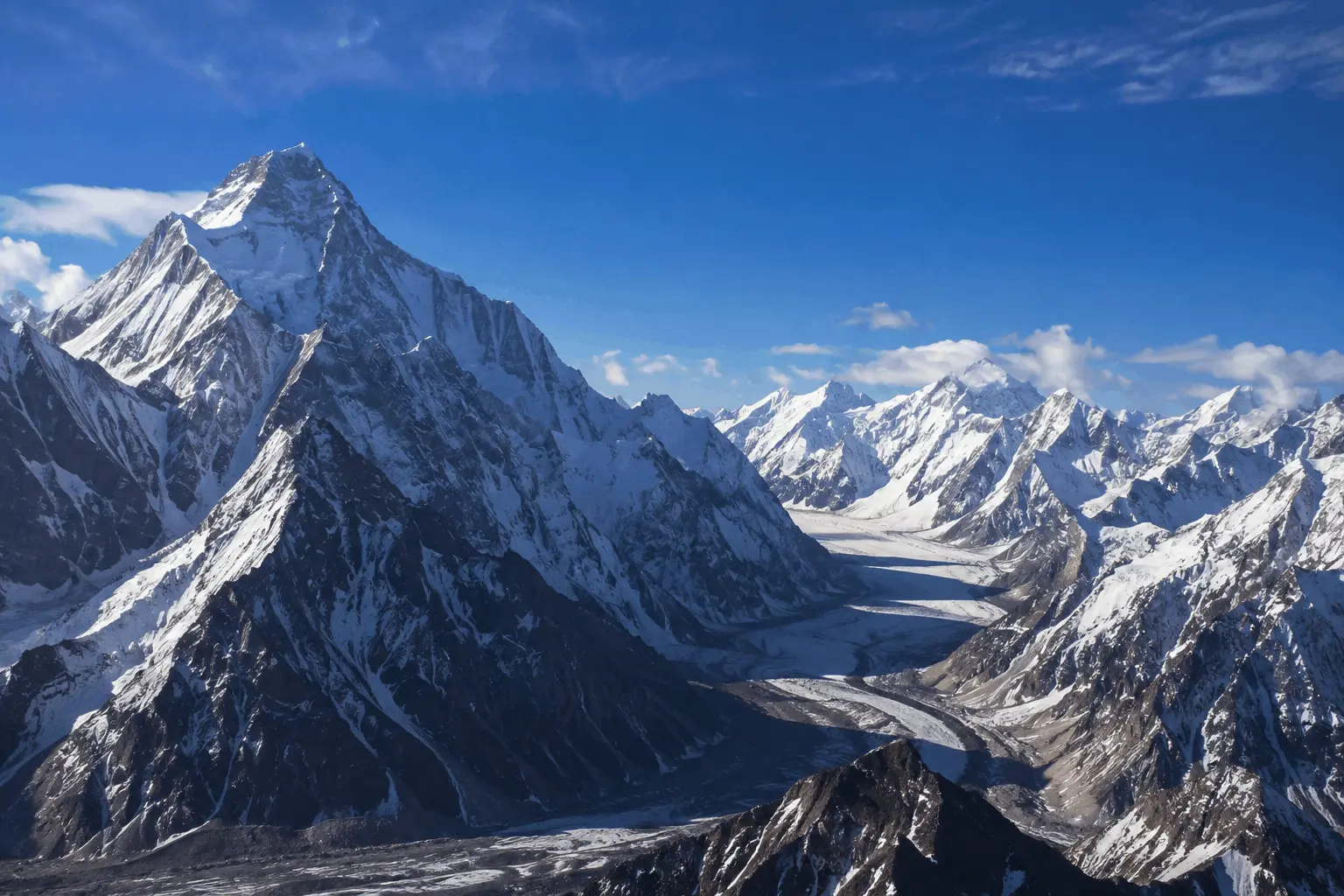
A mountain range peak is the highest point of a mountain within a larger connected system of mountains. The range is the entire chain, while a peak or summit is a specific high point within it. Mount Everest is a peak. The Himalayas are the mountain range it belongs to. Understanding that difference makes it much easier to answer questions about the world’s highest peaks and mountain ranges.
This guide explains what mountain range peaks are, how mountain ranges form, which peaks are the highest in the world, how the major mountain ranges compare, and why Pakistan is home to some of the planet’s most important high altitude mountains.
What Are Mountain Range Peaks?
A mountain range is a connected group of mountains that generally share geological history and formation processes. A peak, also called a summit, is a high point on an individual mountain.
A mountain range can contain dozens or even hundreds of named peaks. Usually, one peak is recognized as the highest point of the range.
The relationship is simple:
Mountain range → individual mountains → peaks or summits → highest peak of the range
For example, K2 is the highest peak of the Karakoram, while Mount Everest is the highest peak of the Himalayas. The mountain and the range are not the same thing. The mountain is an individual landform, while the range is the larger system containing many mountains.
There is one important complication. Geographers and mountaineers do not always agree on exactly where one mountain ends and another begins, especially when several summits share a ridge or belong to the same larger mountain mass.
The UIAA, the International Climbing and Mountaineering Federation, has acknowledged that the distinction between a mountain, a separate peak, a subsidiary summit and a minor point along a ridge can be debated. For the classic Eight Thousanders, however, the traditional list of 14 main summits remains widely recognized by the international mountaineering community.
What Is a Massif?
A massif is a compact group or block of mountains that can be treated as a distinct geographical or geological unit within a wider mountain system.
Mount Vinson, for example, is part of the Vinson Massif in Antarctica. The massif itself sits within the Sentinel Range of the Ellsworth Mountains.
This shows why mountain terminology can sometimes be more complicated than a simple list of highest peaks suggests.
Highest Peaks of Major Mountain Ranges

Different mountain ranges dominate different parts of the world. Each has a highest peak that provides a useful reference point for comparing mountain systems.
| Mountain Range | Region | Highest Peak | Elevation | Country or Area |
|---|---|---|---|---|
| Himalayas | Asia | Mount Everest | 8,848.86 m | Nepal and China |
| Karakoram | Asia | K2 | 8,611 m | Pakistan and China |
| Hindu Kush | Central and South Asia | Tirich Mir | about 7,690 m | Pakistan |
| Pamir | Central Asia | Ismoil Somoni Peak | about 7,495 m | Tajikistan |
| Tian Shan | Central Asia | Jengish Chokusu | about 7,439 m | Kyrgyzstan and China |
| Andes | South America | Aconcagua | about 6,961 m | Argentina |
| Alaska Range | North America | Denali | 6,190 m | United States |
| Caucasus | Europe and Asia | Mount Elbrus | 5,642 m | Russia |
| Alps | Europe | Mont Blanc | about 4,810 m | France and Italy |
| Rocky Mountains | North America | Mount Elbert | 4,401 m | United States |
| Atlas Mountains | Africa | Toubkal | about 4,167 m | Morocco |
| Appalachian Mountains | North America | Mount Mitchell | 2,037 m | United States |
The table shows a clear pattern. The world’s tallest mountain peaks are heavily concentrated in Asia, particularly around the Himalaya and Karakoram region.
That concentration is the result of the region’s unusual tectonic history.
World’s 10 Highest Mountain Peaks
The previous table compared the highest peak of different mountain ranges. This table answers a different question: Which individual mountain peaks are the highest on Earth?
| Rank | Peak | Elevation | Mountain Range |
|---|---|---|---|
| 1 | Mount Everest | 8,848.86 m | Himalayas |
| 2 | K2 | 8,611 m | Karakoram |
| 3 | Kangchenjunga | 8,586 m | Himalayas |
| 4 | Lhotse | 8,516 m | Himalayas |
| 5 | Makalu | 8,485 m | Himalayas |
| 6 | Cho Oyu | about 8,188 m | Himalayas |
| 7 | Dhaulagiri I | 8,167 m | Himalayas |
| 8 | Manaslu | 8,163 m | Himalayas |
| 9 | Nanga Parbat | about 8,126 m | Himalayas |
| 10 | Annapurna I | about 8,091 m | Himalayas |
Nine of the world’s ten highest peaks are associated with the Himalayas, while K2 is the only Karakoram peak in the top ten.
Small differences in reported elevations can appear between sources because different surveys and datasets may use different measurements. These differences normally do not affect the overall ranking.
How Mountain Ranges Form

Mountain ranges form through powerful geological processes that operate over millions of years.
Continental Collision
Continental collision occurs when two continental plates move toward each other. Because continental crust is relatively buoyant, it does not simply sink beneath the other plate. Instead, the crust is compressed, folded and pushed upward.
This is the main process behind the formation of the Himalayas.
The Indian Plate collided with the Eurasian Plate roughly 40 to 50 million years ago. The collision continues today and remains responsible for major geological activity across the region. The US Geological Survey describes the Himalayas as a major expression of this continental collision.
Subduction
Subduction occurs when one tectonic plate moves beneath another plate. This process can produce earthquakes, volcanic activity and mountain building.
The Andes are strongly associated with this type of tectonic setting.
Volcanic Activity
Some mountains form when magma rises from inside the Earth and reaches the surface. Repeated eruptions can build large volcanic mountains over time.
Mount Fuji and Mount Kilimanjaro are examples of famous volcanic mountains.
Erosion and Glaciation
Mountain building does not end when tectonic uplift slows down.
Rivers, glaciers, wind and weather continuously reshape mountains. Glaciers can carve valleys, while rivers cut deeply into the surrounding landscape.
This means that the height and shape of a mountain are the result of both uplift and erosion working over very long periods.
Why Are So Many of the Highest Peaks in the Himalaya and Karakoram Region?
The concentration of extremely high mountain peaks in this region is not accidental.
The Indian and Eurasian plates continue to converge. US Geological Survey research places their relative convergence at roughly 40 to 50 millimeters per year in the Himalaya region. The collision has continued for tens of millions of years, producing major uplift and deformation across the region.
The result is an enormous high altitude mountain system containing the Himalayas, Karakoram and neighboring ranges.
This combination of long term continental collision, continuing tectonic activity and erosion has helped create one of the greatest concentrations of extremely high mountains on Earth.
The 14 Eight Thousanders

The Eight Thousanders are the 14 classic independent mountains recognized by the international mountaineering community as rising above 8,000 meters.
The UIAA officially supports recognition of the classic 14 peaks while also acknowledging continuing discussion about what should count as a separate mountain or peak. The 14 classic mountains are located in the Himalayan and Karakoram regions.
The table above showed the world’s ten highest peaks. The table below completes the full set of 14 Eight Thousanders.
| Rank | Peak | Elevation | Range | Country or Region |
|---|---|---|---|---|
| 1 | Everest | 8,848.86 m | Himalayas | Nepal and China |
| 2 | K2 | 8,611 m | Karakoram | Pakistan and China |
| 3 | Kangchenjunga | 8,586 m | Himalayas | Nepal and India |
| 4 | Lhotse | 8,516 m | Himalayas | Nepal and China |
| 5 | Makalu | 8,485 m | Himalayas | Nepal and China |
| 6 | Cho Oyu | about 8,188 m | Himalayas | Nepal and China |
| 7 | Dhaulagiri I | 8,167 m | Himalayas | Nepal |
| 8 | Manaslu | 8,163 m | Himalayas | Nepal |
| 9 | Nanga Parbat | about 8,126 m | Himalayas | Pakistan |
| 10 | Annapurna I | about 8,091 m | Himalayas | Nepal |
| 11 | Gasherbrum I | about 8,080 m | Karakoram | Pakistan and China |
| 12 | Broad Peak | about 8,051 m | Karakoram | Pakistan and China |
| 13 | Gasherbrum II | about 8,035 m | Karakoram | Pakistan and China |
| 14 | Shishapangma | about 8,027 m | Himalayas | China |
All 14 classic Eight Thousanders are in the Himalayan and Karakoram regions. The UIAA recognizes these 14 as the traditional group, while noting that debates about additional summits and mountain definitions continue.
Who Was the First Person to Climb All 14 Eight Thousanders?
Italian mountaineer Reinhold Messner became the first person to climb all 14 Eight Thousanders, completing the achievement in 1986.
The feat remains one of the defining achievements in high altitude mountaineering.
In 2023, Kristin Harila and Tenjen Lama Sherpa completed all 14 true summits in 92 days. Guinness World Records records the 92 day achievement for both climbers.
Major Mountain Range Peaks in Pakistan

Pakistan has an exceptional concentration of high mountains in its northern regions.
The country’s mountain geography includes the Karakoram, western Himalaya and Hindu Kush, with these major mountain systems meeting across the broader northern Pakistan region.
For Trekkers.pk, this is particularly important because Pakistan is home to some of the world’s highest and most technically demanding mountain peaks.
Karakoram
The Karakoram is one of the world’s great high mountain systems and extends across Pakistan, China and India.
Its highest peak is K2, which rises to 8,611 meters and ranks as the world’s second highest mountain.
The Karakoram also contains several other major peaks, including Gasherbrum I, Gasherbrum II, Gasherbrum III, Gasherbrum IV, Distaghil Sar and Kunyang Chhish.
Western Himalaya
The western Himalaya extends into northern Pakistan.
Its most famous giant is Nanga Parbat, which rises to about 8,126 meters.
Nanga Parbat is widely known as the Killer Mountain, a nickname associated with its difficult and dangerous climbing history. Better equipment, route knowledge and forecasting have improved modern climbing conditions, but Nanga Parbat remains a serious high altitude mountain.
Hindu Kush
Tirich Mir, at about 7,690 meters, is the highest peak of the Hindu Kush.
It is one of the highest mountains outside the Himalayan and Karakoram region and dominates the mountain landscape of northern Pakistan.
Pakistan’s Five Eight Thousanders

Pakistan is associated with five of the world’s 14 classic Eight Thousanders. The UIAA describes these as five peaks in Pakistan or on the border with China.
They are:
- K2: 8,611 m, Karakoram
- Nanga Parbat: about 8,126 m, western Himalaya
- Gasherbrum I: about 8,080 m, Karakoram
- Broad Peak: about 8,051 m, Karakoram
- Gasherbrum II: about 8,035 m, Karakoram
That is more than one third of the world’s classic Eight Thousanders.
Pakistan’s northern mountains also contain many major peaks below 8,000 meters, including Rakaposhi, Masherbrum, Distaghil Sar and Kunyang Chhish.
This concentration of high altitude terrain is one of the reasons northern Pakistan is such an important region for mountaineering and high altitude trekking.
How Mountain Height Is Measured

When people ask which mountain is the tallest, they may not always be talking about the same measurement.
There are three important ways to think about mountain height.
Elevation
Elevation is the height of a summit above sea level.
This is the standard measurement used when ranking the world’s highest mountains. By this measurement, Mount Everest is the highest mountain on Earth at 8,848.86 meters.
Topographic Prominence
Topographic prominence measures how independently a peak rises above the surrounding landscape.
A peak can have a very high elevation but relatively low prominence if it is closely connected to a higher mountain.
Prominence is therefore useful when deciding whether a summit should be considered an independent mountain rather than a subsidiary summit.
Base to Summit Height
Base to summit height measures the vertical distance from the base of a mountain to its summit.
This measurement becomes especially interesting when the mountain begins below sea level.
Is Mauna Kea Taller Than Mount Everest?
Yes, if you measure from the ocean floor to the summit.
No, if you measure elevation above sea level.
The U.S. Geological Survey gives Mauna Kea a summit elevation of about 4,207 meters above sea level. USGS also states that Mauna Kea extends roughly 6,000 meters below sea level and has a total height of nearly 10,211 meters from its ocean floor base to its summit.
That makes Mauna Kea taller than Everest when measured from base to summit.
However, Everest remains the highest mountain above sea level, which is the standard measurement used for global mountain rankings.
So both statements can be correct:
Everest is higher above sea level.
Mauna Kea is taller from base to summit.
They simply use different measurements.
The Seven Summits
The Seven Summits are the highest peaks on the world’s seven continents.
The challenge became especially well known through mountaineering during the 1980s.
| Continent | Highest Peak | Elevation |
|---|---|---|
| Asia | Mount Everest | 8,848.86 m |
| South America | Aconcagua | about 6,961 m |
| North America | Denali | 6,190 m |
| Africa | Kilimanjaro | 5,895 m |
| Europe | Mount Elbrus | 5,642 m |
| Antarctica | Mount Vinson | 4,892 m |
| Oceania | Puncak Jaya or Mount Kosciuszko | 4,884 m or 2,228 m |
Why Is Oceania Different?
The Oceania entry depends on how the continent is defined.
Some Seven Summits lists use Puncak Jaya, also known as Carstensz Pyramid, in Indonesia. Others use Mount Kosciuszko in Australia.
The difference comes from the geographical convention being used rather than a simple disagreement about which mountain is higher.
For mountaineers following the classic Messner style list, Puncak Jaya is generally the mountain used for Oceania. Some other versions use Kosciuszko because it is the highest point of mainland Australia.
Everest vs K2

Everest and K2 are often compared because they are the world’s two highest mountains.
But elevation is not the only difference between them.
| Feature | Everest | K2 |
|---|---|---|
| Elevation | 8,848.86 m | 8,611 m |
| Range | Himalayas | Karakoram |
| Region | Nepal and China | Pakistan and China |
| Global rank | 1st | 2nd |
| Climbing reputation | Extremely demanding and heavily climbed | Widely regarded as technically harder and more dangerous |
| Eight Thousander | Yes | Yes |
K2 has steeper terrain and a reputation for more technical climbing. Its weather can also be extremely challenging.
Everest is higher, but higher does not automatically mean harder to climb.
That distinction is one of the most useful lessons when comparing mountain range peaks.
Famous Mountain Peaks Around the World
Height is not the only reason a mountain becomes famous.
Mount Fuji in Japan is famous for its symmetrical volcanic shape and cultural importance.
The Matterhorn on the Swiss Italian border is one of the most recognizable peaks in the Alps because of its sharp pyramid like form.
Denali is the highest peak in North America and dominates the Alaska Range.
Kilimanjaro is Africa’s highest peak and is famous for its isolated volcanic form.
These mountains show that a peak can become globally famous because of its shape, history, culture or climbing importance, not simply because it is among the highest mountains in the world.
Frequently Asked Questions
What is a mountain range peak?
A mountain range peak is a recognized high point of a mountain within a larger connected mountain range. A range contains many mountains and peaks, while one peak is generally recognized as its highest point.
What is the difference between a mountain and a mountain range?
A mountain is an individual elevated landform. A mountain range is a connected group or system of mountains.
What is the highest mountain range in the world?
There is no single answer because “highest mountain range” can mean different things. The Himalayas contain the highest peak on Earth, Mount Everest. The Himalaya and Karakoram region also contains the greatest concentration of extremely high peaks.
What are the 14 Eight Thousanders?
They are the classic 14 independent mountains above 8,000 meters recognized by the international mountaineering community. The UIAA continues to recognize these traditional 14 while acknowledging ongoing debate about the definition of separate peaks.
How many of the 14 peaks are in Pakistan?
Five of the classic 14 Eight Thousanders are in Pakistan or on the Pakistan China border: K2, Nanga Parbat, Gasherbrum I, Broad Peak and Gasherbrum II.
Which peak is called Killer Mountain?
Nanga Parbat is commonly known as the Killer Mountain because of its difficult and dangerous climbing history.
What are the major mountain ranges in Pakistan?
The major high mountain systems associated with northern Pakistan include the Karakoram, western Himalaya and Hindu Kush.
Is Mauna Kea taller than Mount Everest?
It depends on the measurement. Mauna Kea is taller when measured from its base on the ocean floor to its summit. Everest is higher when measured by elevation above sea level. USGS gives Mauna Kea a total base to summit height of nearly 10,211 meters.
What is topographic prominence?
Topographic prominence measures how independently a peak rises above the surrounding landscape. It is different from elevation, which measures height above sea level.
What is the second highest mountain in the world?
K2 is the world’s second highest mountain, with an elevation of 8,611 meters. It is located in the Karakoram on the Pakistan China border.
What are the Seven Summits?
The Seven Summits are the highest peaks on the seven continents. They are Mount Everest, Aconcagua, Denali, Kilimanjaro, Mount Elbrus, Mount Vinson and either Puncak Jaya or Mount Kosciuszko depending on the geographical convention.


This Post Has 13 Comments