
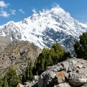
Nanga Parbat View Point at Talechi: Route & Best Time
Nanga Parbat View Point is a free roadside stop at Talechi (also spelled Thalichi) on the Karakoram Highway (KKH) in Diamer, Gilgit Baltistan. It lies between Raikot…

What Country Is K2 In? Pakistan or China?
K2 stands on the border between Pakistan and China, in the Karakoram Range. Its southern and western slopes fall in Gilgit Baltistan, Pakistan, while its northern side…
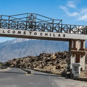
Chilas Pakistan Travel Guide: Places to Visit, Routes & Tips
Chilas is the headquarters of Diamer District in Gilgit Baltistan, a hot, dry town on the left bank of the Indus River along the Karakoram Highway (KKH)….

Best Hiking Trails in Pakistan (2026): 20 Hikes & Treks
Pakistan packs an unusual range of hiking into one country: forested day hikes above Islamabad, alpine lake hikes in Azad Kashmir, and multi week expedition treks toward…

Passu Cones, Hunza: Height, Location & 2026 Travel Guide
The Passu Cones are a row of jagged limestone peaks, shaped like sharp needles, rising above Passu village in Upper Hunza, Gilgit Baltistan. They reach an elevation…

Best Mountains to Visit in Pakistan: Complete 2026 Guide
Best Mountains to Visit in Pakistan Pakistan holds five of the fourteen traditionally recognized peaks above eight thousand meters, along with a large number of additional peaks…

Siran Valley Travel Guide 2026: Places, Weather, Route & Things to Do
Siran Valley sits in the Pakhli region of Mansehra District, Khyber Pakhtunkhwa, roughly 170 to 190 kilometers from Islamabad to its main entry points and about four…

Kumrat Valley Travel Guide 2026: Routes, Road Conditions, Costs & What to Know Before You Go
Kumrat Valley is a forested mountain valley in Upper Dir District, Khyber Pakhtunkhwa, known for its deodar forests, the Panjkora River, Kumrat Waterfall, Kala Chashma, Do Janga,…

Malam Jabba Travel Guide 2026: Ski Resort, Weather, Hotels, Activities & Prices
Malam Jabba combines snowy mountain scenery, an 800 meter ski slope and a year round chairlift in the hills of Swat. This guide covers the latest 2026…