
Table of Contents
Siran Valley sits in the Pakhli region of Mansehra District, Khyber Pakhtunkhwa, roughly 170 to 190 kilometers from Islamabad to its main entry points and about four to five hours by road. It’s a river valley of pine forests, high alpine meadows, and 4,000-meter peaks that sees far fewer visitors than Naran or Murree, mainly because the roads get rougher the deeper you go and the tourism infrastructure is still thin.
That’s also its appeal. If you want green meadows and mountain views without shoulder-to-shoulder crowds, this guide covers exactly what you need: how to get there, when to go, which places are worth the detour, and what to expect once you’re off the paved road.
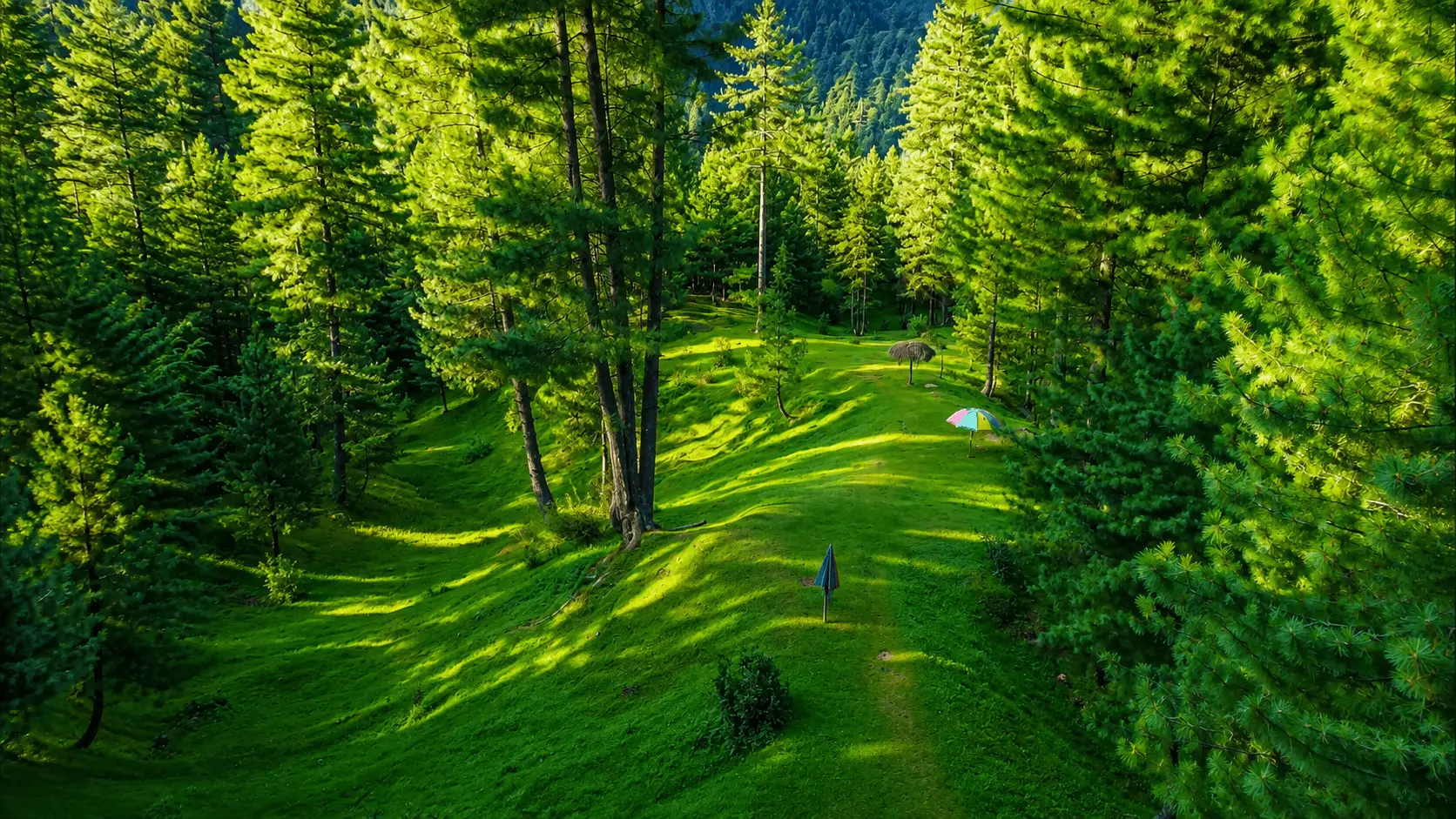
[IMAGE: Siran Valley landscape — suggested alt text: Siran Valley landscape in Mansehra, Khyber Pakhtunkhwa]
Siran Valley at a Glance
| Detail | Information |
|---|---|
| Location | Pakhli region, Hazara Division, Khyber Pakhtunkhwa, Pakistan |
| District | Mansehra |
| Region | Hazara Division, near the border with Kaghan Valley |
| Main river | Siran River, which originates near the Manda Gucha Glacier and joins the Indus near Tarbela Dam |
| Main gateway/access | Shinkiari, then onward through Jabori, Dadar, or Sachan |
| Famous trekking peak | Musa Ka Musalla (the valley’s best-known trek; Churko Peak is the highest point) |
| Best for | Trekking, camping, meadows, and quiet mountain scenery away from crowds |
| Best trekking season | July to September |
| Road access | Paved to Shinkiari and the lower valley; gravel, dirt, and 4×4-recommended past Jabori toward Mundi and the upper meadows |
Where Is Siran Valley Located?
Siran Valley lies in the Hazara Division of Khyber Pakhtunkhwa, within Mansehra District. It takes its name from the Siran River, which originates near the Manda Gucha Glacier (also spelled Mandagucha) in the valley’s upper reaches and eventually joins the Indus River near Tarbela Dam. The valley itself stretches from lower villages near Shinkiari up into high-altitude meadows and glacial terrain close to the border with Kaghan Valley.
A few clarifications worth making, since online searches often blur this:
- Siran Valley is not “in” Abbottabad. It’s accessed via Mansehra, though some travelers approach through routes associated with Abbottabad district. Treat any “Siran Valley Abbottabad” search result as a regional reference, not a location claim.
- It’s geographically close to Kaghan Valley but functions as a separate valley, the two are divided by mountain ridges. Musa Ka Musalla, Siran’s best-known trekking peak, sits right at the junction between the two, which is one reason the valleys get grouped together in travel searches.
- Upper Siran Valley refers to the higher meadows and trekking zones Mundi, Baleja, Khandagali, and the approach to Musa Ka Musalla as opposed to the lower villages closer to Shinkiari and Jabori.
Siran Valley Map and Location
Siran Valley isn’t a single destination you can pin on a map, it’s a corridor that runs roughly northeast from Shinkiari, following the Siran River up through Jabori, Dadar, and Sachan in the lower valley, then continuing through Manda Gucha into the higher meadows and trekking zones near the Kaghan Valley border.

For orientation: Mansehra city is the nearest major town and the reference point most route directions use. Shinkiari, just outside Mansehra, is where the road toward Siran Valley branches off the main Hazara Motorway corridor. From there, the valley opens up village by village as you head deeper in, with the terrain and the road quality changing considerably between the lower and upper sections.
If you’re mapping your own route, search for Shinkiari or Jabori as your entry point rather than “Siran Valley” directly, since map services don’t always center on a single coordinate for the valley.
How to Reach Siran Valley from Islamabad, Mansehra and Abbottabad
From Islamabad, the standard route runs: Islamabad → Hazara Motorway (M-15) → exit near Mansehra → Shinkiari → valley entry points such as Jabori, Dadar, or Sachan. The distance to these entry points is approximately 170 to 190 km, and the drive typically takes four to five hours depending on traffic and your final destination inside the valley. Reaching further points such as Manda Gucha adds extra distance and time on top of this.
From Mansehra city, it’s a shorter run, around 40 to 60 km depending on which part of the valley you’re heading to, since Siran Valley isn’t a single point but a corridor of villages and meadows stretching well into the mountains.
From Abbottabad, you’d join the same route through Mansehra rather than taking a direct road, since Abbottabad and Siran Valley aren’t directly connected by highway.
Road conditions vary sharply depending on how far into the valley you’re going, see Siran Valley Road Conditions and 4×4 Requirements below for the full picture before you plan your route.

Approximate distances to Siran Valley access points and destinations:
| Starting Point | Approx. Distance | Travel Time | Route Notes |
|---|---|---|---|
| Islamabad | ~170 – 190 km | 4 – 5 hrs | Via M-15 Hazara Motorway, exit near Mansehra |
| Mansehra | ~40 – 60 km | 1.5 – 2.5 hrs | Depends on destination inside the valley |
| Abbottabad | ~90 – 110 km | 2.5 – 3.5 hrs | Route joins via Mansehra |
| Shinkiari | ~15 – 40 km | 30 min – 1.5 hrs | Entry point for most valley destinations |
Since Siran Valley spans everything from roadside villages to high meadows near Manda Gucha, treat these figures as a starting range rather than a fixed number, your actual distance depends on exactly where inside the valley you’re headed.
A practical note echoed by nearly every recent traveler account: aim to be back at your entry point before dark. Mountain roads here have no lighting, and the last stretch out of the valley is not something you want to navigate at night in unfamiliar terrain.
Best Time to Visit Siran Valley
There’s no bad season for Siran Valley, but each one changes what you’ll actually get to do.
Spring (March – May) brings the meadows to life. Wildflowers spread across Khandagali and the higher galis, snowmelt feeds the river, and the whole valley turns a deep green. It’s arguably the best window for photography, though upper trekking routes may still hold snow into April.
Summer (June – August) is peak trekking season. Days are cool relative to the plains, trails are clear, and this is when most Musa Ka Musalla and Churko Peak attempts happen. It’s also the busiest period, so expect more traffic on weekends.
Autumn (September – October) shifts the forests to gold and brings crisp, clear air good for long-distance mountain views but with a shorter daylight window for hikes.
Winter (November – February) brings heavy snowfall to the upper valley. Lower villages remain accessible, but roads toward Mundi and the meadows become difficult or impassable without proper winter gear, and trekking routes are only realistic for experienced, well-equipped groups. Temperatures at altitude regularly drop below freezing.
If your priority is straightforward sightseeing by car, April through October is the reliable window. If trekking is the goal, July through September gives you the most stable trail conditions. These are general seasonal patterns, not a forecast. Before traveling, check the latest weather warnings and forecasts from the Pakistan Meteorological Department (PMD), especially if you’re planning to enter the upper valley or undertake a high-altitude trek.
Best Places to Visit in Siran Valley
Jabori
The largest market town inside the valley and the practical gateway for most travelers. This is where you’ll find the biggest bazaar, basic groceries, and the last reliable point to stock up before roads get rougher further in.
Mundi and Mundi Meadows

A central hub for the upper valley, Mundi serves as both a scenic stop and the base camp many trekkers use before heading toward Musa Ka Musalla. Surrounded by pine forest, it’s one of the more accessible high meadows and a popular overnight camping spot.
Baleja Meadows
Also referred to as Paleja Meadows in some sources, this is one of the quieter, more remote pastures in the upper valley — wide open grassland, shepherd huts, and minimal infrastructure. It rewards travelers willing to camp overnight rather than day-trip.
Khandagali -The Valley of Flowers
Sitting in the upper valley, Khandagali earns its nickname during spring and early summer when wildflowers, including geraniums, blanket the meadow. It combines forest and open pasture in a single stretch, making it a favorite for both casual visitors and photographers.
Aram Gali
At roughly 11,000 feet, Aram Gali the name is generally translated as “place of rest” offers sweeping mountain views. Traveler accounts consistently describe the area as calm, with locals known for their hospitality toward passing trekkers. It sits along the route many groups take toward Khanda Peak.
Sachan and the Siran River Viewpoints

Also spelled Sachan or Suchan in different sources, this stretch sits closer to the road than most valley attractions and requires no hiking to reach. Traveler accounts describe a wooden footbridge, shaded riverside ground suitable for a picnic, and at some points along the river old water-powered stone mills still standing on the bank, a small but genuine piece of local history worth pausing for.
Manda Gucha
Also spelled Mandagucha or Munda Gucha, this is the last point most vehicles can reach before trekking begins. It functions as the practical trailhead for routes into Jacha, Dhor, and onward toward Musa Ka Musalla, and it’s also where most jeep hires happen if you’re heading further up.
Shazaib Lake

A small lake near Kolegah village, in the lower valley close to Shinkiari, closer to the road than most of the upper-valley attractions on this list, which makes it more realistic for a day trip than the higher meadows. It’s a newer name on the Siran Valley tourism map compared to long-established stops like Sachan or Jabori, and detailed, verified information on trail length and facilities is still limited. If you’re planning to include it, it’s worth confirming current access and road conditions locally before you go, especially outside the main travel season.

Villages and Areas of Siran Valley
Beyond the named attractions, the valley is dotted with settlements worth knowing about if you’re planning a longer stay:
- Dadar: One of the more established bases in the lower valley, with a small cluster of basic guest houses. Several tour operators use it as a staging point before heading further up the valley.
- Bhogarmang: Historically significant: the valley was originally known as Dara Bhogarmang, after this village, before the name Siran (from the river) took over in later writing. It’s centrally located and functions more as a residential union council than a tourist stop.
- Sacha Kalan: One of the valley’s main union councils, referenced in official and geographic sources alongside Jabori and Bhogarmang, though it isn’t a developed tourist destination.
- Sum and Domail: Smaller villages along the route deeper into the valley, useful as waypoints rather than standalone stops.
These villages aren’t tourist attractions in themselves, but they’re where you’ll find guest houses, small restaurants, and the local guides who make trekking into the upper meadows considerably easier.
Things to Do in Siran Valley
Hiking and trekking dominate the valley’s appeal, ranging from easy walks around Sachan and Mundi to multi-day treks toward the high peaks. Trail difficulty varies enormously depending on how far up you go, so match your route to your fitness level rather than assuming every path is a casual walk.

Camping is arguably the best way to experience Siran Valley properly. Meadows like Khandagali, Mundi, and Baleja offer dark skies and quiet nights. Bring your own gear, since rental options inside the valley are limited to none.
Photography benefits from the valley’s mix of river, forest, and open meadow within short distances of each other. Photographers who’ve documented the valley tend to favor early morning light along the river near Sachan and late-afternoon views from the higher galis, though conditions vary by season and weather.
Picnicking and river time near accessible points like Sachan or the roadside stretches near Jabori work well for families who want the scenery without the hike. Several of these spots have shaded riverside ground and basic seating, based on traveler accounts.
One practical warning that comes up repeatedly in recent traveler accounts: litter is becoming a visible problem at popular riverside stops. If you’re bringing food and supplies in, plan to carry your waste back out there’s no collection infrastructure once you’re past the main bazaars.
Musa Ka Musalla and Other Trekking Peaks
Musa Ka Musalla
The valley’s most well-known trekking destination, Musa Ka Musalla stands at roughly 4,080 to 4,100 meters, with slightly different figures appearing across sources. It’s the second-highest peak in the Siran Valley system. Its name “Musa’s prayer mat” comes from a local legend about a shepherd who prayed at the summit. A shrine there is still considered spiritually significant by residents of the area. On clear days, the summit ridge offers views toward Kohistan, Kaghan, Kashmir, and occasionally Nanga Parbat.
The common approach runs through Manda Gucha to Jacha, then on to Dhor and Khori before the final push toward the base and summit ridge. Many itineraries take around two to three days, depending on route, pace, group size, and weather. Treat published trek-duration figures as estimates rather than guarantees conditions and route choice change the timeline more than most guides admit.
[IMAGE: Musa Ka Musalla — suggested alt text: Musa Ka Musalla trekking landscape in Siran Valley]
Churko Peak
The highest point in the valley, generally cited at roughly 4,265 to 4,300 meters depending on the source. Churko is the more demanding of the two major peaks. The trek usually three to four days passes through meadows, streams, and glacial scree, and is generally considered tougher than Musa Ka Musalla because of the terrain in the final approach.
Khanda Peak
Sitting around 3,900 meters near Khunda Gali, Khanda is noted for its distinctive conical shape, which some trekkers compare to K2’s silhouette. It’s considered more approachable than the two higher peaks and is a common choice for trekkers who want a serious climb without the multi-day commitment of Churko or Musa Ka Musalla.
Planning Your Trek
A local guide is strongly recommended for any route beyond Mundi or Manda Gucha trail markers are minimal, weather changes quickly at altitude, and phone signal disappears entirely in the upper meadows. Pack for genuine temperature swings: warm layers even in summer, since nights above 10,000 feet drop sharply regardless of season. Water sources are generally reliable along the trekking routes, but bring a filter or purification tablets rather than assuming every stream is safe untreated.
Where to Stay: Hotels, Guest Houses and Camping
Accommodation inside Siran Valley itself is limited and basic, a handful of guest houses and small hotels exist in villages like Dadar, Nawazabad, and Manda Gucha, but don’t expect resort-level facilities, and availability can be inconsistent. If you want more reliable options, nearby towns like Mansehra or neighboring valleys such as Kaghan and Shogran have a wider range of hotels, and many travelers choose to base themselves there and day-trip into Siran.
For most upper-valley visitors, camping is the more realistic option. Meadows like Mundi and Khandagali are popular overnight spots, but come prepared there’s no equipment rental inside the valley, so tents, sleeping bags, and cooking gear all need to travel with you.
Siran Valley Travel Cost
Costs vary widely depending on whether you’re day-tripping by private car or organizing a multi-day trek with a guide and jeep hire. Broadly, budget for these categories:
- Transport: fuel for a private vehicle from Islamabad, or jeep hire once past Manda Gucha for the rougher upper sections
- Accommodation: guest house rooms in nearby villages, or camping gear if staying in the meadows
- Food: basic meals and tea are available in Jabori and a few village stops, but supplies get sparse and pricier further into the valley
- Guide and porter fees: recommended for any trek toward the peaks, negotiated locally rather than fixed
- Entry and parking fees: some access points charge a small per-vehicle or per-person fee, expect this rather than being caught off guard by it
Exact prices shift often enough in this region that publishing fixed figures here would go stale quickly. Confirm current rates locally or through a tour operator before finalizing your budget.
Practical Logistics: Network, Food and Supplies
Mobile network coverage is patchy at best once you’re past the main villages, and essentially absent in the upper meadows and trekking routes, download offline maps before you leave paved road. Electricity is available in villages like Jabori and Dadar but shouldn’t be relied on for charging devices deeper in the valley, so bring a power bank.
Jabori functions as the valley’s main market for groceries, basic supplies, and simple meals. Past that point, shops thin out quickly, so bring your own food, water, and any essentials, this isn’t a valley where you can restock as you go.
Siran Valley Road Conditions and 4×4 Requirements
The road stays paved and comfortable up to Shinkiari and into the lower valley a normal sedan can manage this stretch without trouble, including day-trip stops like Jabori and Sachan.

Past villages like Jabori and toward Mundi, Baleja, or the upper meadows, the road narrows and turns into gravel or dirt track that gets rough after rain. For the higher meadows and trekking trailheads, a 4×4 or jeep hire from a village like Manda Gucha is the safer, faster option, and in several cases the only realistic one.
In short: if your plan stays within the lower valley (Jabori, Dadar, Sachan), a private car is fine. If you’re heading toward Mundi, Baleja, Khandagali, or any of the trekking trailheads, plan on a jeep or 4×4 for at least the final stretch and build flexibility into your schedule, since rain can change road conditions quickly.
Is Siran Valley Safe?
For day trips along the main road to accessible viewpoints, Siran Valley is generally manageable, similar to most mountain road trips in northern Pakistan. The considerations that matter more are practical than dramatic: road conditions worsen quickly after rain, especially past Shinkiari; night driving on unlit mountain roads should be avoided; and altitude and weather become real factors once you’re trekking above the meadows.
For families, the lower valley Jabori, Sachan, and the roadside stretches is manageable without specialized gear, though toilets and rest stops are limited, so plan accordingly. For solo trekkers heading toward the peaks, hiring a local guide isn’t just a convenience, trail markers are sparse enough that navigation alone is genuinely risky, and cell coverage won’t help you if something goes wrong.
Suggested Itineraries
1-Day Trip: Best for families or first-time visitors. Drive from Islamabad to Jabori, stop at Sachan for a riverside picnic, and visit a nearby meadow viewpoint or, road conditions permitting, Shazaib Lake near Kolegah, before heading back before dark. This covers the valley’s accessible highlights without any hiking commitment.
2-Day Trip: Adds an overnight stay in a Jabori-area guest house or camping at Mundi, giving you time to explore Khandagali and Baleja meadows without rushing the return drive.
3-Day Trekking Trip: For those heading toward Musa Ka Musalla or Churko Peak. Day one covers the drive and jeep transfer to Manda Gucha; days two and three cover the trek itself, with camping en route. Build in a buffer day if weather looks uncertain, trekking schedules in this valley shift often.
Don’t assume every attraction listed in this guide fits into a single day. The valley is large enough that trying to cram meadows, river stops, and a peak attempt into one trip usually means rushing all of it.
Is Siran Valley Worth Visiting?

If your idea of a good trip is quiet forests, uncrowded meadows, and rivers you can actually hear over the sound of other tourists, yes Siran Valley delivers that more reliably than most northern Pakistan destinations still growing in popularity. It won’t suit travelers who want polished infrastructure, wide hotel choice, or guaranteed mobile signal. What it offers instead is a genuinely less-commercialized alternative to places like Naran, with real trekking terrain for those who want it and low-key scenery for those who don’t.
If you’re comparing Siran Valley with other destinations across the country, our guide to the best places to visit in Pakistan in 2026 covers more options, including popular mountain destinations, cultural sites, and practical travel considerations.
FAQs
Where is Siran Valley located?
Siran Valley is in Mansehra District, Khyber Pakhtunkhwa, in Pakistan’s Hazara Division, roughly 170 – 190 km from Islamabad to its main entry points.
How far is Siran Valley from Islamabad?
About 170 to 190 km to the valley’s entry points, typically a 4 to 5-hour drive via the Hazara Motorway (M-15). Points further into the valley, like Manda Gucha, add extra distance and time.
How far is Siran Valley from Mansehra?
Roughly 40 to 60 km, depending on which part of the valley you’re heading to.
Is Siran Valley near Abbottabad?
Not directly. There’s no direct highway between Abbottabad and Siran Valley, travelers from Abbottabad join the same route through Mansehra as everyone else. It’s roughly 90 to 110 km and 2.5 to 3.5 hours by that route.
How do you reach Siran Valley?
Take the Hazara Motorway from Islamabad, exit near Mansehra, continue to Shinkiari, then head to entry points like Jabori, Dadar, or Sachan. Deeper meadows require jeep transport.
Do I need a 4×4 to visit Siran Valley?
Not for the lower valley Shinkiari, Jabori, and Sachan are reachable by a normal car. Past Jabori, toward Mundi, Baleja, or the trekking trailheads, a 4×4 or local jeep hire is strongly recommended and, in several stretches, the only realistic option.
Can a sedan reach Siran Valley?
Yes, up to Shinkiari and the lower valley including Jabori and Sachan. Beyond that, toward Mundi and the higher meadows, a 4×4 is recommended.
What is the best time to visit Siran Valley?
April to October covers most needs, spring for wildflowers, summer for trekking, autumn for clear skies and foliage. July to September is most reliable for high-altitude hikes.
Does it snow in Siran Valley?
Yes, heavily in the upper valley during winter (November – February). Lower villages stay more accessible, but upper meadows and trekking routes become difficult without winter gear.
Is Siran Valley safe for families?
The lower valley Jabori, Sachan, and roadside viewpoints is manageable for families with a private car. Facilities like toilets and rest stops are limited, so plan supplies accordingly.
What are the best places to visit in Siran Valley?
Jabori, Mundi Meadows, Baleja Meadows, Khandagali (the “Valley of Flowers”), Aram Gali, and the riverside spots around Sachan are the standout stops.
What is the Musa Ka Musalla trek difficulty?
Moderate to challenging, typically completed over two to three days via Manda Gucha, Jacha, and Dhor. A local guide is strongly recommended.
Where can you stay in Siran Valley?
Basic guest houses exist in villages like Dadar and Manda Gucha, but options are limited. Many travelers base themselves in Mansehra or camp in the meadows instead.


