
Table of Contents
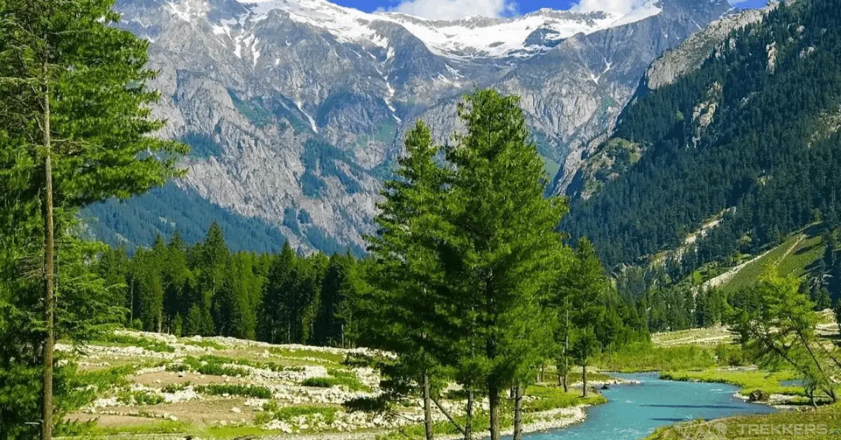
Kumrat Valley is a forested mountain valley in Upper Dir District, Khyber Pakhtunkhwa, known for its deodar forests, the Panjkora River, Kumrat Waterfall, Kala Chashma, Do Janga, Jahaz Banda and Katora Lake. It is one of the major tourist attractions officially associated with Upper Dir.
But planning a Kumrat trip is not simply a matter of choosing a hotel and following Google Maps. The road, your vehicle, the weather and the distance between the valley’s attractions can significantly change the experience. The approach to Thal is different from the rougher tracks farther into the valley, while Jahaz Banda and Katora Lake require trekking rather than ordinary sightseeing.
This guide focuses on those practical details: how to reach Kumrat, what the road is actually like, when a jeep makes sense, what the major attractions require, how many days to plan, what to budget for, where to stay, and what to check before leaving.
Planning note: Road conditions, jeep fares, accommodation prices and access to remote attractions can change quickly. Treat the prices and route times below as planning ranges rather than fixed rates, and confirm conditions locally shortly before your trip.
Kumrat Valley at a Glance
| Travel Detail | Information |
|---|---|
| Location | Upper Dir District, Khyber Pakhtunkhwa, Pakistan |
| Main gateway | Thal (Thall) |
| Approx. elevation of main valley | Around 2,400 m / 7,900 ft is commonly cited |
| Distance from Islamabad | Roughly 370 – 385 km, depending on the exact endpoint |
| Typical road journey | About 8 – 12 hours, depending on traffic, stops and conditions |
| Main river | Panjkora River |
| Transport beyond Thal | Local 4×4 jeep is the practical choice for rougher sections |
| Common travel season | May to September |
| High-altitude trekking season | Generally summer, subject to trail and weather conditions |
| Main attractions | Kumrat Forest, Kumrat Waterfall, Kala Chashma, Do Janga, Jahaz Banda and Katora Lake |
Kumrat is also an area undergoing tourism-development planning. In 2026, the Khyber Pakhtunkhwa government (KITE) said master planning for Kumrat was underway, with an emphasis on tourism infrastructure, environmental protection and more sustainable development.
Where Is Kumrat Valley?

Kumrat Valley is in Upper Dir District of Khyber Pakhtunkhwa, in the mountainous region of northern Pakistan. The Panjkora River runs through the valley, while the surrounding landscape is characterized by forests, mountains and alpine areas.
Kumrat is not administratively part of Swat. The confusion mainly comes from the fact that travelers can approach the wider Kumrat region through Kalam and Badgoi Pass under suitable seasonal conditions.
Pakistan’s national tourism material also lists Kumrat Valley, Panjkora River, Thal Mosque, Katora Lake, Jahaz Banda and Badgoi Pass among the major attractions of Upper Dir.
Is Kumrat Valley in Swat?
No. Kumrat Valley is in Upper Dir District, not Swat District.
However, the geography of the region connects Kumrat with destinations in and around Swat, and the Badgoi Pass route from the Kalam/Utror side is one reason travelers sometimes associate the two areas.
Thal is the key gateway for the standard approach to Kumrat. It is where many independent travelers make their transport decision: continue with their own vehicle if conditions and vehicle capability allow, or arrange a local jeep for the rougher sections.
Why Is Kumrat Valley Worth Visiting?
Kumrat’s appeal comes from the combination of forest, river, mountain scenery and access to high-altitude trekking routes.
The main valley offers relatively easy sightseeing around the forest and river, while farther routes lead toward places such as Do Janga, Jahaz Banda and Katora Lake. That means a Kumrat trip can be as relaxed as a riverside camping weekend or as demanding as a multi-day trekking trip.
It is particularly attractive to:
- Travelers who enjoy forests and rivers rather than developed hill stations
- Families visiting the main valley
- Campers
- Photographers
- Hikers and trekkers
- Travelers looking for a longer northern Pakistan road trip
The important distinction is that these are not all the same type of Kumrat experience. The waterfall and forest are relatively accessible; Do Janga requires a rougher vehicle journey; Jahaz Banda and Katora Lake require substantially more physical effort.
How to Reach Kumrat Valley

For most travelers coming from Islamabad, the practical road route is:
Islamabad → M1 → Swat Motorway/M16 → Chakdara → N45 → Timergara → Upper Dir/Sheringal area → Thal → Kumrat
Exact route details can vary according to road conditions and the destination you enter into your navigation app.
Islamabad to Kumrat by Road
The journey is long, so thinking about it in sections is more useful than relying on one total driving time.
1. Islamabad to Chakdara
The Islamabad-to-Chakdara section uses motorway routes and is generally the easiest and most predictable portion of the journey.
2. Chakdara toward Thal
After Chakdara, the route continues through Lower and Upper Dir toward Thal. The road becomes more mountainous, winding and slower than the motorway sections.
Older route accounts put the Chakdara-to-Kumrat journey at roughly 177 km, while newer travel guides commonly place the Islamabad-to-Kumrat road distance around 370 – 385 km depending on the endpoint used.
3. Thal into Kumrat
This is where planning becomes more important.
The road beyond Thal is considerably rougher than the main approach, with travelers reporting rocky sections, uneven tracks and stream crossings. Recent travel guides continue to recommend a 4×4 for the rougher final sections.
Do not assume that the entire Kumrat trip is one normal paved-road journey simply because Google Maps gives you a single destination and travel time.
Kalam to Kumrat via Badgoi Pass
Another route connects the Kalam/Utror side with Upper Dir through Badgoi Pass.
This route can be attractive to travelers already exploring Swat or Kalam, but it should not automatically be treated as the easier or faster route.
Mountain-road conditions can change considerably with weather, and rough 4×4 tracks are reported on this approach. Historical traveler accounts describe the route as suitable for 4×4 vehicles rather than ordinary low-clearance cars.
If you plan to use Badgoi Pass, check the current local road status immediately before departure rather than relying on an old travel blog, YouTube video or map estimate.
Islamabad to Kumrat Valley Distance and Travel Time
How far is Kumrat Valley from Islamabad?
A practical planning figure is around 370 – 385 km by road, although the exact distance depends on where within Kumrat you set your destination.
Current travel guides generally put the journey in the broad 8 – 11 hour range, while a more conservative door-to-door planning window can be longer once stops, traffic, mountain roads and the final rough section are included.
| Starting Point | Approx. Road Distance | Practical Planning Time |
|---|---|---|
| Islamabad / Rawalpindi | ~370 – 385 km | ~8 – 12 hours |
| Peshawar | Varies by route | Plan a full travel day |
| Lahore | ~690 – 730 km depending on route | Usually best split into stages |
| Mingora / Swat | Route-dependent | Several hours |
| Kalam | ~60 – 70 km commonly cited via Badgoi | Rough mountain route; allow substantially more time than the distance suggests |
These are planning ranges, not guaranteed journey times.
The most important point is that mountain travel time is not proportional to distance. A relatively short rough section can take longer than a much longer motorway section.
Kumrat Valley Road Conditions
The most useful way to think about Kumrat’s roads is in sections rather than one simple “good” or “bad” rating.
Before Thal
The Islamabad-to-Dir approach includes motorway and paved highway sections, followed by increasingly mountainous roads.
Around Thal
Thal is the main gateway for travelers heading deeper into Kumrat.
Beyond Thal
The road becomes much more demanding. Travelers report rocky and uneven sections, stream crossings and rough tracks toward parts of the valley. Current travel guides continue to describe the final approach as a 4×4-oriented route.
The exact condition is not permanent.
Rain, landslides, flooding, construction and routine road maintenance can change conditions. This is particularly important during the monsoon season.
In fact, the provincial government has been actively discussing road construction and rehabilitation to improve access to tourist destinations across Khyber Pakhtunkhwa.
Before leaving Thal, check:
- Whether the road to your intended attraction is currently open
- Whether recent rain has damaged crossings or tracks
- Whether your vehicle has enough ground clearance
- Whether a local jeep is recommended that day
- Whether your accommodation can arrange onward transport
Do not use an old road-condition video as proof that the road is still in the same condition.
Can You Take a Car to Kumrat Valley?
Sometimes, but that does not mean you should.
This is one area where travel reports can appear contradictory because “going to Kumrat by car” can mean different things.
A vehicle may reach Thal without the same problems encountered farther inside the valley. Some travelers have also reported taking capable vehicles farther in during favorable dry conditions.
But the more useful question is:
Can my specific vehicle comfortably and safely handle the road beyond Thal on the day I am traveling?
For a normal low-clearance car, the answer becomes much less certain once you leave the better road.
| Vehicle | Beyond Thal | Comfort | Practical Recommendation |
|---|---|---|---|
| Low-clearance sedan | Limited | Low | Park at Thal if local conditions are poor |
| Hatchback | Condition-dependent | Low – moderate | Avoid assuming it can reach every area |
| High-clearance SUV | Better | Moderate | More capable, but still weather-dependent |
| 4×4 Jeep | Best suited | Best practical option | Recommended for rougher routes |
| Motorbike | Possible for experienced riders | Physically demanding | Weather and terrain dependent |
My practical recommendation
If you are traveling with family, have a low-clearance car, or simply want to avoid unnecessary vehicle risk:
Drive to Thal → arrange a local jeep → continue into Kumrat.
That removes much of the uncertainty surrounding ground clearance, stream crossings and rough sections.
Thal — The Real Decision Point

Thal is more than just a location you pass on Google Maps.
For independent travelers, it can be the point where you:
- Arrange a jeep
- Park your private vehicle
- Buy last-minute supplies
- Check local road conditions
- Confirm accommodation or transport
- Continue toward the main valley
Pakistan’s tourism material specifically identifies Thal Mosque among Upper Dir’s attractions, so if your schedule allows, the town itself can also be part of the cultural side of the journey.
Because local conditions and facilities can change, confirm parking arrangements and jeep availability locally rather than assuming every service is permanently available.
Kumrat Valley Jeep Rent
There is no single official nationwide “Kumrat jeep rate” that travelers should assume applies everywhere.
The amount can change according to:
- Destination
- Vehicle type
- One-way vs return journey
- Number of passengers
- Season
- Weather
- Waiting time
- Whether several attractions are combined
- Demand on holidays
Published and traveler-reported figures vary significantly. Older travel accounts, for example, recorded several thousand rupees for particular jeep routes, while newer guides report substantially higher prices for longer or private excursions.
Therefore, instead of publishing one supposedly “average” price as fact, use this rule:
Before hiring a jeep, confirm:
- Total price
- Exact destination
- Whether the price is one-way or return
- How long the driver will wait
- Whether fuel is included
- Whether the same vehicle returns you
- Whether additional stops cost extra
If a driver quotes a very different price from another driver, ask what is included before deciding that one is overcharging you.
Important
For your final published article, do not hard-code a PKR 7,000 – 20,000 range as an official Kumrat rate unless you have current 2026 quotations from multiple local operators. Prices are too variable for that level of certainty.
Kumrat Valley Travel Cost
There is no single “Kumrat Valley cost” because two travelers can take completely different trips.
A budget camper traveling with friends and sharing a jeep will spend very differently from a family staying at a premium riverside property.
Budget Trip
A budget trip generally means:
- Private/public transport to Thal
- Shared jeep
- Camping or a basic room
- Simple local food
- Limited paid activities
Mid-Range Trip
A more comfortable trip may include:
- Private vehicle to Thal
- Private/shared jeep excursions
- Mid-range accommodation
- Restaurant meals
- Two or three days in the valley
Premium Trip
A premium trip may include:
- Private transport
- Private 4×4
- Resort or glamping accommodation
- Organized excursions
- Multiple nights
- Trekking/guide arrangements
Do not use online package prices as a universal Kumrat travel cost. Tour operators often include different combinations of transport, accommodation, meals, jeep transfers and guide services.
If you compare packages, ask for a written breakdown of what is included and what is not included.
Best Places to Visit in Kumrat Valley
The biggest mistake is treating every attraction as if it were a roadside viewpoint.
Kumrat’s attractions fall into three practical categories:
Easy-access / Main Valley
- Kumrat Forest
- Panjkora River
- Kumrat Waterfall
Rough-road / Jeep-accessible
- Kala Chashma
- Do Janga
- Other remote valley sections depending on current road conditions
Trekking destinations
- Jahaz Banda
- Katora Lake
This distinction is one of the most important things to understand before planning your itinerary.
Kumrat Waterfall

Kumrat Waterfall is one of the valley’s best-known attractions and is significantly easier to visit than the high-altitude trekking destinations.
The exact walking distance from your accommodation depends on where you stay, so avoid assuming that every hotel or campsite has the same access.
Allow time for the surrounding forest and river rather than treating the waterfall as a five-minute photo stop.
Kala Chashma
Kala Chashma is a natural spring/stream attraction farther into the valley.
It is generally treated as a vehicle-accessible excursion rather than a major high-altitude trek, although the road itself can be rough.
The attraction makes the most sense for travelers who want to explore farther than the main waterfall without committing to the multi-hour trekking required for Jahaz Banda and Katora Lake.
Do Janga
Do Janga is one of the more remote experiences associated with Kumrat.
Getting there can involve a long rough-road jeep journey and walking, depending on the exact access point and current road condition.
Do not treat it as a quick stop between breakfast and lunch.
Check current local conditions before committing to the route, particularly after heavy rain.
Jahaz Banda and Katora Lake

Jahaz Banda and Katora Lake are frequently mentioned together, but they are not the same sightseeing stop.
Jahaz Banda
Jahaz Banda is a high-altitude alpine meadow reached by vehicle to a trailhead followed by trekking.
Travel sources commonly describe the trek from the jeep drop-off area as taking several hours, with the exact duration depending on the starting point, pace, weather and trail condition.
Katora Lake
Katora Lake is farther beyond Jahaz Banda and requires additional trekking.
The exact distance and time vary between route descriptions, but traveler reports commonly put the Jahaz Banda-to-Katora section at several hours of hiking rather than a short walk.
What this means for your itinerary
If you are fit and experienced, you may be able to combine the two efficiently.
If you are new to high-altitude trekking, do not build your entire schedule around a fixed same-day return time.
Weather, trail conditions, altitude and your own pace can all change the timetable.
Kumrat Forest

The deodar forest is one of the defining characteristics of Kumrat.
The forest and Panjkora River create the landscape that distinguishes Kumrat from more developed roadside destinations.
For a relaxed trip, you do not need to climb to Katora Lake to experience what makes Kumrat special. Walking through the forest, spending time beside the river and camping in suitable areas can already make a worthwhile trip.
At the same time, increasing tourism creates pressure on natural areas. Current government planning for Kumrat explicitly includes environmental protection and sustainable tourism as development priorities.
As a visitor:
- Do not cut live trees
- Do not leave plastic or food waste behind
- Avoid polluting streams
- Keep fires controlled
- Stay away from unstable riverbanks
- Follow local restrictions
Where to Stay in Kumrat Valley

Accommodation ranges from simple local rooms and camps to more comfortable resort-style properties.
Basic Hotels and Rooms
Expect simple facilities rather than city-hotel standards.
Facilities can vary considerably between properties, so confirm:
- Hot water
- Bathroom arrangements
- Electricity
- Heating
- Parking
- Food availability
- Mobile coverage
- Distance from the main road
Camping
Camping is one of Kumrat’s most popular experiences.
You can either bring your own equipment or use camps arranged locally, depending on availability.
Resorts and Glamping
Some properties offer more comfortable rooms, chalets or glamping-style accommodation.
However, do not copy one property’s nightly rate and present it as the average Kumrat accommodation price. Prices can change by season, weekend, holidays, room category and availability.
During peak summer and holiday periods, booking ahead is the safer option.
Kumrat Valley Camping

Camping beside the forest and river can be one of the best ways to experience Kumrat, but location matters.
Choose your campsite carefully
Avoid placing your tent immediately beside the river.
Mountain rainfall upstream can change river conditions quickly, and a calm-looking riverbank is not automatically a safe campsite.
Bring weather protection
Even during summer, mountain weather can change.
Carry:
- A waterproof layer
- Warm clothing
- Ground protection
- A proper sleeping bag for the expected temperature
- A headlamp
- Power bank
- Basic first aid
Leave no trace
Kumrat’s popularity is increasing, while government authorities are simultaneously planning tourism development and environmental protection measures for the valley.
The simplest contribution a traveler can make is to leave the campsite cleaner than they found it.
Kumrat Valley Weather
Kumrat has a mountain climate, so temperatures are generally much cooler than Pakistan’s lowland cities.
Summer is the main tourist season, while higher trekking areas can remain considerably colder than the valley floor.
Rather than relying on a generic “Kumrat temperature” number, check the forecast immediately before traveling.
This is particularly important during the July – August monsoon period, when rainfall can affect mountain roads and streams.
Summer
Expect:
- Pleasant daytime conditions compared with the plains
- Cool evenings
- Cooler conditions at higher elevations
- Possible rain
- Rapid weather changes
Winter
Winter conditions can be severe in the upper valley, with snow and difficult access.
If your objective is a straightforward sightseeing and trekking trip, summer is the more practical season.
Best Time to Visit Kumrat Valley

For most travelers, May through September is the practical travel window, although conditions vary from year to year.
May – June
A good option for travelers looking for:
- Greener landscapes
- Relatively manageable temperatures
- Fewer peak-season crowds
July – August
This is the busiest summer period and generally offers good access to high-altitude trekking areas when conditions are suitable.
The trade-off is:
- More visitors
- Higher demand
- More pressure on accommodation
- Greater monsoon-related weather risk
September
September can be an attractive compromise for travelers who prefer fewer crowds while still aiming for summer access.
October – April
Conditions become progressively colder and higher routes can become difficult or inaccessible because of winter weather and snow.
Always check current road and trail conditions before traveling, especially if your trip includes Badgoi Pass, Jahaz Banda or Katora Lake.
Is Kumrat Valley Safe?
Kumrat is a mountain destination, so the biggest practical risks often come from roads, weather, water and terrain rather than the scenery itself.
Road safety
Do not underestimate the rough sections beyond Thal.
Weather
Heavy rain can change mountain-road and river conditions quickly.
Hiking
Wet rocks and steep trails can become significantly more difficult after rain.
River safety
Never camp immediately beside fast-flowing water, and do not enter the Panjkora River simply because a section appears calm.
Vehicle breakdowns
Remote sections have fewer services than major towns. Carry basic emergency supplies if you are driving.
Network limitations
Do not assume that your phone will have reliable coverage throughout the valley.
Local customs
Thal and surrounding communities have their own local cultural norms. Dress modestly and behave respectfully, particularly in villages and around religious or community spaces.
The right approach is not to portray Kumrat as either “dangerous” or “completely risk-free.” It is a remote mountain destination that rewards basic preparation.
Mobile Network, Cash & Practical Facilities
Do not plan a Kumrat trip on the assumption that every part of the valley will have reliable mobile service.
Coverage can vary by:
- Network
- Location
- Terrain
- Weather
- Distance from populated areas
Download your maps before leaving reliable coverage.
Carry cash
Cash is particularly important for:
- Jeep fares
- Camping
- Small shops
- Local food
- Parking
- Guides
- Unexpected transport costs
Do not assume that card payments or ATMs will be available where you need them.
Food and supplies
Basic food and shops are available in populated sections, but options become more limited as you move deeper into remote areas.
Bring important personal supplies with you rather than depending on finding them later.
What to Pack for Kumrat Valley
Essential
- Warm layers
- Waterproof/rain jacket
- Comfortable trekking shoes
- Extra socks
- Power bank
- Offline maps
- Cash
- Personal medication
- Basic first-aid kit
- Reusable water bottle
- Sunglasses and sunscreen
If driving
- Spare tire
- Tire-pressure check
- Basic emergency kit
- Jumper cables/jump starter
- Vehicle documents
- Enough fuel for the planned route
If trekking to Jahaz Banda/Katora Lake
Add:
- Proper trekking footwear
- Lightweight backpack
- Headlamp
- Extra layers
- Trekking poles if useful for you
- High-energy snacks
- Water purification method if appropriate
- Weather protection
Suggested Kumrat Valley Itineraries
2-Day Kumrat Trip
Day 1: Islamabad → Chakdara → Dir/Thal → Kumrat → accommodation/camping → forest and waterfall.
Day 2: Morning in the forest → optional short jeep excursion → begin the return journey.
This is possible, but the Islamabad return makes Day 2 long.
Best for: travelers who mainly want the forest, river and waterfall.
3-Day Kumrat Trip
Day 1: Islamabad → Thal → Kumrat → check-in → forest/river.
Day 2: Kumrat Waterfall → Kala Chashma or another jeep-accessible attraction → return to accommodation.
Day 3: Morning in Kumrat → begin the return journey to Islamabad.
Best for: first-time visitors who want to experience the main valley without rushing into high-altitude trekking.
4 – 5 Day Kumrat + Jahaz Banda Trip
Day 1: Islamabad → Thal → Kumrat.
Day 2: Explore the main valley and prepare for trekking.
Day 3: Jeep to the appropriate trailhead → trek to Jahaz Banda → overnight if conditions and accommodation allow.
Day 4: Katora Lake trek or return toward the valley, depending on fitness, weather and trail conditions.
Day 5: Buffer/return day.
This itinerary is considerably safer from a planning perspective than trying to squeeze a high-altitude trek into a rigid two-day trip.
Things Most Kumrat Travel Guides Don’t Tell You
1. “Going to Kumrat” does not mean one single type of trip.
The forest, waterfall, Do Janga, Jahaz Banda and Katora Lake require different amounts of time and physical effort.
2. Thal is an important planning point.
It is where many travelers make the decision about private vehicles, parking and local jeep transport.
3. A car being able to reach somewhere does not mean it should.
Road conditions and vehicle clearance matter more than what another traveler managed to do last summer.
4. Jeep prices are not fixed like a bus ticket.
Destination, season, vehicle and negotiation can change the price.
5. Distance alone is misleading.
A short mountain-road section can take longer than a much longer motorway section.
6. Jahaz Banda is not a roadside attraction.
You need to trek after the vehicle section.
7. Katora Lake requires even more effort.
Do not treat it as a quick extension of the waterfall visit.
8. Weather can change your itinerary.
Build flexibility into any plan involving remote roads or high-altitude trekking.
9. Cash is more important than many first-time visitors expect.
Carry enough for transport and unexpected expenses.
10. Tourism in Kumrat is changing.
The provincial government is actively planning Kumrat’s tourism development, including infrastructure and environmental protection. That means the destination may continue to change rather than remaining exactly as it appears in older videos and blogs.
Common Mistakes to Avoid
- Assuming a normal sedan will comfortably handle every road beyond Thal.
- Treating a Google Maps travel time as a guaranteed arrival time.
- Hiring a jeep without confirming whether the quoted price is one-way or return.
- Assuming one jeep price applies to every attraction.
- Camping directly beside the river.
- Planning Katora Lake as a quick sightseeing stop.
- Relying completely on mobile network.
- Carrying too little cash.
- Traveling without warm and waterproof layers.
- Using old road-condition information without checking locally.
- Trying to fit too many attractions into a two-day trip.
- Assuming a hotel or campsite has the same facilities as a city property.
Frequently Asked Questions
Where is Kumrat Valley?
Kumrat Valley is in Upper Dir District, Khyber Pakhtunkhwa, Pakistan. It is associated with the Panjkora River and is known for its forested landscape, waterfall, Jahaz Banda and Katora Lake.
Is Kumrat Valley in Swat?
No. Kumrat is in Upper Dir District. Its connection with Swat mainly comes from the wider regional geography and the Badgoi Pass route.
How do I reach Kumrat Valley from Islamabad?
The standard road approach goes through the Islamabad motorway network toward Chakdara, then onward through Dir toward Thal. From Thal, travelers commonly use a local jeep for rougher sections farther into Kumrat.
How far is Kumrat Valley from Islamabad?
A practical figure is approximately 370 – 385 km, depending on the exact endpoint. Allow roughly 8 – 12 hours for planning rather than relying on a single fixed driving time.
Do I need a 4×4 for Kumrat Valley?
Not necessarily for every kilometer of the journey, but a 4×4/local jeep is the safest practical assumption for rougher sections beyond Thal, particularly when road conditions are poor.
Where can I hire a jeep for Kumrat?
Thal is the main place travelers commonly arrange onward jeep transport. Your accommodation may also be able to help arrange a vehicle.
How much does a Kumrat jeep cost?
There is no reliable single fixed rate. Prices vary by route, vehicle, season, group size and whether the journey is one-way or return. Confirm the full price and inclusions with the driver before departure.
How many days are enough for Kumrat Valley?
Three days is a good starting point for the main valley, waterfall and one or more jeep excursions. Plan four to five days or more if you want to include Jahaz Banda and Katora Lake without rushing.
What is the best time to visit Kumrat Valley?
For most travelers, May to September is the practical season. July and August offer peak summer access but also bring greater crowding and monsoon-related weather risk.
Can families visit Kumrat Valley?
Yes. The main forest, river and waterfall areas can work well for families. Remote jeep routes and high-altitude treks require more careful consideration of age, fitness, weather and road conditions.
Is there mobile network in Kumrat Valley?
Coverage varies by location and network. Do not rely on continuous service, particularly in remote sections. Download offline maps before your trip.
Can you camp in Kumrat Valley?
Yes. Camping is one of Kumrat’s most popular experiences. Choose a safe campsite away from the immediate riverbank and check the weather before setting up.
Is Kumrat Waterfall accessible by car?
The waterfall is not simply a normal roadside stop from Islamabad. Depending on your accommodation and current road conditions, you may need a jeep and/or a short walk to reach it.
Can I visit Do Janga without a jeep?
A jeep is the practical option for the rougher route toward Do Janga. Exact access can change with road conditions, so confirm locally before traveling.
How do I reach Jahaz Banda?
The usual approach involves a jeep to a suitable trailhead followed by a multi-hour trek. The exact starting point and trekking time depend on the route and current conditions.
How do I reach Katora Lake?
Katora Lake is reached by trekking beyond Jahaz Banda. It is a substantially more demanding excursion than visiting the main Kumrat Valley attractions.
What should I carry for Kumrat Valley?
Carry warm layers, rain protection, suitable shoes, cash, offline maps, a power bank, personal medication and basic first-aid supplies. Add proper trekking equipment if you plan to visit Jahaz Banda or Katora Lake.
Final Verdict: Is Kumrat Valley Worth Visiting?
Yes, but Kumrat is best enjoyed when you plan around the logistics rather than only the scenery.
The main valley gives you the forests, Panjkora River, camping and waterfall experience. Farther routes add jeep excursions such as Kala Chashma and Do Janga, while Jahaz Banda and Katora Lake turn the trip into a genuine trekking adventure.
If you are driving from Islamabad, treat the journey as a full travel day. If you have a low-clearance vehicle, consider parking at Thal and using a local jeep. If you are trekking, leave enough flexibility for weather and trail conditions. And before departure, verify the current road situation, transport prices and accommodation availability rather than relying on figures from an older article.
That is the real Kumrat experience: beautiful, increasingly popular, and still dependent on mountain roads, weather and local logistics.


This Post Has One Comment