
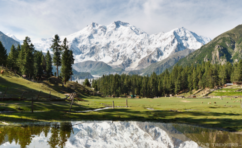
Secluded within the western extremity of the mighty Himalayas of Gilgit Baltistan is the majestic Nanga Parbat. It is the world’s ninth-highest mountain and second-highest mountain in Pakistan. Standing at an elevation of 8,126 meters, it is also known as the king of mountains (Diamir) or the Killer Mountain for its rocky terrain, difficult ascent, and three faces!
Approximately, 100 climbers each year reach the top of the Naked Mountain and conquer it. The nerve-chilling thing is only 30 to 40% of those mountaineers are successful each year. Now, various factors can put a damper on the unsuccessful climber’s efforts. But knowing the best or safest route plays an integral part in successfully climbing to the top of the entrancing eight-thousander.
Faces of Nanga Parbat:
The exclusivity of Nanga Parbat from other mountains is its three faces. The Killer Mountain, Nanga Parbat, has three faces to climb the mountain: the Diamir face, the Rupal face, and the Rakhiot face. All three have different difficulty levels, and they each have a peculiar charm.

The Diamir Face:
The most used and most well-known among the climbers is the Diamir Face, located to the west. Although it is an extremely complex ascent with high risks of altitude storms, perilous icefalls, and constant threat of avalanches, it still is the easiest way to climb the Nanga Parbat. The Diamir face has an elevation ranging from around 1,600 meters at its base and 8,000 meters at the summit.
The accessibility of the Diamir face makes it the most approachable. The trailers are less steep and safer than the other two faces. Being the most accessible, it still is quite hard to climb because of the harsh weather and the unpredictable trails.
The Rakhiot Face:
After Diamir face, the second in accessibility or popularity is the Rakhiot face. Its elevation ranges from 3,500 meters to 8,126 meters, from the base to the summit. Found on the Eastern side of the Nanga Parbat, it is known for its picturesque view and popular glaciers along the way.

Though not the hardest route, the Rakhiot face still requires exceptional mountaineering skills to succeed in climbing the 8,126-meter mountain. It poses great difficulties like crevasses, icy terrains, and extremely steep slopes. Only climbers used to climbing in unexpected circumstances can climb the Rakhiot face because anything can happen during this journey!
The Rupal Face:
The last and the deadliest face of the Nanga Parbat is the southern face of the mountain, the Rupal Face. It has an elevation of 4,600 meters from the base to the summit. But while covering the distance, there are endless possibilities of something unpredictable happening.

Ascending Rupal’s face requires advanced skills and technical expertise in climbing. You might come face to face with unpredictable weather conditions, including frequent avalanches and rockfalls. It is the least frequently used face because of the extreme technical difficulties that occur while climbing the Rupal face. Many climbers have lost their lives while climbing this very route. So it is better to avoid the Rupal Face, as there are two other better routes to facilitate a better and safer journey for you.
Conclusion:
When climbing the heavenly Nanga Parbat, it is better to climb the King of mountains through the Diamir Face. You need to be as safe as you can be while climbing one of the deadliest mountains in the world. It is necessary to prepare for what is about to come.
The Rupal Face, being the most dangerous, and the Diamir Face being the easiest out of all of them, makes it clear which route to choose. However, some enthusiastic people have successfully climbed to the top of the Nanga Parbat from all three faces.
So, at the end of the day, if you know your way around the mountain and are confident about the route, you can reach the top from any of the three faces.
Read more about Nanga Parbat with a detailed guide here: Guide to Nanga Parbat: All You Need to Know About Killer Mountain.


This Post Has 3 Comments