
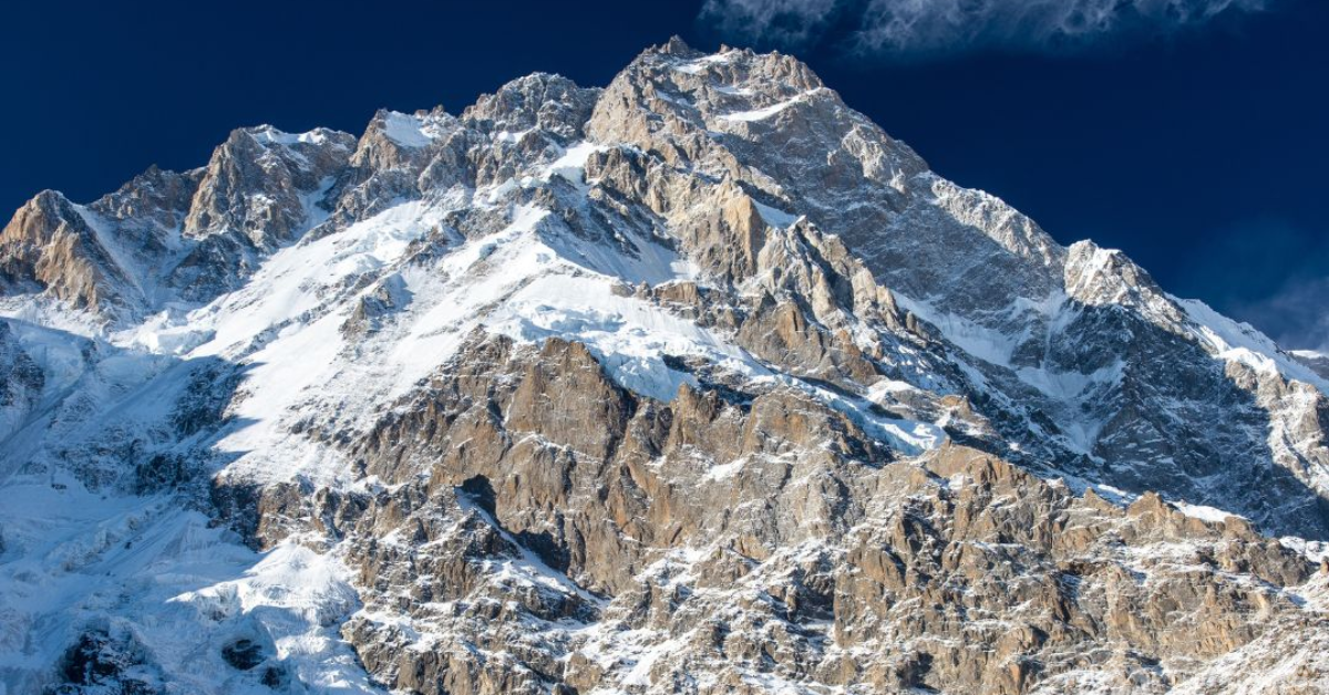
Nanga Parbat is the ninth-highest mountain in the world and the second-highest mountain in Pakistan. It is one of the most ravishing landscapes you will ever get to witness in your life. It is also known as God’s mountain because of the ethereal atmosphere the mountain is surrounded with, being in the Himalayan range of Gilgit Baltistan, Pakistan.
Though I once climbed Nanga Parbat from fairy meadows, I am still thrilled to trek to the Killer Mountain from the Astore Valley. The trek is called the Nanga Parbat Rupal Face trek because we get a Rupal South face of the majestic peak. This trail from the enchanting Astore Valley to the Nanga Parbat is a popular trek because of the breathtaking scenery throughout.
My friends and I decided to climb the 8,126-metre mountain for our annual reunion. We were all inconvenienced in different universities located in different cities. We all booked a flight to Islamabad to get on with the riveting journey ahead of us.
After landing in Islamabad, I linked with my friends, and we rented a Jeep for our journey. The car took us on a long but pleasing journey filled with beautiful landscapes and architecture.
From Islamabad, we drove for 7 hours through the Karakoram Highway, where we passed Mansehra, Shinkiari, and Battagram. We also had to cross through the serene Indus River, passing through some high and well-made dam sites. Then, we went to Chilas for a night’s stay.
The next morning, we continued our drive and moved to our next stop, the Astore Valley.
Driving along the Astore River, through villages like the Tarashing Village, was a beautiful experience. We got to witness the rich culture, the verdant greenery, the enchanting water bodies, and the welcoming locals. We also stopped at the vibrant Astore Bazaar during our drive. I bought exquisite items like local handicrafts and miniature models of the Nanga Parbat.
While being in the Tarashing Village, we decided to resume our journey. It was through Rupal Village by climbing the bone-chilling Tarashing Glacier.
Climbing the beautiful glacier led us to the lush green fields of Rupal Village. By continuing our trek to the north with multiple stops, we finally arrived at the Herrligkoffer base camp (3,350 meters).
Spending a night at the Herrligkoffer base camp was a glorious experience. The stunning scenery made us want to stay longer. But the road ahead of us had more exhilarating adventures waiting for us.

The majestic Nanga Parbat consists of three strikingly beautiful faces. They are the Raikot East face, Diamer West face route, and Rupal South face, Herrligkoffer BC, which is the highest face, 4600m from the base camp. We chose to climb the Rupal’s face because it has the most ravishing scenery, and it is the highest face.
From Herrligkoffer base camp, we trekked to Shaigiri, Latoba, Mazeno BC, and then to the Gasherbrum base camp to climb the magnificent Rupal Face. It took us thirty-two days to reach the top, where we had to face the unpredictable weather. The Avalanches and the rock falls along the steepness of the trail were not easy. But after a little more than a month, we were standing on top of the Rupal face of the Nanga Parbat. We were marveling at the view beneath us.
Standing at the top of the highest face of Nanga Parbat blurred all of the hardships we faced during our trip. Because the sense of accomplishment we felt standing there was unmatched by anything I have ever felt. The surrounding mountains and the surprisingly better created a striking atmosphere to revel in.

After staying there for a while to bask in the absolute beauty of nature, we descended back to the base camp. There, we stayed for some time before trekking back to the Tarashing Village, where we got ourselves a Jeep to drive us to Naran. Then, I will go to Islamabad to fly back home.
This journey, the Nanga Parbat Rupal face trek from Astore Valley, was one of the best I have ever had! My perfect personal experience and the out-of-this-world scenery I got to witness during this trek is indescribable.
So, as an adventurer, if there is one place you need to visit, it is the trek from Astore to Nanga Parbat’s Rupal face!
To know more about the Killer Mountain, refer to this article:


This Post Has One Comment