
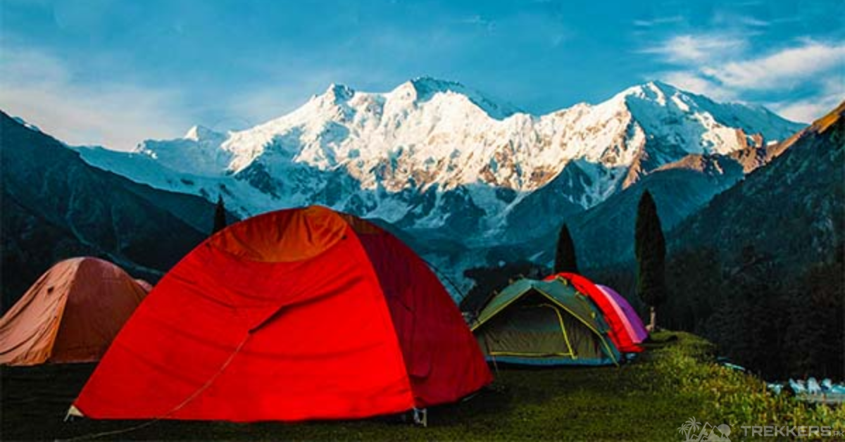
Rakhiot Peak is one of the peaks of the Himalayan range, south of the Indus River, located in Gilgit-Baltistan, Pakistan. The mountain stands on an elevation of 7,070 meters. It is one of the most prominent summits of the Nanga Parbat Mountain. It was first climbed by Peter Aschenbrenner and Herbert Kunigk. Ice climbing the Rakhiot mountain was always a dream of mine that I got to fulfill during this trip.
Ice climbing is notorious for how risky it is. But with the right equipment, the right gear, the right technique, and an insightful instructor, I think anyone can ice climb without having a fear for their life. I have ice-climbed quite a few times now, once on this mountain too, during my expedition to Nanga Parbat. And though it is quite different and difficult from standard rock climbing, you can still successfully do it with appropriate training and gear.
The first step of this exhilarating journey was to pack suitable gear for the climb. We had to climb for days to finally reach the top. We were advised to keep warm clothes, sturdy hiking shoes, a flashlight, a first aid kit, water, food, and necessary tools like an ice axe, crampons, harnesses, ropes, and a helmet. VAfter packing all of the essentials in my reliable backpack, we headed to the Airport to fly to Islamabad.
Staying in Islamabad never gets old. Visiting the beautiful monuments is always a pleasure. Though our stay there was brief, we still spent our time there with great entertainment. From Islamabad, we rented a Jeep Cherokee to drive to our next destination.
The drive to Chilas was surprisingly a pleasing experience. It was all because of the breathtakingly beautiful landscape we got to witness during our 6 to 7-hour drive. After covering 239 km, we finally arrived at the hotel, where we spent the night. From Chilas, we reached Jheel, where we warmed ourselves up for the long journey ahead of us.

After a long trek with multiple stops to acclimatize and eat, we finally reached the beautiful Base camp. Our first day was spent resting and training for the exciting journey ahead of us. I was confident in our mountaineering guide and myself that I would be able to climb the peak. I knew I would bless myself with an entrancing view of the breathtaking nature surrounding me.
The next day, we started our climb to the seven-thousand-meter Peak. Our porter briefed us about the basic climbing techniques and positions. He also informed us about not being overly energetic while climbing because our energy is like water that can end at any point in the tiring journey. After brushing up on the basic information, we started our ascent.
The first challenge we faced during our ascent was the cold weather. The biting cold made climbing the mountain slightly complex. But we all were determined and prepared for the cold. So we pulled through and continued our hike to the top.
As we climbed to the top, the thin air made it hard to breathe. But the rests in the base camps at various elevations to acclimatize helped us through this. The icy and steep terrain required great focus as every movement had to be precise and calculated to climb safely.
We slowed out in between as one of our group members pulled a muscle while using their ice axe too hard. The longer rest than usual turned out to be a blessing as we all got to freshen up for our journey ahead. Throughout the rest of our journey, except for the unpredictable weather, where one moment you would be bathed in the sunlight and the next, a snowstorm would engulf the mountain. Our group faced no other problems.
Finally, after what felt like an eternity, we stood on top of the Rakhiot Peak. Basking in the magnificent view before our eyes was totally overwhelming. The sense of accomplishment was quite overwhelming as I reveled in the panoramic view encapsulating me. The surrounding peaks, like the Chongra Peak and others, made the scenery more beautiful than words could ever explain.
After marveling at the magnificence in front of me and taking pictures of the extremely picturesque landscape, we started descending the mountain. It was quite a struggle because of the perilous weather.
From the base camp, we trekked back to Jheel, where we rented a Jeep again to drive to Chilas and then to Islamabad. The drive was long but exhilarating as we stopped to visit the famous tourist sites in between both destinations. After arriving in Islamabad, we headed back to the airport to fly back home with the idyllic memories etched on our minds.
Ice climbing the Rakhiot Peak was a complex but one of the most liberating and thrilling experiences I have ever had. Witnessing nature in its purest form from the top of the Rakhiot Peak was an experience I will definitely cherish forever!
For more information, check these articles out:
A Guide to Nanga Parbat: All You Need to Know About the Killer Mountain


