
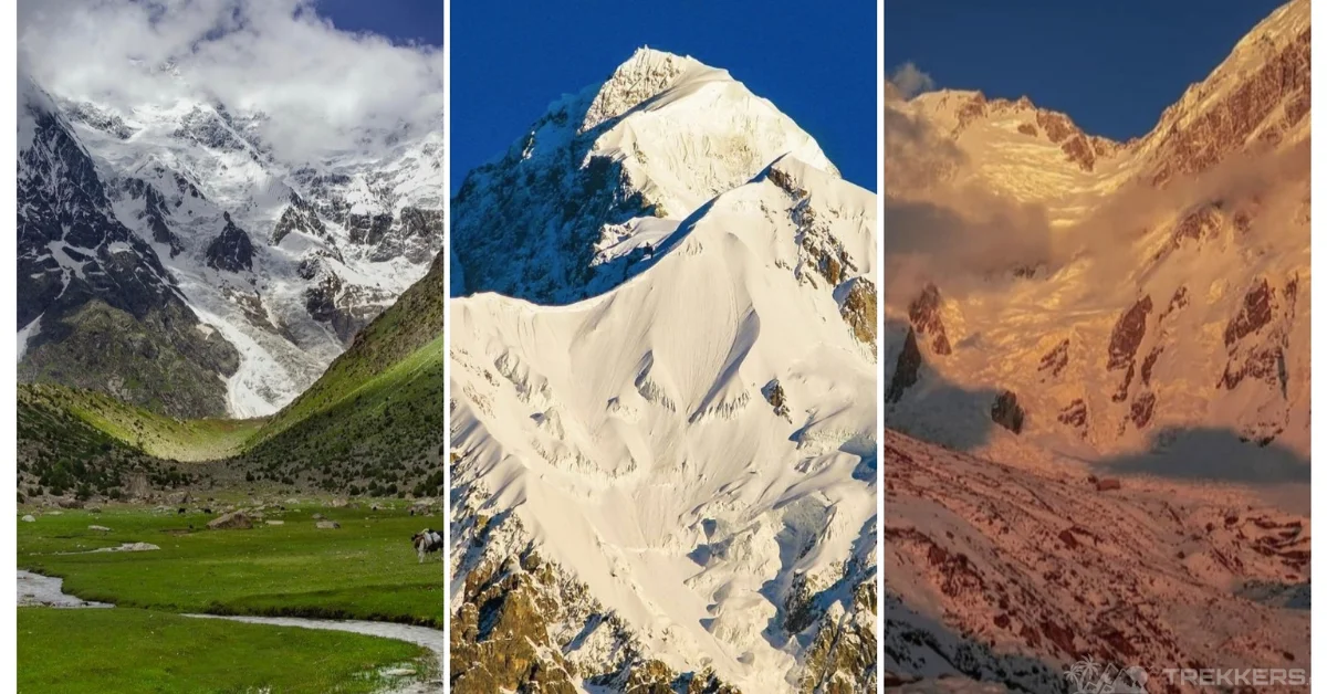
After descending from the formidable Nanga Parbat, notoriously known as the Killer Mountain, we were overjoyed with the triumphant ascent of the peak. After spending some days with our high-altitude porters, one of them mentioned the possibility of ascending Rakhiot Peak if we had additional days.
When we hear this name, we get curious about this idea. Should we head over to the Nanga Parbat again? Doesn’t it seem less appealing to be on the trek again? Over the night, despite feeling fatigued, that blurred thought popped up the next day again.
The notion of exploring an uncharted pathway to Rakhiot Peak sparked my interest. I find it interesting to embrace the opportunity and make the most of our time by adding another feather to my cap.
Location of Rakhiot Peak:
Rakhiot Peak (7070 meters) is relatively unexplored. It’s situated within the Nanga Parbat massif, about 4km northeast of the main ridge. As the Nanga Parbat massif extension, it lies in the many countries’ expanded Himalayas range.
Nanga Parbat features a lengthy ridge that extends from the southwest to the northeast. This ridge comprises an immense mass of ice and rock, presenting three distinct faces: the Diamir, Rakhiot, and Rupal.
- The Rupal Face dominates the mountain’s southeast face. It is one of the world’s deepest gorges and is formed at the base of the mountain.
- The north face, also known as the Rakhiot Face, descends more than 7,000 meters.
- This magnificent peak has another facet on its West Side, also referred to as the Diamir Face.
The most popular route to reach Nanga Parbat is via the Diamir Face, although numerous expeditions have thoroughly investigated the Rupal Face. On the other hand, climbers frequently believe that the Rakhiot Face is the easier and more accessible route. My personal experience of this peak has shown me its distinct charm and what makes it stand out from other Nanga Parbat faces.
The Shift in Plan:
As I ascended the Nanga Parbat, I was acclimatized to its weather and the treacherous terrain of the grand rocky structure. So, this time, I made a change in my ascension journey. I would not summit the Rakhiot peak; instead, I opted for a thrilling paragliding experience from an altitude of seven thousand feet.
To make this unique journey possible, I requested my high-altitude porter to arrange the necessary paragliding equipment and a guide familiar with both paragliding and mountain climbing to accompany us to the top.
I have heard that Pakistanis are known for their versatility. To my amazement, my porter confidently said he could assist me in paragliding because he was well aware of the sport of air. I placed my trust in him, and he efficiently arranged the required stuff for the paraglide within a couple of days, turning this adventure into an exhilarating paragliding escapade.
The Journey from Base Camp:
Considered one of the gentle routes to scale Nanga Parbat, the terrain is icy and steep. So, climbing this peak is not a piece of cake nor a complex challenge for climbers to ace. Good preparation, gear-up tools, and high morale and commitment are required to ascend it.
The rise of the peak to 7070m above sea level gives Rakhiot Peak acclaim for its presence, standing with the grand Nanga Parbat. We set up our base camp at 3965m from this steep peak point and enjoyed the majestic aerial view of nearby towns, lush valleys, and beautiful fairy meadows surrounding the Rakhiot Peak.
Sitting at the steep point of the peak, it feels like the peak invites tourists to head on to the adventure track. Bivouacking at Camp II 4500m. We judge the weather conditions to proceed further and gear up ourselves to track ahead.

By the next day, we resumed our journey and headed to the icy, slippery, and rocky texture. The terrain was very challenging, and sometimes, there was the risk of avalanches or landslides, but god forbid, not on our expedition. We continue to head up, bearing the risk of frostbites. I faced frigid temperatures while echoing the mantra of “Tough but not Invincible” in my head because I believe that solid affirmations reflect in your actions.
After facing the highs and lows of the journey, both physically and emotionally, we reached Camp III at a height of 6,150m. From there, the heart races fast because the last leg of the journey is just a few meters away.
Staying in the camps, listening to the songs on my iPod, a wave of enormous achievement washed over me. I reminded myself that it was not the right moment to celebrate. On the other day, we embarked on the Camp IV route 6850m, and then the adventure took a new turn. Diverging myself to descend from the summit, taking the same route, gearing up myself, with the assistance of my high-altitude porter, extending my canopy wings of parachute to take me to the clouds.
I glided in the sky for about 60 – 70 minutes, more than an hour. Witnessed the valley’s splendor among the Nanga Parbat and Rakhiot peak pinnacles. My amusement was on the seventh sky, Euphoric! Shouting and yelling like a mad person. But that was my expression of my achievement as I was out of words to explain it whenever I traced back to the account.

Weather Conditions and Challenges of Rakhiot Peak:
My journey to the Rakhiot Peak was safe and sound. Probably because I made all the arrangements beforehand, or I had ascent a higher and more technical mountain before, or simply because luck was on my side. But it is not the same in every case. Many mountaineers face various challenges and must take precautions to ensure their safety before scaling the peak.
Being the extension of Killer Mountain, Rakhiot Peak also poses harsh weather conditions, including snowstorms, high winds, and extreme cold. My previous experience contributes a lot to carrying weather-appropriate gear. You should be well informed about forecasts and be prepared for sudden changes.
It is better to be equipped with supplemental oxygen. Altitude sickness on these towering peaks is redundant. With the elevation, try to acclimatize yourself and adapt your body to the weather conditions. Although the cold weather doesn’t make you dehydrated, keep on hydrating yourself promptly.
Unpredictable avalanches while ascending to the world’s ninth-highest peak are common. The preventive measures to assess avalanche risk include using safety gear like beacons, shovels, and probes and avoiding high-risk areas.
Safety Measures for Aspiring Climbers of Rakhiot Peak:
Your physical endurance should be well enough to surmount the terrain of this mountain. Before embarking on long, physically demanding climbs that require stamina, strive to achieve physical fitness.
Training adequately, maintaining physical fitness, and being aware of personal limitations. These aspects can be favorable to ensure that your body is ready enough to embrace the climb.
Technical climbs may involve the use of specialized equipment and skills. So acquire proper training, use certified equipment, and climb within your skill level.
In case of any challenge of malfunction or failure of climbing equipment. Try to regularly inspect and maintain equipment, carry backups, and know how to use them. If you find any malfunction, you can change it or replace it before the ascension.
Mountains are the labyrinth of complex terrains, and they can lead to navigation challenges. Many climbers go astray from their groups during their expeditions and go missing.
So before setting off for your expedition, carry maps, GPS devices, and compasses, and have strong navigational skills. Or at least be with a person who possesses knowledge of the mountain maze.
Conclusion:
The journey towards the Rakhiot peak is a hard-to-forget one. It has left an indelible mark in my memory. The technical ascension of the peak retakes me to relive the memories of Nanga Parbat. Each step echoed with the voice of my previous mountaineering escapades, creating a unique blend of excitement and reflection.
The most essential and cherished memory to take with me forever is the awe-inspiring paragliding experience from higher slopes. Watching my dream unfold and become a reality as I soared through the skies was nothing short of magical.
My personal account on the Rakhiot Peak allowed me to explore another facet of Nanga Parbat. It also left me yearning for more adventures in the majestic Himalayas. I am privileged to contribute my own chapter to the tales of the Himalayan range by seeking to summit this towering peak, just like adventurers worldwide.


