
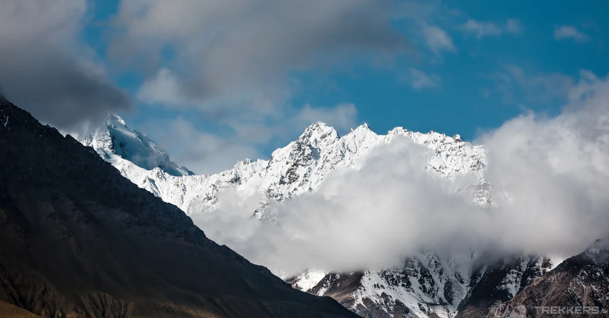
There is something about conquering the rugged terrain, being surrounded by towering peaks, and the breathtaking landscape that cannot be topped. The Hindukush mountain range is the ultimate epitome of experiencing that blissful feeling. Nestled in the Chitral district of Khyber Pakhtunkhwa, Pakistan, the Hindukush range spans over 800 kilometers and is home to some of the range’s highest peaks.
The Hindukush range enjoys a more niche recognition. It is a majestic range with towering peaks and lush scenery. My journey to climb the mountains of Hindukush started five years ago. I started from Pakistan as many of the peaks from the range are located there. Starting from the Hindukush Range was important for me, as this was the range where my dad climbed his last mountain.
The Hindukush Range, located in Central Asia, stretches across Afghanistan and Pakistan, linking both countries through nature. Derived from the Persian words “Hindu” (meaning “Indian”) and “Kush ” (meaning”killer ” or”slayer “), referring to the range’s perilous terrain. Some other sources say that the term was earliest used by Ibn Battuta. According to him, “Hindu Kush” translates to “Hindu Killer,” attributing the name to the historical narrative that suggests harsh climatic conditions in these mountains claimed the lives of slaves from the Indian subcontinent.
Here are my brief recounts of the Hindukush peaks I have climbed to this day. Embark on a riveting journey through the majestic Hindukush Range peaks in this comprehensive guide and discover expert insights to help you!
Tirich Mir of the Hindukush Range:

Perched at an impressive height of 7,708 meters above sea level, Tirich Mir is the highest mountain from the Hindukush range and the 33rd highest peak in the world. The ascent was challenging yet so rewarding. My team and I started our journey from Chitral. From Chitral, we directly drove to Shahgrom (2,760 meters) in our rented Jeep Wrangler. After reaching Shahgrom, we decided to leave the jeep there and experience the glory of Hindukush by basking in the beauty of the range. While trekking to the Babu base camp, we also passed incredibly beautiful spots like Atrak.
Every step had to be more precise than the other as the trail kept getting narrower. The risk only thrilled me to reach our main destination. After successfully conquering the trails of Tirich Glacier, we reached the Babu base camp. The view from the base camp was out of this world with mountains like Istor-o-Nal and Noshaq surrounding it.
Though the expedition got progressively harder, the spectacular view made up for the complexity of the route. Reaching the summit was an indescribable feeling. The sense of accomplishment along with the overwhelming scenery makes every inconvenience and struggle worthwhile.
Noshaq of The Hindukush Range:

Noshaq is Situated on the border between Afghanistan and Pakistan. The north and west side of the mountain is located in Afghanistan, while the south and east side of the mountain is in Pakistan. I chose to climb the 7,492-meter mountain from Pakistan as it is said to have a more convenient and organized route.
We initially trekked on the same route as we did for Tirich Mir until Babu base camp by trekking up the lower and upper Tirich Glacier. From Babu base camp, we moved toward the Noshaq base camp. The ascent was short but quite challenging, but everything felt worth the effort once I reached the top. I was beyond grateful for being there among the magical Hindukush mountains, just taking in the beauty.
Climbing the second-highest peak of the Hindukush range was one of the most memorable experiences I have ever had, and it is one of the mountains that I would want to climb again.
Istor-o-Nal of The Hindukush Range:

After my expedition to Noshaq, the next in line was the third-highest Peak of the range, Istor-o-Nal at an elevation of 7,403 meters. The majestic peak is situated a few kilometers northeast of Tirich Mir, across the Tirich Mir Glacier.
The peak is not as appreciated as it should be as it is not as visible because of Tirich Mir being right in front of it. The trek started from Zani Pass where we acclimatized for a day. From Zani Pass, we trekked to the lower part of Tirich Glacier to reach the intermediate base camp at 13,000 feet. After resting for a while, we resumed our journey.
Our ascent from Camp I to Camp IV was not conventionally easy but we were determined to reach the summit. The weather was not ideal, but we accomplished our goal. The view from the top was breathtaking, with the twin peaks of Tirich Mir in sight.
Saraghrar of The Hindukush Range:

Saraghrar is the fourth-highest peak of the range at 7,338 meters. Our goal was to climb the mountain from the Northwest Face of the peak. We acclimatized on Languta-e-Barfi; a majestic mountain 6,833 meters high. The weather and the route were the biggest contributing factors to our successful journey. Even though the trek was filled with treacherous terrains and tricky trails, the weather made it easy to reach the top. The descent, however, turned out to be a lot harsher than we expected but we pulled through. Getting back to the base camp, I could only reminisce about the beautiful scenery I saw from the top of the peak.
Udren Zom of The Hindukush Range:

My next destination was Udren Zom. The mountain is located at an elevation of 7,140 meters and is one of the highest peaks outside of the Karakoram and Himalayan ranges. Already being in the Terich Valley, we started from Zondrangram to the summer huts also popularly known as “Ghari”.
We rested for a while there to restore our energy, then moved up to Duru camp. After our long but beautiful journey, we finally reached the base camp. After a moderate ascent, we were finally at the top.
The struggle was worth everything once I witnessed the panoramic view of Noshaq, Darband Zom, Sarghrar, and other Himalayan mountains encapsulating us in their beauty
Lunkho-e-Dosare:
My climbing adventure came to a pause because of an injury. So, I had to pause my yearly expeditions to the Hindukush range. My next destination would have been the Lunkho-e-Dosare mountain.
Sitting on the border between Afghanistan and Pakistan, Lunkho-e-Dosare is an enchanting mountain at a height of 6,901 meters. The mountain is not as popular as it should be with its breathtaking view and convenient climb.
Sakar Sar:
Another mountain that I have to climb from Pakistan in my journey is Sakar Sar Mountain at an elevation of 6,272 meters.
Despite the mountain’s easier route from Afghanistan, I’ll likely opt for the Pakistan route to climb it.
Conclusion:
The Hindukush range is not as appreciated as the Karakoram range and Himalayan range but in my opinion the range is just as beautiful. Perfect for beginners, the location offers diverse mountains of varying difficulty levels, ideal for starting a climbing journey.
When ascending Hindukush’s stunning peaks, the only constant is the breathtaking atmosphere. So without any second thoughts, pack your bags and set off for incredible expeditions to Hindukush Range!


