
Table of Contents
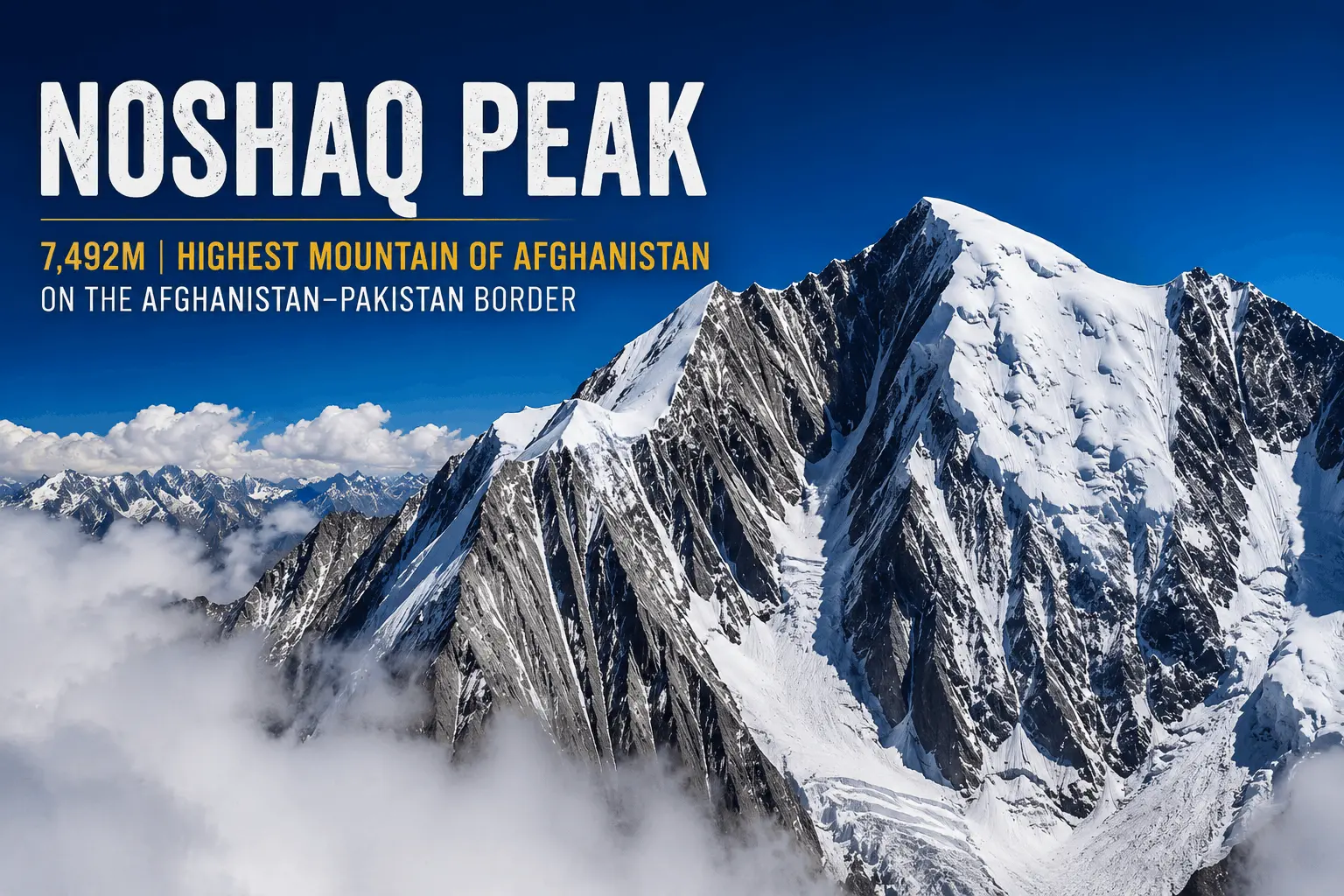
Noshaq Peak rises 7,492 meters (24,580 feet) above sea level, the highest point in Afghanistan and the second-highest summit in the Hindu Kush after Tirich Mir. It sits directly on the Afghanistan-Pakistan border, which is why climbers and trekkers on the Pakistani side have just as much reason to know this mountain as anyone in Kabul or Faizabad.
Its southern and eastern flanks fall inside Khyber Pakhtunkhwa, and one of its two established climbing approaches begins in Chitral’s Tirich Valley, the same corridor that leads to Tirich Mir. That makes Noshaq part of Pakistan’s mountain geography, even though it isn’t a Pakistani peak.
Noshaq Peak: Quick Facts
| Fact | Detail |
|---|---|
| Elevation | 7,492 m / 24,580 ft |
| Location | Afghanistan-Pakistan border (Badakhshan/Wakhan and Khyber Pakhtunkhwa) |
| Mountain range | Hindu Kush |
| Rank in Hindu Kush | 2nd highest, after Tirich Mir |
| Rank in Afghanistan | Highest point in the country |
| Rank worldwide | Approximately 52nd-highest mountain on Earth* |
| Distinction | Widely cited as the westernmost 7,000-meter peak in the world* |
| First ascent | August 17, 1960 (Japanese expedition) |
| First winter ascent | February 13, 1973 (Polish team, North Face) |
| Normal route | West Ridge, from the Afghan side |
*World-rank and “westernmost” claims are geographic superlatives repeated across multiple sources; treat as approximate rather than precisely verified figures.
What Is Noshaq Peak?
Noshaq also written as Noshakh or Nowshakh, is a 7,492-meter peak in the Hindu Kush, straddling the Afghanistan-Pakistan border. Its northern and western slopes lie in Afghanistan’s Badakhshan province; its southern and eastern slopes reach into Pakistan’s Khyber Pakhtunkhwa.
What makes Noshaq unusual is the combination of three things rarely found together: it’s a national high point, a legitimate 7,000-meter mountaineering objective, and a remarkably remote mountain, largely because of decades of regional instability rather than any lack of climbing appeal.
How High Is Noshaq Peak?
Noshaq stands at 7,492 meters (24,580 feet). That figure is consistent across mountaineering references and expedition reports.

For context, Noshaq is taller than every peak in the Alps or the Rockies, yet it falls well short of the eight-thousanders clustered in the Karakoram and Himalaya farther east. It’s also commonly cited as the westernmost 7,000-meter peak on Earth, nothing farther west reaches that altitude band, which is part of why mountaineers treat it as a distinct geographic milestone.
Where Is Noshaq Peak Located?
Noshaq sits on the Afghanistan-Pakistan border in the Hindu Kush, roughly where Afghanistan’s Wakhan Corridor meets Pakistan’s Chitral district. Depending on which side you approach from, the entry point, permits, and terrain all change:
- From Afghanistan: access runs through the Wakhan Corridor to the village of Qazideh (also spelled Qazi Deh), the traditional staging point for the West Ridge.
- From Pakistan: access runs through Chitral town, up the Tirich Valley, past the Lower and Upper Tirich glaciers, toward Noshaq’s south side.
Is Noshaq the Highest Mountain in Afghanistan?
Yes. No other peak inside Afghanistan’s borders reaches Noshaq’s elevation, which is why it also serves as the country’s official geographic high point.
It’s worth being precise here, because the distinction matters for a Pakistan-based audience: Noshaq is Afghanistan’s highest point, not Pakistan’s. Pakistan’s own highest mountain, K2, stands at 8,611 meters well above Noshaq. The two facts aren’t in tension; they’re describing two different national rankings.
Noshaq and the Hindu Kush

The Hindu Kush is home to a tight cluster of 7,000-meter peaks, and Noshaq ranks second among them, just below Tirich Mir (7,708 m), roughly 20 kilometers away in Pakistan’s Chitral district. Because the two mountains are close enough to see from each other’s flanks, they’re often discussed together in Hindu Kush mountaineering literature, but they shouldn’t be confused. Tirich Mir holds the range’s highest point; Noshaq holds second place.
Beyond these two, the Hindu Kush also contains Istor-o-Nal and Saraghrar, both also in Chitral, making this one of the most concentrated groupings of high peaks anywhere in the Hindu Kush-Karakoram-Himalaya system.
Noshaq Peak and Pakistan
Noshaq isn’t an isolated Afghan mountain, it has a documented Pakistan connection that goes beyond a shared border line on a map.
Geography. The mountain’s south and east faces lie in Khyber Pakhtunkhwa. Its southern and eastern slopes extend into Khyber Pakhtunkhwa, giving the mountain a direct geographic connection to Pakistan.
Access. One of the two established climbing approaches starts in Chitral and follows the same Tirich Valley route used for Tirich Mir expeditions, via the Lower and Upper Tirich glaciers to Babu Camp, before branching toward Noshaq’s south ridge.
Mountaineering history. Pakistani-side attempts date back to at least 1971, when an Austrian expedition led by Wolfgang Stefan climbed via the South Ridge from the Upper Tirich Glacier, retreating around 6,500 meters after an earthquake disrupted the climb.
Regional identity. Noshaq belongs to the same Hindu Kush system that gives Chitral its Tirich Mir, Istor-o-Nal, and Saraghrar. For anyone already familiar with Pakistan’s northern mountain geography, Noshaq completes the picture of what sits just across the Wakhan border.
None of this makes Noshaq a Pakistani mountain, it remains Afghanistan’s highest point first. But it’s a legitimate part of the Hindu Kush mountaineering landscape that Chitral-based climbers and trekkers already engage with through Tirich Mir.
Noshaq Climbing History
Noshaq’s first ascent came on August 17, 1960, when a Japanese expedition led by Professor Yajiro Sakato put climbers Goro Iwatsubo and Toshiaki Sakai on the summit via the West Ridge from the Afghan side, as documented in the original 1960 expedition account. That climb established the route still used as the standard line today.
Three years later, in 1963, Austrian climbers Gerald Gruber and Rudolf Pischenger made the first ascents of Noshaq’s East, Central, and West subsidiary summits. In 1970, an Austrian ski-mountaineering team completed the first ski descent from the main summit.
The most historically significant post-1960 climb came on February 13, 1973, when Tadeusz Piotrowski and Andrzej Zawada, part of a Polish expedition, reached the summit via the North Face, Noshaq’s first winter ascent. It’s also widely cited as the first winter ascent of any 7,000-meter peak anywhere in the world, a benchmark that put Polish Himalayan climbing on the map years before the country’s famous 8,000-meter winter campaigns of the 1980s.
Access largely closed after Afghanistan’s 1978 Saur Revolution and the decades of conflict that followed. Reports around 2011 indicated the route to the summit had become accessible again, and expeditions gradually resumed through the 2010s. Current on-the-ground accessibility should always be verified independently rather than assumed from older reports, regional conditions change, and this article isn’t a substitute for that check.
How to Climb Noshaq Peak

Climbing Noshaq is a serious high-altitude undertaking, though it’s technically more approachable than most other 7,000-meter mountains in the region. A typical expedition on the standard West Ridge route follows this general arc:
Approach. Climbers reach Qazideh via the Wakhan Corridor, usually after arranging border logistics and an Afghan climbing visa in advance.
Trek to base camp. From Qazideh, the trek covers roughly 37 kilometers of rocky moraine terrain, typically over two to three days.
Acclimatization and high camps. Climbers establish a series of camps up the mountain, gaining altitude gradually to manage the risks of altitude sickness before a summit attempt. (See altitudes below.)
Summit push. The final stretch typically involves a steep couloir, sustained snow slopes, and a rock band that requires short technical pitches before a long, exposed ridge walk to the summit.
Descent. Descent generally retraces the ascent route, with rappels through the technical sections.
A realistic expedition timeline from base camp to summit often runs two to three weeks, though well-acclimatized teams have compressed that considerably in specific cases. This is general guidance, not a technical manual anyone planning an actual attempt needs current route beta from an operator or a climber who has been on the mountain recently.
Noshaq Climbing Routes
West Ridge (Afghanistan, normal route). The route used on the 1960 first ascent and still the standard line today. It’s considered the least technical way up Noshaq, though it still demands full high-altitude mountaineering skills, glacier travel, and comfort on exposed, mixed terrain above 6,500 meters. One expedition account describes the summit rock band as roughly 5.6/M4 in difficulty a useful reference point, though it reflects one climber’s field impression rather than a formally established grade.

South Ridge (Pakistan approach). Climbers from Chitral follow the Tirich Valley route through the Lower and Upper Tirich glaciers to Babu Camp, then branch toward Noshaq’s south side, crossing a moraine between two icefalls before reaching the south ridge. Expedition accounts generally describe this as the more technically demanding of the two routes, due to the icefall crossings.
North Face. Used for the historic 1973 winter ascent, the North Face is more technical and rarely climbed, generally reserved for experienced winter mountaineers.
There’s no fixed-rope infrastructure maintained year to year on Noshaq the way there is on commercially guided 8,000-meter peaks. Any rope or anchor found from a previous season should be treated as unreliable until independently inspected, expedition accounts have documented fixed lines that were partially cut or degraded by weather.
Pakistan vs Afghanistan Routes to Noshaq
| Factor | Afghanistan Approach | Pakistan Approach |
|---|---|---|
| Staging point | Qazideh, Wakhan district | Chitral town |
| Route | West Ridge | South Ridge via Tirich Valley |
| Technical difficulty | Generally considered the easier, standard line | Generally regarded as more technical, due to icefall crossings |
| Access requirements | Afghan visa plus permission from Afghanistan’s Ministry of Information and Culture | Pakistani mountaineering permit, typically processed through Islamabad |
| Route character | Reports describe residual unmarked minefields near parts of the historical approach, a legacy of past conflict that must be independently verified locally before any trek, not assumed from older trip reports | More organized road access via jeep to the Tirich Valley roadhead |
| Best suited for | Climbers prioritizing the historically proven, comparatively moderate line | Climbers already working within the Chitral/Tirich Mir mountaineering ecosystem |
Both routes reach the same summit, but they represent genuinely different expeditions in terrain, bureaucracy, and risk profile. Teams should decide early which country they’re climbing from, since permits, guides, and supply chains don’t overlap between the two approaches.
Noshaq Base Camp and High Camps
Base camp elevation depends on the route. Historical Afghan-side accounts place base camp around 4,400 – 4,600 meters near Qazideh, reached after the multi-day trek across glacial moraine, the exact figure shifts by expedition and year, so treat this as a typical range rather than a fixed number.
From there, climbers have typically established Camp 1 near the top of a steep couloir around 5,400 meters, Camp 2 near 6,000 – 6,200 meters on a sheltered rock shoulder, and Camp 3 close to 6,900 meters, just below the technical rock band guarding the upper mountain. These figures come from specific past expeditions and can vary with route conditions in any given season.
On the Pakistan side, three camps are typically established above Babu Camp before the final push, following the icefall and moraine crossing toward the south ridge.
How Difficult Is Noshaq Peak to Climb?

Noshaq is technically one of the more moderate 7,000-meter peaks by Himalayan standards, but “moderate” at this altitude still means serious mountaineering. The West Ridge doesn’t demand advanced technical climbing for most of its length, yet the summit day involves mixed rock and snow terrain, sustained exposure, and altitude above 7,000 meters where decision-making and physical performance both degrade.
What makes Noshaq genuinely hard isn’t the climbing grade, it’s everything around it. There’s no guiding infrastructure, no maintained fixed lines, and minimal rescue capacity in a remote, politically sensitive region. Common mistakes include underestimating the psychological toll of that remoteness, trusting old fixed ropes without inspection, and rushing acclimatization on the approach trek, which itself gains significant altitude in a short distance.
Best Time to Climb Noshaq

Most expeditions target the summer window, roughly July through August, when the west ridge route sees the most reliable weather and the approach trek is snow-free. Multiple expedition accounts describe a consistent daily pattern in this window: clear mornings giving way to building cloud by early afternoon, with a real chance of snow which is why summit bids are typically timed for early starts with a return before the midday weather turns.
Winter ascents are exceptionally rare. Only one has ever been completed, in February 1973, and it remains a landmark in high-altitude winter mountaineering rather than a template most teams attempt to replicate. Conditions, access, and permit availability shift from year to year, so anyone planning a specific season should verify current status directly with an operator or the relevant permitting authority rather than relying on older trip reports.
How Much Does a Noshaq Expedition Cost?
There’s no single fixed price for a Noshaq expedition. Costs vary significantly by operator, route, group size, and how much support you bring versus organize independently. The main drivers are:
- Permits and visas: Afghan climbing permission or Pakistani mountaineering permit, depending on route
- Transport: international flights, regional transfers, and 4×4 travel to the roadhead
- Guides and local staff: mountain guides, liaison officers where required, and support crew
- Porters: load-carrying between roadhead and base camp
- High-altitude support: climbing staff on larger expeditions
- Accommodation: guesthouses en route and tented base camp living
- Equipment: technical gear, fixed rope, and group climbing equipment
- Expedition duration: a longer summit window generally means higher cumulative costs
Given how much these factors vary by operator and year, treat any specific price you find elsewhere online as a starting reference point, and confirm current pricing directly with an expedition operator before committing.
Permits and Requirements for Climbing Noshaq
Requirements differ by approach. On the Afghan side, foreign climbers have historically needed an Afghan visa plus a special permission letter from Afghanistan’s Ministry of Information and Culture. On the Pakistan side, climbers need a Pakistani mountaineering permit, typically processed in Islamabad before heading to Chitral.
Permit regulations, border crossing rules, and security conditions in this region are genuinely time-sensitive and tied to the current political situation. Treat everything above as background, not current instruction, and confirm 2026 requirements directly with the relevant permitting authority or a licensed expedition operator before finalizing any climbing plans.
Current Access & Safety Note: Access, permits, border procedures and security conditions around Noshaq can change. Some information in historical expedition reports may no longer reflect current conditions. Anyone considering an expedition should verify the latest requirements and local conditions with a licensed operator and the relevant authorities before traveling.
Frequently Asked Questions
What is Noshaq Peak?
Noshaq is a 7,492-meter mountain in the Hindu Kush, located on the Afghanistan-Pakistan border. It’s Afghanistan’s highest point and the second-highest peak in the Hindu Kush.
How high is Noshaq Peak?
Noshaq stands at 7,492 meters (24,580 feet) above sea level.
Is Noshaq the highest mountain in Afghanistan?
Yes, no other peak within Afghanistan’s borders reaches its elevation.
Is Noshaq Peak in Afghanistan or Pakistan?
Both. It sits directly on the border, with its north and west slopes in Afghanistan’s Badakhshan province and its south and east slopes in Pakistan’s Khyber Pakhtunkhwa.
What is Noshaq’s connection to Pakistan?
Part of the mountain lies within Khyber Pakhtunkhwa, and one of its two climbing routes approaches through Chitral’s Tirich Valley, the same corridor used for Tirich Mir expeditions. It isn’t a Pakistani peak, but it’s part of Pakistan’s Hindu Kush mountaineering geography.
Is Noshaq the highest peak in the Hindu Kush?
No, that’s Tirich Mir, at 7,708 meters. Noshaq ranks second.
What is the normal climbing route on Noshaq?
The West Ridge, approached from Qazideh on the Afghan side, is the normal route and was the line used on the 1960 first ascent.
How difficult is it to climb Noshaq Peak?
Moderately technical by 7,000-meter standards, with mixed rock and snow near the summit, but the remoteness, lack of guiding infrastructure, and unpredictable afternoon weather make it demanding for experienced high-altitude climbers only.
When was Noshaq Peak first climbed?
August 17, 1960, by a Japanese expedition, with climbers Goro Iwatsubo and Toshiaki Sakai reaching the top via the West Ridge.
What is the best time to climb Noshaq?
Most expeditions target July and August, when weather on the west ridge is most stable, though afternoon cloud and snow are common even in peak season.
How much does a Noshaq expedition cost?
Costs vary by operator, route, and group size, driven mainly by permits, transport, guides, porters, and expedition duration. There’s no fixed price, get current quotes directly from an expedition operator.


This Post Has One Comment