
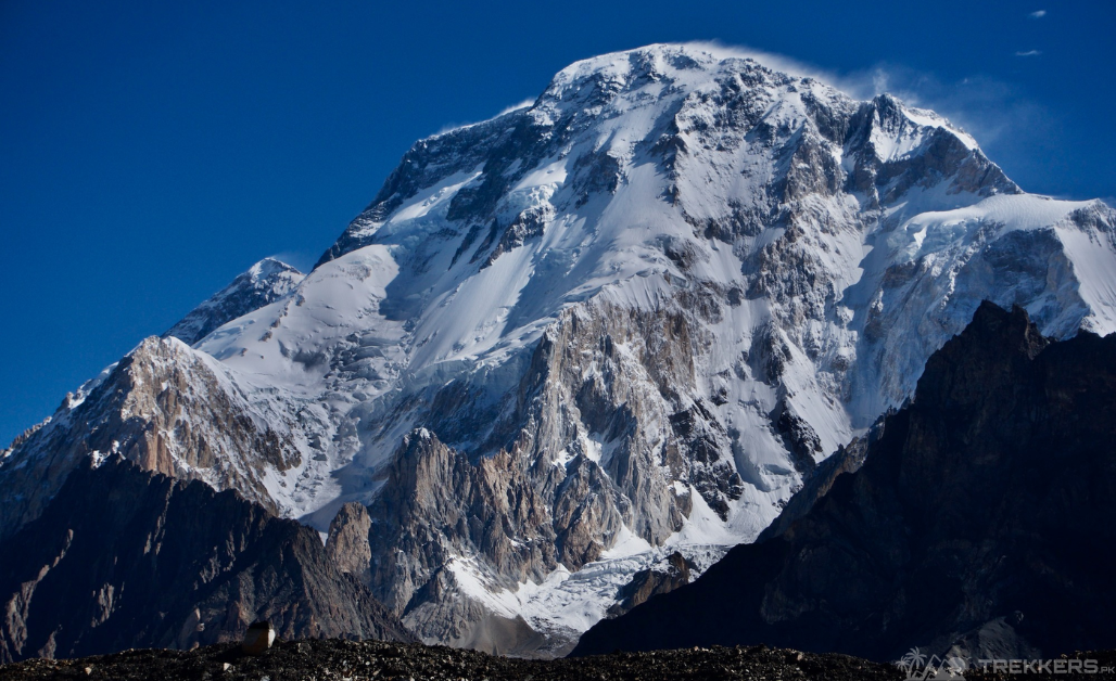
Pakistan’s Broad Peak Mountain, the 12th highest mountain in the world, is one of the eye-catching ventures that draws both local enthusiasts and international travellers to acclaim its beauty. It offers a captivating allure to those who have a profound love for climbing. It has an appreciation for the tranquillity and magnificence held by these monumental, majestic, and mighty mountains. On such towering peaks as Broad Peak, one must be completely prepared with a comprehensive guide to face the challenges.
This essential Broad Peak Guide explores the mountain adventure of this majestic peak of the Karakoram ranges in Pakistan. Read this article to discover the beauty and challenges of this expedition that will help you to prepare!
Starting the Journey from Skardu towards Broad Peak:
We begin our travel from the valley of Skardu and progress towards Askole; trekkers eventually reach the legendary Concordia. It takes multiple trekking trails to be covered in almost a week. The route from Askole to Concordia spans Joula, Paiju, Urdukus, and Goro II, and culminates at Concordia.
Concordia is where the Baltoro and Godwin-Austen Glaciers converge. As discovered by pioneering explorers, it stands out as the perfect location to establish the Base Camp.
Here, we prepare for the next phase of our expedition to ascend the pyramid-shaped giant. This is where the journey from base camp to Broad Peak Mountain unfolds, taking us through some of the world’s most breathtaking and challenging terrain.
Enlisting the Routes:
Base Camp of Broad Peak is strategically located just ahead of the base camp of K2. It is accessible via the Baltoro Glacier. This expansive campsite offers generous space, typically characterized by rocky terrain. However, it can transform into a snowy wonderland when snowfall graces the region.
It is better to be led by a Broad Peak guide to commence your journey, and we hired one for a smooth adventure. The path from Base Camp (at an altitude of 4,850 meters) to the initial leg of the route entails navigating across the glacier. This endeavor takes approximately one hour.
Then the route goes on the rocky slope of mountains where the rocks release untimely, depending on the weather conditions. We experienced that Camp 1 is at a height of 5,500 meters. The journey here is unchallenging and predictable.
Trek from Camp 1 and Camp 2, this section necessitates conquering a series of challenging ice and rocky steps. Climbers said that it’s not technical, but every step makes it steeper, demanding more courage and determination to continue the path.
The path leading to Camp 2, perched at an elevation of 6,250 meters, marks the steepest segment of the entire route. Camp 3 and Camp 4 are strategically positioned at elevations of 7,100 meters and 7,500 meters, respectively. In some cases, Camp 4 is deemed unnecessary, particularly when favourable conditions allow for a direct summit attempt from Camp 3.
The route follows a course that initially passes the summit on the West Ridge, subsequently circling back to the southeast to gain access to the ultimate summit.
When it was time to descend, we retraced our steps along the same route, eventually making our way back to the Base Camp.

Exploration of Nature’s Humongous Testament:
On the route before reaching the camps, the blurred appearance of the peaks makes my heart beat faster. Broad peak, as its name suggests, aptly describes its physical characteristics. It is over 1.5 kilometres (7⁄8 miles) in length, giving it the appearance of a “broad peak.”
According to many climbers, Broad Peak ascension acclimatizes trekkers for other treks. One can assess the tribulations, training, and trials before mounting the other eight-thousanders. On the other hand, reaching the broad peak mountain becomes a fitting opportunity for us to witness the stunning view of Gasherbrum II and I, as well as the world’s second-largest peak, K2.
Challenges Faced During the Expedition:
Broad Peak is often dubbed the “easiest” mountain in its range, but the amateur climbers might not feel the same. While it lacks technical difficulties, such as vertical walls, its harsh conditions, and frigid temperatures are still a challenge. The temperature at Broad Peak is fairly -30 °C, which is surely a physical strain on the human body.
As experienced, the major challenge while ascending was altitude sickness due to low saturation in blood. Steeping high above sea level decreases oxygen intake, which is a cause of muscle fatigue. However, accompanying breathing masks and supplemental oxygen help us sustain the journey.
With high altitude and steep, rocky, and ice-covered terrain, trekking in this area demands excellent fitness and preparation. The ascent of Broad Peak is not without its share of challenges. The mountain is known for its unpredictable weather, harsh conditions, and technical difficulties. The struggle against the thin air, the low temperatures, and the weight of the gear tests our physical and mental limits.
Climbing high mountains comes with a risk, but there’s also a reward to check your physical and mental endurance. Precisely, these challenges made the journey worth it.
Essential Equipment for Expedition:
This Broad Peak guide explains that a successful expedition depends on meticulous preparation. One should be equipped with specialized gear and equipment tailored for the unique challenges of high-altitude mountaineering. The extensive checklist includes insulated clothing, crampons, ice axes, and high-altitude tents, each item carefully selected to ensure safety and comfort during the climb.
Food items such as dry fruits, energy drinks, nuts, seeds, nut-based bars, or nut butter packs become our survivor kits, not only for their long preservation qualities but also for their bare minimum space in the luggage. The Broad Peak requires the same baggage of preparation as another mountain entails.
Descent and Return:
Broad Peak, though relatively less treacherous than some other mountains, is not without risks. Avalanches, altitude sickness, and frostbite are the perils of any trek, but the final touchdown washing over us gives a sense of accomplishment.
The descent continues as we make our way down from Base Camp to Camp 3, then to Camp 2, and finally to Camp 1. Each camp is a crucial stop on the way back, allowing us to rest and recover. Once we leave Camp 1, we navigate our way across the challenging terrain of the Baltoro Glacier, which involves crossing crevasses and other glacial features. This last leg of the journey takes us back to the broader glacier and begins the long trek back.
Expedition to Broad Peak is a journey of revelation, self-discovery, and adventure. It’s an expedition that begins in the heart of Skardu, unfolds along the breathtaking routes to the mountain’s base camp, and culminates in the conquest of a humongous testament to nature.
This Broad Peak guide certainly encapsulates the essence of this journey. From commencement to closure, each step takes us further away from the summit, yet carrying its memory in our hearts.
The adventure doesn’t end here! Continue exploring our next destination, Trekking To Gasherbrum I and II in Karakoram Ranges.


