
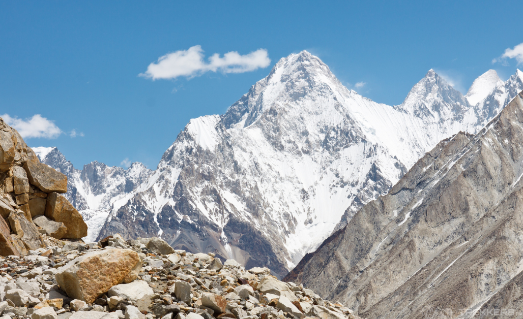
Journey to the most remarkable Gasherbrum I and II, an expedition that ventures and goes deep into the heart of the mighty majestic Karakoram ranges in Pakistan. Both mountain peaks, Gasherbrum I (11th highest in the world at 8,080 m), and Gasherbrum II at 8,035 m – (13th highest in the world) are next to each other. They are around 15 kilometers away from the K2 base camp.
We started to imagine and prepare ourselves for the awe-inspiring grandeur. Concordia and the remarkable Baltoro Glacier, both of which define the essence of Pakistan’s beauty.
So read our expedition to Gasherbrum I and II, where we explore the stunning Karakoram mountain range in Pakistan.
Our Expedition to Gasherbrum I & II
In this adventure, we experienced traversing the mesmerizing Baltoro Glacier, with the joy of witnessing the majestic peaks. Exploring vibrant valleys like Skardu, Shigar, and Askole, all surrounded by breathtaking mountains.
Our Gasherbrum I and II Expedition began in Islamabad, Pakistan. When we reached Islamabad, it was a heartwarming feeling. Hospitable locals welcomed us with open hearts. From there, we were accompanied by our tour guide and flew to Skardu.
When the flight started, we explored the beauty of breathtaking vistas and spectated the iconic peak of Nanga Parbat.
After arriving in Skardu and checking in at the hotel, we had a day to rest and prepare for the adventure ahead. Skardu is an important place for trekkers and climbers as this is where the adventurers get everything they need for their journeys.
The Trek Begins
The following day, we started driving from Skardu towards Askole. On the way, we followed the Indus, Shigar, and Braldu Rivers. Askole is the last village before we went deep into the Karakoram Mountains. After spending our first-night camping under the starry sky, we began our first day of walking to the K2, starting from Askole. After experiencing that mammoth natural wonder we progressed to the Gasherbrum Massif.
The journey started when we walked towards Braldu George and reached the start of the Baltoro glacier. We followed the glacier to Concordia, which is the heart of the Karakoram Range. It took us 9 days to reach Concordia, after trekking through rugged terrains and camping the nights. Our team and members made sure to make these stays memorable. While our skilled chefs prepared tasty and nutritious meals to keep us strong during the multi-day hike.

From Concordia, we continued walking to the Gasherbrum base camp.
Gasherbrum I
Gasherbrum I and II are next to each other. Both share a height above 8000m and have a common base camp. Mountaineers have the advantage of going for both by paying just the fees of one.
The first route to Gasherbrum I has remained closed due to the Siachen conflict. It is now usually being climbed from its most prominent route from the plateau on Gasherbrum Glacier. The most common route now is from the Gasherbrum plateau up to the Japanese Culvert or the route along the north ridge.
The other interchange route is the west ridge, which is technically less demanding but takes longer time. It is due to the long distance between Camp I and the summit.
Gasherbrum I & II base camp is a 5-6 hour walk from Concordia. It is the junction point of Godwin Austen Glacier with Baltoro Glacier. The base camp lies directly below the Conway Saddle, which was the first route used to reach the major Karakoram peaks.

Gasherbrum II
Gasherbrum II is a more accessible peak with an 8,035 m height. The Gasherbrum II will also awaken all the senses with its dreadful beauty and adventure-filled journey of interesting views which are bewitching.
Our wish was to witness these peaks from their base camps, and it came true when they were right in front of our eyes. These eight-thousanders might have been overshadowed by the renowned K2 but they equally hold their significance.
After a stay at the Gasherbrum base camp I and having the most of our time there, we had the option to either retrace our steps to Askole or take the alternative route via Gondogoro La to Hush Valley, eventually returning to Skardu and catching a flight back to Islamabad, all while savouring breathtaking mountain panoramas.
Conclusion
We decided to head back from Askole while carrying the everlasting memories with us. These days with the local fellow adventurers, chasing our dreams together while sharing a chucklesome time was indeed a lifetime experience for all of us.
I would love to fly back to Skardu and explore more such wondrous places in Pakistan!
Click forward to unveil more incredible journeys and wanderlust-worthy destinations, Skyang Kangri: Unveiling the Majestic Staircase Peak.


