
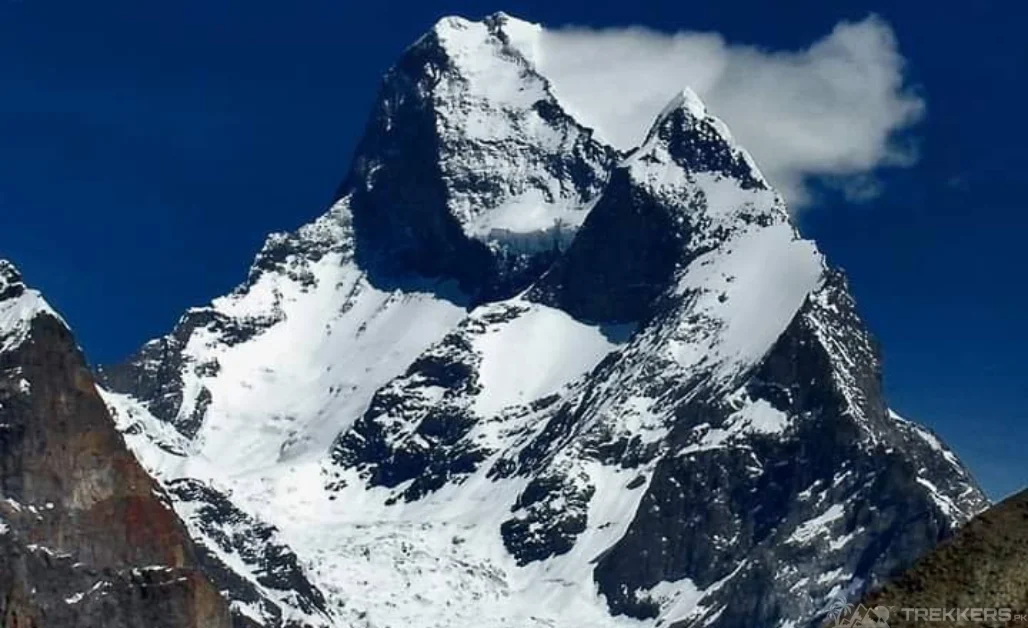
Muztagh Tower is known to be the amazing and strenuous summit in the Karakoram Range, situated in the Baltistan area of Pakistan. It is 7,276 meters (23,871 feet) tall, making it the 91st highest mountain in the world, according to Wikipedia.
While it is not as well-known as some of the other peaks in the region, such as K2 or Broad Peak, it is a true gem of the Karakoram Range. It offers stunning views and technical challenges for climbers.
Muztagh Tower, this unfathomed peak, has always fascinated me. It translates to “Icy mountain,” and it has long been on my bucket list.
I, Maisie from England, was staying in Pakistan with my friends. We had planned an extensive stay, and explored a number of beautiful valleys and destinations in Skardu. As avid explorer, I couldn’t miss coming to Pakistan and witness it. So, our last and the best destination to visit in Pakistan was, the Muztagh tower.
This blog narrates our expedition and provides insights about the icy mountain – Muztagh tower.
Journey Towards Muztagh Tower:
The starting point for the trek is from Askole. If you want to know about our journey from Skardu to Askole, read the blog here.
Askole is the last settlement in the Shigar district. The trek itself is about 51.6 kilometers long, and it takes about 5 days to complete.
We started trekking and camping at different sites and followed the Baltoro Glacier for the first few days, which was relatively easy. But as we got higher, the terrain became more challenging. We had to cross steep slopes, glaciers, and icefalls. The weather, which was often cold and windy, was also a challenge.
But despite the challenges, the trek was also an amazing experience. The scenery was breathtaking, and we saw some of the most beautiful mountains in the world. Muztagh Tower is in the Baltoro Muztagh range and is situated on the border of the Gilgit-Baltistan region of Pakistan and the Xinjiang Uygur region of China. Its location between the Baltoro and SarpoLaggo Glaciers adds to its allure and challenge for mountaineers seeking to conquer its summit.

On the fifth day, we finally reached Muztagh Tower base camp, which is at an elevation of 4600m.
What an incredible feeling it was to stand at the base of this magnificent mountain! We didn’t attempt to climb it, but we were content to just admire its beauty. It left me completely spellbound.
It is prominent for being one of the most difficult and technical climbs of the Karakoram range and, therefore, regarded as an Ultra mountain.
The trek back to Askole was much easier than the trek up. We were tired and sore, but we were also filled with a sense of accomplishment. We had made it to Muztagh Tower, and we had experienced the power and beauty of the Karakoram mountains.
Conclusion:
This was a once-in-a-lifetime experience that I will never forget. It was a challenge, but it was also an amazing journey that I am grateful to have had with my friends. Pakistan had given us memories that we will forever cherish. And I am looking to plan a trip again soon!
I would highly recommend the Muztagh Tower trek to everyone looking for a challenging and rewarding mountaineering experience.


