
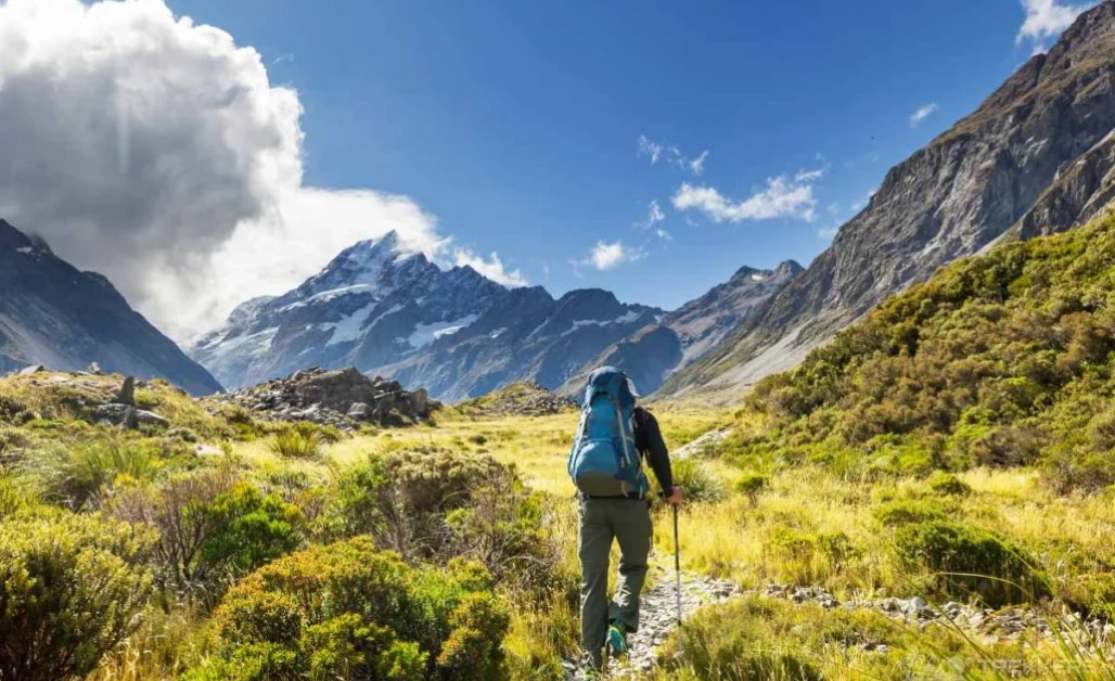
Hiking is one of the most admired and enjoyed sports when you go for a visit to the northern side of Pakistan. And when you’re visiting the Deosai Plains, the second largest plateau of the world, it is something that you must consider compulsory!
Hiking in Deosai
Hiking in Deosai is an experience that gives pure ecstasy when walking on seemingly never-ending land. Wide and broad with unusual wilderness, Deosai looks ethereal and unreal when you ascend higher.
I got an opportunity to visit the high-altitude plain, Deosai National Park, and took the chance. For an adventure enthusiast like me, this is the best thing I could ask for!
So, after flying to Islamabad, meeting the hospitable locals, and accompanying them to Skardu, we started our journey of a lifetime of hiking in Deosai.
At a distance of 40 km away from Skardu city, Deosai is located at an elevation of 4114M (14500 ft) above sea level. Have a look at this ‘Land of Giants’!
Expedition to Deosai
We started our journey towards Deosai, early in the morning. The air was crisp and the sun was shining brightly. I was part of a small group of hikers, and we were guided by a local expert. We all were so excited to discover this intact paradise while driving in a Jeep from Skardu. After a one-hour bumpy ride, we finally reached the vast treeless land.
“What a stunning natural world!” were the words that uttered spontaneously out of me while admiring the spectacular raw beauty of Deosai.
We took a moment to soak its beauty. Next, we hiked through lush green meadows and past sparkling streams. The scenery was breathtaking.
Hiking Trails in Deosai
As we ascended higher, the vegetation became sparser and the terrain became more challenging. We had to cross several rocky streams and climb up steep hills. However, the views from the top were worth the effort.
We hiked to a high point in the park, where we had panoramic views of the surrounding mountains and valleys. It was an incredible sight to behold.
The areas that we explored during this expedition included Sheosar Lake, Kala Pani, Bara Pani, Ali Malik Pass Trek, Chota Pani Lake, and Burji La Trek in Deosai. Read about these places in detail here so you can picture the experience.
Bara Pani Trail

When you are hiking in Deosai, the first lake that would come is Bara Pani. The trail is a walkway that goes and passes from a bunch of rivers, connected by lakes and wetlands. Those lands are home to many species of birds, animals, and different living beings. Hiking on this trail gave us a view of beautiful and wonderful lands surrounded by mountains and sceneries.
The significant thing about this place was its bridge. Traversing on this bridge while the river’s gushing flow pleased our ears, making it a unique experience, more when you opt for camping here.
Kala Pani Trail

The next one is Kala Pani. It is one of the perfect places for having a time of relaxation. This jewel is in a valley surrounded by mountains, and plenty of activities that kept us entertained. We ended up enjoying all the moments.
Although it is a shallow stream as compared, the experience is exquisitely amazing. It is named Kala Pani (Blackwater) because of the bewitchingly dark color of the lake. I just couldn’t take my eyes away from its hauntingly beautiful water.
Sheosar Lake Trail

Sheosar Lake, a large body of water known as Jewel in the Skardu’s Crown by the locals, is one of the famous tourist spots in the northern Pakistan state of Gilgit Baltistan. It is located at an altitude of 13500 ft above sea level with a length of 65 km.
When we stepped here, I could feel the chills. The lake is situated at a high elevation and therefore it is cold at most times.
The Sheosar Lake was covering itself with beautiful flowers. The colorful butterflies added a different touch to this lake’s beauty. The fascinating views in a peaceful atmosphere was something that I couldn’t get can’t get enough of!
Burji La Trek
One of the secret gateways in the mountains. It’s a high-altitude place where we could walk and explore the different beautiful, serene, and eye-catching nature. Imagine yourself going up in the mountains and reaching a stop where you stop to see the breathtaking scenes of nature. This is exactly what we witnessed at this place.
The giant map can be seen from the upper areas which showcased all the places that one can see in the mountains.
Ali Malik Pass Trek

Trekking on a pass like Ali Malik pass offered an adventurous, refreshing, and challenging atmosphere to us. Ali Malik Pass is the second-largest alpine plateau in the world. This trek required proper preparation and acclimatization. Though it was suitable for us, and other experienced trekkers.
The journey of hiking in Deosai through the thrilling trails was full of eye-striking and jaw-dropping sights. With the beautiful vibrant green meadows along with the crystal clear lakes and the majestic plateau and waters, this place is full of nature’s bounties waiting to be explored by tourists and is worth investing your precious time and money.
Conclusion
Whether you’re a nature lover, an adventurer, or simply seeking a peaceful escape, Deosai’s trails offer a remarkable experience that will leave you with unforgettable memories.
So, when you’re ready to embark on a journey of wonder and discovery, Deosai National Park beckons you to its breathtaking trails.


