
Table of Contents
The K2 Base Camp Trek is a 14 to 21 day wilderness expedition through Pakistan’s Karakoram Range, following the Baltoro Glacier from the village of Askole to the foot of the world’s second highest mountain. There are no teahouses or villages along the way, so every trekker camps, and every foreign visitor must travel with a licensed Pakistani operator. It is widely considered tougher than Everest Base Camp, not because of technical climbing, but because of its remoteness and terrain.
If you’re trying to decide whether this trek belongs on your list, or you’re already booking one, this guide covers the full picture: what the route actually looks like day by day, what it costs, when to go, how hard it really is, and what nobody tells you until you’re standing on the Baltoro Glacier with sore feet.
What Is the K2 Base Camp Trek?
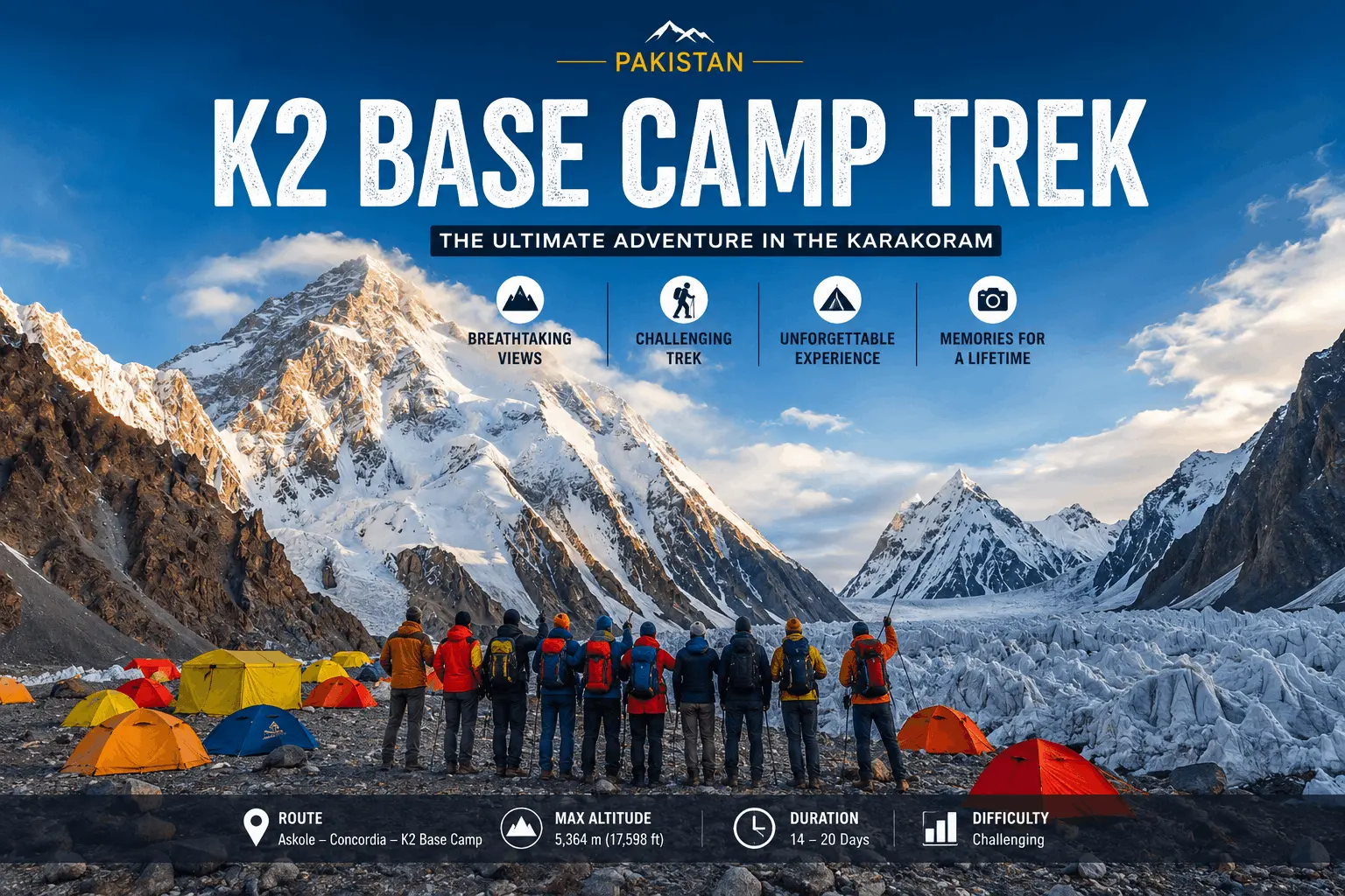
The K2 Base Camp Trek is a high-altitude trekking route in Gilgit-Baltistan, Pakistan, that follows the Baltoro Glacier through the Karakoram Range to reach the base of K2, the world’s second highest mountain at 8,611 meters. Trekkers pass through Concordia, a glacial confluence surrounded by four peaks above 8,000 meters, before reaching K2 Base Camp itself at roughly 5,150 meters.
Unlike the Annapurna Base Camp Trek, where villages and teahouses are part of the experience, the K2 Base Camp Trek is a true expedition from start to finish. The sense of isolation is much closer to remote wilderness treks in Patagonia than to the more developed trekking routes found elsewhere in the Himalaya.
If your goal is to stand on the summit rather than reach base camp, our complete guide to climbing K2 explains the mountaineering route, technical requirements, permits, and preparation involved.
Quick Facts
| Key Metrics | Expedition Overview |
|---|---|
| Location | Karakoram Range, Gilgit-Baltistan, Pakistan |
| Starting point | Askole village, reached via Skardu |
| Distance | Approximately 90-100 km one way (180 – 200 km round trip) |
| Duration | 14 – 21 days, including travel days |
| Max altitude | ~5,150 m at K2 Base Camp |
| Best season | Late June to early September |
| Technical climbing required | No |
| Guide required | Yes, mandatory for foreign nationals |
| Accommodation | Camping only after Askole |
While standard packages on the ground span 14 to 17 days, a full international itinerary typically requires an 18 to 21 day window to account for travel and transit.
Where Is K2 Base Camp Located?
K2 Base Camp sits in the Karakoram Range in northern Pakistan, within Gilgit-Baltistan and inside the Central Karakoram National Park. It is not part of the Himalaya, though the two ranges are often confused. Most trekkers reach the region by flying from Islamabad to Skardu, then driving several hours by jeep to Askole, the last village before the wilderness begins.
Weather-permitting flights to Skardu take about an hour. When flights are cancelled, which happens periodically in this part of the Karakoram, travelers make the same journey by road along the Karakoram Highway, a considerably longer drive. Most well-planned itineraries build in a spare day specifically to absorb this kind of delay.
Skardu is worth treating as more than a transit stop. It’s the last place with reliable ATMs, functioning SIM cards, and pharmacies before the trek starts, and experienced trekkers use the rest day here to withdraw enough cash for the entire trip, since Askole and the trail beyond have no banking facilities of any kind. Pakistani rupees are the only practical currency once you leave Skardu.
Why Is the K2 Base Camp Trek So Famous?
Three things make this trek stand out from almost anything else on Earth: the Baltoro Glacier itself, one of the longest glaciers outside the polar regions; Concordia, where four peaks over 8,000 meters are visible from a single point; and K2, a mountain with a reputation for danger that has made it far less crowded and far more mystique-laden than Everest.
Concordia in particular deserves more explanation than it usually gets. What makes it extraordinary isn’t just the altitude or the names on the map. It’s the scale: standing at the confluence of the Baltoro and Godwin-Austen glaciers, surrounded by a 360-degree wall of granite and ice with no roads, no villages, and often no other people in sight, gives a sense of remoteness that few places on the planet can match. Photographs rarely do it justice.

None of this would be reachable without the Balti guides and porters who have worked this terrain for generations. Their knowledge of glacier conditions, weather patterns, and safe camp locations is arguably as important to a successful trek as any piece of gear you pack, and it’s part of why hiring an experienced local crew matters far more here than on better-developed trekking routes.
To understand why this trek attracts serious adventurers rather than casual tourists, it also helps to know why K2 itself earned its reputation as the “Savage Mountain.” That nickname isn’t marketing language. It reflects a genuine climbing history that’s worth understanding on its own, separate from the trekking route.
Is the K2 Base Camp Trek Right for You?
This is the question most guides skip, and it matters more than any itinerary. The trek suits people who want genuine wilderness and can tolerate real physical discomfort. It is not a good fit for anyone expecting comfort, predictability, or a quick decision to turn back if things get hard.
| If you want… | Is K2 Base Camp a fit? |
|---|---|
| Remote, untouched wilderness | Yes |
| Comfortable lodges or hotels | No |
| Extreme, dramatic mountain scenery | Yes |
| Technical climbing or mountaineering | No, this is a trek, not a climb |
| Cultural villages along the route | Limited, mostly before and after the trek |
| Predictable daily conditions | No, weather and terrain shift constantly |
Quick Decision Checklist
You’re likely ready for the K2 Base Camp Trek if you can answer “Yes” to most of these questions:
- Have you completed at least one multi-day trek before?
- Can you comfortably hike 6 – 8 hours for several consecutive days?
- Are you willing to camp for two weeks with limited facilities?
- Can you dedicate several months to training before departure?
- Are you comfortable with unpredictable mountain weather and flexible travel schedules?
- Does the idea of remote wilderness excite you more than luxury or convenience?
If you answered “No” to several of these questions, consider building experience on shorter high-altitude treks before attempting K2 Base Camp.
Not a great fit if you:
- Dislike or have never tried multi-day camping
- Cannot comfortably walk 6 – 8 hours a day for two weeks straight
- Have an untreated heart or lung condition
- Need daily hot showers, flush toilets, or phone signal
- Get anxious without a fast, easy exit option
A strong fit if you:
- Have some multi-day hiking or trekking experience, even if not at altitude
- Are comfortable with basic camping and variable weather
- Can train consistently for several months beforehand
- Value remoteness and are willing to trade comfort for it
If you can’t confidently tick most of these, it’s worth reconsidering timing rather than the destination itself. This trek rewards patience more than enthusiasm.
If you’re still deciding whether this expedition matches your goals, our guide on 10 reasons to choose the K2 Base Camp Trek explores what makes this adventure different from other high-altitude treks.
K2 Base Camp Trek Route

The classic route follows the Baltoro Glacier from Askole to Concordia and on to K2 Base Camp, generally returning the same way. Trekkers who want a longer, circular alternative exit over the Gondogoro La pass into Hushe valley instead of backtracking, though that adds difficulty and requires glacier travel gear such as crampons and fixed ropes.
| Stage | Approx. Altitude | Notes |
|---|---|---|
| Askole | 3,050 m | Last permanent village, trek starts here |
| Jhola (Jhula) | 3,200 m | First camp along the Braldu River |
| Paiju | 3,450 m | Last major campsite before the glacier proper |
| Urdukas | 3,990 m | Views of Trango Towers and Cathedral peaks |
| Goro II | 4,380 m | Junction with the upper Baltoro Glacier |
| Concordia | 4,620 m | Confluence of Baltoro and Godwin-Austen glaciers |
| K2 Base Camp | ~5,150 m | Highest point of the standard trek |
| Gondogoro La (optional) | 5,585 m | Alternate return route via Hushe valley |
Choosing between the out-and-back route and the Gondogoro La circuit really comes down to time, budget, and risk tolerance. The straightforward return route is more predictable and needs less specialized gear. The Gondogoro La option delivers a genuinely different landscape and a sense of completing a circuit, but it depends heavily on weather and snow conditions, and the pass has been known to close even during peak season.

Viewpoints worth slowing down for. The itinerary table tells you where you’ll camp, not what’s worth pausing for along the way. Urdukas offers one of the best unobstructed views of the Trango Towers on the entire route, and it’s a spot many trekkers rush through simply because it isn’t the “main event.” The short detour to Gilkey Memorial near K2 Base Camp, a stone monument to climbers who died on the mountain, is easy to skip if you’re tired, but most trekkers who make the effort call it one of the more affecting moments of the trip. If your schedule and weather allow it, a same-day detour to Broad Peak Base Camp from Concordia adds another 8,000-meter perspective without significantly extending the trek.
Day-by-Day Itinerary
Itineraries vary by operator, but most 18 to 21 day packages follow a similar structure. A representative outline looks like this:
| Days | Activity |
|---|---|
| 1 – 2 | Arrive Islamabad, fly or drive to Skardu |
| 3 | Rest day and preparation in Skardu |
| 4 | Jeep drive to Askole |
| 5 – 9 | Trek Askole → Jhola → Paiju → Urdukas → Goro II |
| 10 – 11 | Trek to Concordia, acclimatization |
| 12 | Day trip to K2 Base Camp and Gilkey Memorial |
| 13 – 17 | Return trek (or Gondogoro La crossing, if included) |
| 18 – 19 | Drive to Skardu, fly to Islamabad |
| 20 – 21 | Buffer days for weather or flight delays |
Two or three contingency days are standard on almost every reputable itinerary. This isn’t padding. Domestic flights to Skardu are weather-dependent, and mountain conditions can add a day or two to the trekking schedule itself. Operators who don’t build this in are usually cutting corners somewhere else.
K2 Base Camp Trek Distance
The full round trip covers roughly 180 to 200 kilometers, depending on the exact route and whether Gondogoro La is included. That works out to about 90 to 100 kilometers one way from Askole. Daily distances vary from around 10 to 18 kilometers, but glacier terrain and altitude mean these distances take far longer to cover than the same distance on a normal trail.
The longest days are typically the push from Urdukas toward Goro II and the final approach from Concordia to K2 Base Camp and back, both of which can involve seven to nine hours of walking.
K2 Base Camp Elevation
K2 Base Camp sits at approximately 5,150 meters (16,900 feet), though the exact figure varies slightly depending on the source and the precise camp location used that season. For context, that’s roughly the same altitude as Everest Base Camp in Nepal. Concordia sits lower, at around 4,620 meters, and the highest point on the standard trek is the base camp itself, unless the Gondogoro La extension is included, which climbs to 5,585 meters.
Total elevation gain over the trek is significant even though no single day involves extreme climbing. It’s the cumulative effect of consecutive days above 3,500 meters that matters most for acclimatization planning.
K2 Base Camp Trek Difficulty
The K2 Base Camp Trek is graded as difficult to very difficult. It requires no technical climbing skills, ropes, or mountaineering experience for the standard route, but it demands strong cardiovascular fitness, mental resilience, and tolerance for sustained discomfort over roughly two weeks.
Compared with Kilimanjaro, where the primary challenge is altitude over a relatively short schedule, K2 Base Camp combines altitude with glacier travel, remoteness, and nearly two weeks of continuous trekking. Many experienced hikers find that combination more physically and mentally demanding than the elevation alone suggests.
Three factors combine to make it harder than most treks of similar altitude:
Terrain. Long sections cross the Baltoro Glacier’s loose moraine, ice, and uneven rock, which is more tiring and slower to walk than a maintained trail.
Remoteness. There are no villages, lodges, or quick exit points once you’re past Askole. If something goes wrong, help is hours or days away.
Duration and altitude combined. It isn’t one hard day. It’s twelve to sixteen consecutive demanding days, several of them above 4,000 meters.
Altitude sickness is the most common health risk, and acclimatization is not optional. Rushing the schedule to save a day or two is one of the more common and preventable mistakes trekkers make. Building fitness and understanding pacing well before departure changes the entire experience, and that kind of preparation deserves more space than a short overview here can give it.
What the effort actually feels like day to day.
Fitness guides tend to focus on training plans and skip what the trekking itself demands physically. On the Baltoro, walking speed on moraine and glacier sections often drops to half of what you’d manage on a normal trail, so trekkers who pace themselves against flat-ground expectations tend to burn out faster. Expect to need more calories than a typical hiking day, consistent small breaks rather than one long lunch stop, and deliberate recovery in camp rather than pushing straight into socializing or photography the moment you arrive.

The mental side is underrated.
Physical training gets most of the attention, but the psychological grind of this trek surprises a lot of first-timers. Days of similar-looking glacier and moraine terrain, cold nights, no phone signal, and genuine physical fatigue can wear on morale well before the body gives out. Trekkers who go in expecting some homesickness, boredom, or frustration around days seven to ten tend to handle it far better than those who assume every day will feel like the highlight reel from Concordia.
A quick comparison against other well-known treks:
| Trek | Fitness Required | Altitude | Technical Climbing | Support Infrastructure |
|---|---|---|---|---|
| K2 Base Camp | Very high | High (~5,150m) | No | Camping only, no villages |
| Everest Base Camp | Moderate – high | High (~5,364m) | No | Teahouses, villages throughout |
| Annapurna Base Camp | Moderate | Moderate (~4,130m) | No | Teahouses, well-developed trail |
| Kilimanjaro | Moderate – high | Very high (~5,895m) | No | Organized camps, shorter duration |
Best Time for the K2 Base Camp Trek
The best time to trek to K2 Base Camp is from late June through early September, with July and August offering the most stable weather and the highest success rate for reaching Concordia and base camp comfortably. Outside this window, snow, cold, and unpredictable conditions make the trek considerably harder or impossible.
June can still have lingering snow on higher sections, particularly early in the month. July and August are peak season, with the warmest days, the most reliable weather windows, and the best odds for anyone also planning to cross Gondogoro La, since fixed ropes are typically only maintained through this period. September offers clearer skies and fewer trekkers, but nights turn noticeably colder and the window for safe pass crossings starts closing.
Winter trekking isn’t a realistic option. Heavy snowfall, extreme cold, and the complete absence of trail support make the region unsafe and largely inaccessible outside the summer season.
Weather at K2 Base Camp

Expect wide daily temperature swings even in peak summer. Daytime temperatures at lower camps can reach 15 – 20°C, while nights at higher camps regularly drop below freezing, sometimes to -10°C or colder near Concordia and base camp. Skies are generally clear and dry in July and August, but afternoon cloud buildup, sudden wind, and occasional snowfall at higher elevations are normal even in the best months.
This variability is exactly why flexible scheduling matters more on this trek than on most others. A stretch of bad weather can delay a summit day trip to base camp or push back a Gondogoro La crossing by a day or two. Trekkers who understand how to read and plan around these patterns tend to have a noticeably smoother trip, and that’s a topic worth exploring in more depth than a single section can cover.
K2 Base Camp Trek Cost
Full-board packages for the K2 Base Camp Trek typically range from around USD 1,800 to USD 2,900, depending on duration, whether Gondogoro La is included, and what’s bundled into the price. Independent or minimally supported arrangements can still run close to USD 3,000 per person once permits, guide fees, porter wages, and transport are added up, since guides are mandatory regardless of how much personal gear you bring.
A realistic budget breakdown looks roughly like this:
| Category | Typical Range (USD) |
|---|---|
| Trek package (guide, porters, camping, meals) | $1,400 – $2,200 |
| Domestic flights (Islamabad – Skardu, round trip) | Often included, or $150 – $250 |
| Pakistan Mountaineering & Trekking Visa | $150 – $250, including invitation letter |
| K2 Trekking Permit (government fee) | Approximately $90 per person |
| CKNP conservation fee | Approximately $160 per person |
| Personal gear and clothing | $300 – $800, depending on what you own |
| Travel insurance (with evacuation coverage) | $100 – $300 |
| Tips for guides and porters | $150 – $300 |
| Personal spending money | $100 – $200 |
Most reputable operators fold the permit and conservation fees into the package price, but it’s worth confirming this before booking since the two amounts together add up to roughly USD 250 per person. Group treks are generally more affordable per person than private departures, since fixed costs like permits, jeep hire, and staff wages get split across more travelers. To check the latest official processing fees and entry requirements for restricted zones, you can visit the Official Government Visa Portal before coordinating with your local operator.
Permits and Visa Requirements
Foreign trekkers need two separate approvals: a Pakistan Mountaineering & Trekking Visa and a K2 Trekking Permit, since the route runs through a restricted zone inside the Central Karakoram National Park. Neither can be applied for independently. Both must be arranged through a registered Pakistani tour operator, who provides the official invitation letter (LOI) required for the Pakistan Online Visa System and handles the paperwork on your behalf.
Applying four to six weeks before departure gives enough buffer for processing delays. Pakistani nationals face fewer restrictions but should still confirm current requirements with their chosen operator, since rules and fees are periodically revised by the government.
Things First-Time International Trekkers Often Don’t Expect
Planning the trek is only part of the challenge. Many international visitors are surprised by small logistical details that rarely appear in standard itineraries but can make the journey much smoother if you know about them in advance.
- Flights to Skardu are weather-dependent. Even during peak trekking season, domestic flights can be delayed or cancelled. Keeping one or two buffer days in your itinerary isn’t overly cautious—it’s standard practice.
- Carry enough cash before leaving Skardu. Once the expedition begins, there are no ATMs, banks, or reliable card payment facilities. Most trekkers withdraw enough Pakistani Rupees in Skardu to cover personal expenses, tips, and unexpected costs.
- Buy personal snacks before Askole. Trek meals are generally plentiful, but energy bars, electrolyte tablets, coffee, chocolate, and favorite snacks can be difficult to find once you leave Skardu.
- Mobile coverage disappears quickly. Expect little to no mobile signal beyond Askole. Most expedition teams carry satellite communication for emergencies, but regular internet access should not be expected.
- Power is limited throughout the trek. Charging opportunities are extremely limited after leaving Skardu. Carrying one or two high-capacity power banks and keeping spare camera batteries warm inside your jacket can prevent unnecessary frustration.
- Porter tipping is part of local trekking culture. While tipping isn’t mandatory, it is widely appreciated and should be included in your overall budget as a way of recognizing the hard work of guides, cooks, and porters.
- Respect local customs. Gilgit-Baltistan is known for its welcoming communities. Dressing modestly in villages, asking permission before photographing people, and greeting locals politely are simple gestures that are always appreciated.
Fitness and Preparation
A good baseline includes several months of cardiovascular training, leg strength work, and, ideally, some multi-day hiking with a loaded pack before departure. Prior high-altitude experience helps but isn’t strictly required if acclimatization is respected and the schedule includes proper rest days.
Training specifics, week-by-week plans, and altitude-specific conditioning are worth their own dedicated attention rather than a quick summary here, since getting this part wrong is one of the most common reasons trekkers struggle midway through the route.
What to Pack for K2 Base Camp Trek

Packing for this trek means preparing for both summer heat at lower camps and near-freezing nights at higher altitude, often within the same day.
- Clothing: down jacket, waterproof shell, thermal base layers, mid-layer fleece, trekking pants, thermal socks, gloves, warm hat, sun hat, gaiters.
- Gear: sturdy broken-in trekking boots, trekking poles, four-season sleeping bag, sleeping mat, headlamp with spare batteries, category 4 glacier sunglasses, sunscreen, water bottles and a water filter or purification tablets, duffel bag for porter transport, daypack.
- Health and extras: basic first aid kit, personal medications, blister care, hand sanitizer, wet wipes (far more useful than toilet paper on this route), power bank.
Break in your boots weeks before departure. New boots on a two-week glacier trek is one of the most common and entirely avoidable mistakes trekkers make.
Camera gear deserves a specific mention, since this is one of the most photographed treks in the world for a reason. Cold quickly drains batteries, so keep spares in an inner jacket pocket rather than your pack, and bring more storage than you think you’ll need. Sunrise at Concordia and clear nights for Milky Way shots are the standout opportunities, but they both depend on weather cooperating, so build flexibility into your schedule rather than pinning hopes on one specific evening.
Is the K2 Base Camp Trek Safe?
The K2 Base Camp Trek is reasonably safe when done with a licensed operator, proper acclimatization, and adequate travel insurance, but it carries real risks that shouldn’t be understated. Altitude sickness is the most common concern, followed by gastrointestinal illness from contaminated water sources and injury from uneven glacier terrain.
Emergency evacuation options are limited and expensive. Horse-assisted evacuation is the more affordable option where terrain allows; helicopter rescue, arranged through the Pakistani military, costs significantly more and depends on weather clearance. This is exactly why comprehensive travel insurance covering high-altitude trekking and evacuation isn’t optional, it’s essential.
Mobile network coverage disappears almost entirely past Askole, so groups rely on satellite phones for emergency communication. Traveling with an experienced guide and support crew, who know the terrain, the weather patterns, and the evacuation logistics, makes a meaningful difference to overall safety.
Responsible trekking matters here as much as anywhere else, arguably more, given how fragile this environment is. Pack out everything you bring in, avoid contaminating glacier melt streams that serve as the only water source for everyone downstream, and support the local economy directly by tipping porters and guides fairly rather than only paying the package price. Small habits like these matter more on a route with no waste management infrastructure than they would almost anywhere else.
Broader questions about traveling safely in Pakistan as a foreign visitor, separate from the trek itself, come up often enough that they deserve their own honest answer rather than a brief mention here.
What a Typical Day Looks Like
Mornings start early with breakfast around 6:30 or 7 AM, followed by packing and departure while temperatures are still cool. Walking continues for four to seven hours with a tea break and lunch stop along the way, timing depends heavily on terrain and weather that day. Camp arrival is usually mid to late afternoon, followed by rest, dinner prepared by the cook team, and an early night, since darkness and cold set in quickly at altitude.
Toilets and washing facilities are basic tent setups at most camps, and drinking water comes from glacier melt streams that must be filtered or boiled. It’s not a comfortable routine by hotel standards, but most trekkers adapt within the first few days.
Meals are usually simple, hearty, and repetitive by design: rice, lentils, flatbread, and vegetables, with tea served constantly throughout the day. Balti cooks working these routes for years know how to stretch limited supplies into filling meals, and complaints about food are rare once trekkers understand that variety takes a back seat to calories and reliability out here.
Expectations vs Reality
A lot of marketing photography sets expectations that don’t quite match the day-to-day experience. Knowing the gap in advance helps you enjoy the trek on its own terms rather than being disappointed by it.
| What people expect | What actually happens |
|---|---|
| A scenic, varied trail | Long stretches of similar-looking moraine and glacier walking |
| Comfortable camping | Basic tents on rocky, uneven ground |
| Clear views every day | Clouds and haze roll in often, even in peak season |
| Simple hiking | Continuous uneven, unstable footing that demands constant attention |
| One dramatic highlight | Several quieter, repetitive days between the highlight moments |
None of this makes the trek less worthwhile. It just means the reward is concentrated in specific moments, Concordia, base camp, the mountain panoramas, rather than spread evenly across every single day.
Common Misconceptions
Myth: K2 Base Camp Trek requires mountaineering skills. Reality: It’s a trek, not a climb. No ropes, harnesses, or technical climbing are involved on the standard route.
Myth: Only elite athletes can complete it. Reality: Consistent preparation and pacing matter far more than elite fitness. Most reasonably fit, well-trained trekkers complete it successfully.
Myth: You’ll have phone signal at the major camps. Reality: Coverage is essentially nonexistent past Askole. Plan for two weeks largely offline.
Common Mistakes Trekkers Make
- Skipping acclimatization days to save time. This is the single biggest cause of altitude sickness on this route.
- Wearing new, unbroken-in boots. Blisters on day three can derail the entire trek.
- Underestimating glacier walking. Moraine and ice are far slower and more tiring than a normal trail, even for strong hikers.
- Packing too much gear. Porters have weight limits, and excess baggage creates its own logistical headaches.
- Ignoring hydration. Dehydration worsens altitude symptoms and is easy to prevent with consistent water intake.
- Assuming fitness alone is enough. Endurance, patience, and mental resilience matter as much as cardiovascular conditioning.
Mistakes Even Experienced Trekkers Still Make
Experience helps, but it doesn’t eliminate every challenge. Even seasoned hikers can underestimate what makes the K2 Base Camp Trek different from other famous long-distance treks.
- Treating glacier terrain like a normal hiking trail. Walking on loose moraine demands slower pacing, shorter strides, and constant attention to foot placement.
- Walking too fast during the first few days. Strong hikers often push the pace early, only to lose energy later as altitude begins to take effect.
- Ignoring hydration because the weather feels cool. High-altitude air is extremely dry, and dehydration develops surprisingly quickly even when you don’t feel hot.
- Packing excessive camera equipment. Many photographers regret carrying several heavy lenses that are rarely used. A lighter setup often results in a more enjoyable trek.
- Leaving spare batteries exposed overnight. Cold temperatures drain batteries rapidly. Keeping them inside your sleeping bag or jacket helps preserve their charge.
- Assuming previous trekking experience guarantees an easy trip. Every mountain environment is different. Respecting the Karakoram, following your guide’s advice, and maintaining a steady pace remain essential regardless of past experience.
K2 Base Camp vs Everest Base Camp
Both treks reach similar altitudes, but the experience is fundamentally different. Everest Base Camp runs through a well-developed trail network with teahouses, villages, and daily access to food and basic services. K2 Base Camp offers none of that. It’s full camping, longer stretches of glacier travel, and far greater isolation.
Most experienced trekkers who’ve done both describe K2 as the tougher of the two, not because of altitude, but because of terrain, duration, and the complete absence of any comfort or quick exit option. Everest Base Camp is more accessible for a first high-altitude trek; K2 Base Camp suits those who want a genuine expedition and have some trekking background already.
This comparison deserves a fuller side-by-side look if you’re weighing the two directly, since factors like cost, crowding, and logistics differ in ways that matter for decision-making beyond just difficulty.
Five Things Nobody Tells You Before Trekking to K2 Base Camp
- The Baltoro Glacier feels much longer than the map suggests. Distances may appear manageable, but loose moraine and uneven terrain slow every step.
- Concordia is even more impressive than photographs suggest. Almost every trekker says pictures fail to capture the scale of the surrounding peaks.
- The hardest day isn’t always the highest day. Fatigue usually builds gradually after several consecutive days of walking rather than appearing at one specific altitude.
- Small comforts become surprisingly important. Fresh socks, a hot drink, or a dry sleeping bag can dramatically improve morale after a long day on the glacier.
- The journey changes many people’s definition of wilderness. Few places remain as remote, quiet, and untouched as the upper Baltoro Glacier, which is why so many trekkers describe the experience as life-changing long after they return home.
FAQ
Do you need previous trekking experience for K2 Base Camp?
Prior multi-day hiking experience is strongly recommended but not strictly required. What matters more is consistent physical training beforehand and a realistic understanding of what camping at altitude for two weeks actually involves.
Can you trek to K2 Base Camp without a guide?
No. Pakistani regulations require all foreign nationals to trek with a licensed guide and registered tour operator, since the route runs through a restricted area inside the Central Karakoram National Park.
Is mobile network available during the trek?
Coverage is unreliable to nonexistent past Askole. Most operators carry a satellite phone for emergencies, but trekkers should not expect to stay connected for the majority of the trip.
Can children or older trekkers join this expedition?
It’s possible with strong fitness and prior high-altitude or trekking experience, but this isn’t a beginner-friendly or family trek given the terrain, altitude, and limited support infrastructure. Each operator sets its own age and fitness policies.
Is drone photography allowed on the trek?
Drone use in Pakistan’s northern areas is tightly regulated and often requires separate permission. Check current rules with your tour operator well before departure, since regulations have changed periodically.
What wildlife might you encounter along the route?
Sightings are uncommon but possible, including Himalayan ibex, golden eagles, and marmots at lower elevations. Snow leopards exist in the region but are rarely seen and shouldn’t be treated as an expected highlight.
Are dietary requirements accommodated on the trek?
Most established operators can accommodate vegetarian diets and common restrictions with advance notice, since the cook team plans meals around trekker needs. Highly specialized diets should be discussed directly with the operator before booking.
How long does K2 trekking permit approval take?
Processing times vary, so it’s best to submit your permit and visa application through a registered operator at least 4 to 8 weeks before your planned departure. Avoid leaving the paperwork until the last minute.
Is travel insurance mandatory for this trek?
While not always legally mandatory, comprehensive travel insurance covering high-altitude trekking and emergency evacuation is essential given the remoteness of the route and the high cost of helicopter rescue.
How cold does it get at night during the trek?
Even in peak summer, nighttime temperatures at higher camps like Concordia and K2 Base Camp regularly drop below freezing, sometimes to -10°C or lower, despite comfortably warm daytime conditions.
Is cash or card accepted along the trekking route?
Cash only, and only in Pakistani rupees. Skardu is the last stop with functioning ATMs, so trekkers should withdraw enough for tips, souvenirs, and incidentals before heading to Askole.


This Post Has 4 Comments