
Table of Contents
Batakundi is a small village on Pakistan’s N-15 National Highway, about 15 to 16 km north of Naran in the Kaghan Valley, sitting at roughly 2,624 meters (8,607 feet) above sea level. Most people search for it because they’re deciding whether to base themselves here instead of Naran, or because they’re trying to work out road conditions before pushing on toward Babusar Top or the Lalazar jeep track. Both are good reasons, and this guide answers both.
If you’re short on time, here’s the direct version: Batakundi is quieter and cooler than Naran, a standard car can reach it without difficulty in the normal travel season, and it’s the only realistic starting point for the Lalazar jeep track, which needs a 4×4 and should not be attempted after rain. Everything below explains why, with the seasonal and safety detail that decision actually depends on.
We at Trekkers.pk drove up from Naran ourselves, in our own car, and much of what follows is shaped by that trip alongside verified research from official and local sources. Where something is our own observation rather than a fixed fact, we’ve said so directly, because mountain conditions here change by the week and a single visit is a data point, not a guarantee.
This guide is built for a wide range of readers with different needs: first-time visitors picking a base in the valley, families weighing altitude and comfort, motorcyclists and drivers assessing whether their vehicle can handle the roads, campers deciding between a tent and a hotel room, and photographers timing their visit around light and weather. Where advice differs by traveler type, it’s called out directly rather than buried in general text.
What Batakundi Actually Is, and Why It’s Different From Naran
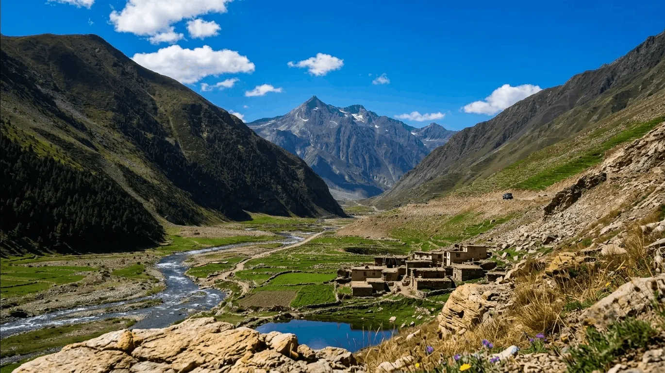
Batakundi is not a resort town in the way Naran has become. It’s a working village that has grown a tourism layer on top of an existing agricultural economy, and that shows in everything from the size of its bazaar to the rhythm of its year. Most residents are Gujjars who speak Hindko as a first language, and the local economy still runs substantially on farming — red potatoes and peas grown in the short summer window alongside the guesthouses, hotels, and jeep services that have expanded quickly over the last decade.

The practical difference travelers care about is this: Naran has more hotels, more restaurants, and noticeably better mobile coverage. Batakundi has fewer people, direct access to the Lalazar jeep track at its edge, and a shorter drive to Babusar Top the next morning. Neither town is “better” outright — they solve different problems, and a lot of experienced travelers end up splitting a trip between the two rather than choosing one.
During our own visit, the contrast with Naran was immediate. We’d spent the previous day in Naran’s crowded bazaar, and arriving in Batakundi in the evening felt like a different pace of place entirely — fewer vehicles on the road, fewer people out, and a stillness that made the sound of the Kunhar River genuinely audible once traffic thinned out.
Batakundi vs. Naran at a glance
| Factor | Batakundi | Naran |
|---|---|---|
| Crowds | Noticeably quieter | Busier, especially July–August |
| Mobile coverage | Weaker, inconsistent | Better, though still not fully reliable |
| Hotel inventory | Smaller, growing fast | Larger, more established |
| Restaurant variety | Limited — local staples mainly | Wider range, including fast food |
| Distance to Babusar Top | Shorter | About 15 km longer |
| Distance to Saif ul Malook | Slightly further | Closer, roughly 8 km by jeep |
| Access to Lalazar jeep track | Starts right at the village | Requires driving to Batakundi first |
| Overall atmosphere | Slower, rural | More of a tourist town |
Where Batakundi Is Located
Batakundi is in Mansehra District, Khyber Pakhtunkhwa, on the N-15 National Highway — also called the Mansehra–Naran–Jalkhad–Chilas Road — about 15 to 16 km north of Naran and roughly 250 km from Islamabad by road.
The village sits near where the Siran Nala meets the Kunhar River, at approximate coordinates 34.93°N, 73.77°E. It’s the first settlement travelers reach heading north out of Naran, which means every trip toward Jalkhad, Lulusar Lake, Babusar Top, or Gilgit-Baltistan on this route passes through it, whether or not people choose to stop.
Understanding its position on the map matters for planning, because Batakundi functions as a hinge point. Everything south of it — Naran, Balakot, Mansehra, Islamabad — is reliably paved and accessible by standard vehicles for most of the year. Everything north and off the main highway, particularly Lalazar and the stretch beyond Jalkhad toward Babusar, becomes progressively more weather-dependent and, in places, requires a 4×4.
Driving from Naran? Open the Google Maps directions from Naran to Batakundi before you leave to check the latest route, estimated travel time, and any temporary road delays.
Good to Know: If you’re mapping this out yourself, search “Batakundi” directly rather than “Naran Batakundi road” — most mapping services now list it correctly on the N-15, but older map data sometimes shows it as an unnamed stop.
Elevation and What Altitude Actually Means for Your Trip
Batakundi sits at approximately 2,624 meters (8,607 feet), roughly 200 to 300 meters higher than Naran. Most healthy travelers won’t notice significant altitude effects here, but nearby destinations climb much higher — Lalazar to about 3,123 meters and Babusar Top to 4,173 meters — where altitude becomes a genuine planning factor.
At Batakundi’s own elevation, the main effects are environmental rather than physiological: cooler daytime temperatures than Naran, colder nights, and thinner light in the early morning and evening as the sun clears or drops behind the surrounding ridgelines later or earlier than it would in a lower valley. Breathlessness on a steep uphill walk is common and normal here; it’s not a sign of altitude sickness at this elevation.
The altitude becomes a real consideration once you leave the village. Babusar Top’s 4,173 meters is high enough that some travelers, particularly those with no prior high-altitude experience, notice headaches or fatigue there even if they felt fine in Batakundi.
Family Tip: If you’re driving straight up from a low-elevation city the same day, avoid strenuous activity for your first hour or two in Batakundi rather than heading immediately to a hike or the waterfall trail. Dehydration also happens faster in dry mountain air than most people expect — encourage children and older travelers to drink more than feels necessary.
There’s no hospital in Batakundi itself; the nearest fuller medical facilities are in Naran or further south toward Balakot and Mansehra. Travelers with existing heart or respiratory conditions should carry their usual medication and have a clear sense of the nearest care point before continuing north.
Batakundi Weather and the Best Time to Visit

The reliable travel window for Batakundi is early June through late September. Daytime temperatures in the wider valley typically run 15°C to 25°C in summer, dropping close to freezing overnight even in peak season. Snow closes the road toward Babusar from roughly November through April, and much of the local population relocates to lower ground during that period.
June to September — the working season This is when hotels are fully open, jeep services run reliably, and the Babusar Pass road is most likely to be passable, usually from around mid-June once seasonal snow clearance finishes. Days are comfortable for walking and sightseeing.
We visited in June, and while Batakundi was noticeably colder than Naran once the sun went down, it was comfortable rather than freezing during our stay — a light jacket in the evening was enough. That said, mountain weather here varies year to year and even week to week, so treat this as one data point rather than a promise. A lot of first-time visitors underpack for the evenings regardless, so a proper layer is worth having even if it turns out you don’t strictly need it.
Within this window, July and August carry the heaviest crowds and the highest hotel rates, driven by school holidays and Eid travel. If a quieter visit matters more to you than guaranteed warm weather, late May (once roads reopen) or September offers noticeably fewer people on the road and at the main viewpoints.
Late September into early October — the photography window Poplar and willow trees along the Kunhar River begin turning gold in this stretch, daytime crowds thin out substantially, and temperatures cool to roughly 5°C to 15°C, which tends to produce clearer, crisper light in the early morning than the hazier conditions common in peak summer. This is a genuinely underused window; most tour operators push July and August packages, but a lot of experienced travelers rate late September as the better trip.
November to April — closed season Heavy snowfall closes the road north of Batakundi toward Jalkhad and Babusar entirely, and travel even to reach Batakundi itself becomes unreliable and shouldn’t be attempted without local confirmation. Many hotels reduce services or shut for the season.
Summer vs. autumn at a glance
| Factor | June–August | Late Sept–Early Oct |
|---|---|---|
| Crowds | Heavy, especially weekends | Noticeably thinner |
| Daytime temp | 15–25°C | 5–15°C |
| Hotel rates | Peak pricing | Often discounted |
| Babusar road | Reliably open | Open, but check for early snow |
| Photography light | Hazier, especially midday | Crisper, better contrast |
| Foliage | Green | Gold poplar and willow along the river |
Road Safety Tip: Mountain weather in the Kaghan Valley shifts faster than most forecasting apps account for, particularly around landslide-prone stretches of the N-15 and on the unpaved sections toward Lalazar and Babusar. A clear morning forecast doesn’t guarantee a clear afternoon at altitude. The Pakistan Meteorological Department publishes regional forecasts that are a reasonable starting point, but a same-day phone call to a hotel or transport operator is the more reliable check before setting out on any onward route.
One seasonal detail worth understanding if you’re planning water crossings: glacier and snowmelt feeding the streams around Batakundi tends to run lower and calmer in the early morning and increases through the day as the sun warms higher elevations. If your route involves any stream crossing on foot or by vehicle, an earlier start generally means an easier crossing than the same spot in the afternoon.
Distances From Batakundi to Nearby Destinations
Batakundi sits 15–16 km from Naran (20–45 minutes), about 40 km from Babusar Top (1.5–2.5 hours), and roughly 250 km from Islamabad (7–9 hours). The Lalazar jeep track is only 4–5 km but climbs steeply and can take up to an hour by 4×4.
| Destination | Approximate Distance | Typical Travel Time | Vehicle Needed |
|---|---|---|---|
| Naran | 15–16 km | 20–45 minutes | Standard car |
| Lalazar Meadows | 4–5 km (steep jeep track) | 25–60 minutes | 4×4 jeep only |
| Lulusar Lake | 25–35 km | 45 min–1.5 hrs | Standard car (season dependent) |
| Jalkhad | 20–25 km | 45 min–1 hr | Standard car |
| Babusar Top | ~40 km | 1.5–2.5 hrs | Standard car in good conditions, 4×4 advised |
| Chilas | 75–80 km | 3–4 hrs past Babusar | 4×4 recommended |
| Islamabad | ~250 km | 7–9 hrs | Standard car |
| Gilgit | 180–240 km | 6–8 hrs (summer only via Babusar) | 4×4 recommended past Babusar |
| Skardu | ~330 km | Full day | 4×4 recommended |
| Hunza | ~230 km | 7–8 hrs | Standard car (via KKH) |
These are dry-weather estimates. Every distance north of Batakundi is affected by seasonal road conditions, and travel times can extend considerably after rain, during landslide clearance, or in early season when snow patches linger on higher sections.

Worth noting from our own drive: the 15 km stretch between Naran and Batakundi took us about two hours rather than the 20 to 45 minutes it takes if you drive it directly, simply because we kept stopping. There are several waterfalls right along this road worth pulling over for, including one where the water rushes directly beneath the road on its way down to the river with real force — you feel it more than see it as you cross. We also stopped near a patch of seasonal snow still sitting beside the road in June. If you’re budgeting time for this leg, don’t assume it’s a quick hop; treat it as part of the sightseeing rather than just a transfer.
Travel Tip: At one of the waterfall stops, a local photographer was offering souvenir photos for around PKR 50 each, and the price seemed open to negotiation. It’s a small, low-pressure way to pick up a photo of the trip and support a local micro-business, worth having some small notes on hand for.
Getting to Batakundi: What Vehicle Do You Actually Need
A standard sedan can comfortably reach Batakundi on the paved N-15 from Islamabad during the normal season (mid-May through October). You only need a 4×4 for two specific legs: the Lalazar jeep track, and — in poor conditions — the stretch toward Babusar Top.

This is one of the most commonly overcomplicated points in trip planning, so it’s worth being direct about it. The N-15 from Islamabad through Abbottabad, Mansehra, and Balakot to Naran and on to Batakundi is fully paved. Small city cars make this drive regularly in summer. The road narrows and gains altitude noticeably past Mansehra, so allow extra time and drive cautiously on that stretch, especially with a loaded car, but you don’t need a 4×4, a truck, or specialized equipment to get to Batakundi itself. We made the trip in our own car with no issues.
Where this changes is immediately past the village. The Lalazar jeep track requires a genuine 4×4 with an experienced local driver — this is not a route for a rental sedan or an unfamiliar SUV, regardless of how capable the vehicle seems on paper. The road toward Babusar Top stays paved for a meaningful stretch beyond Batakundi but deteriorates in sections, and after rain or early in the season when snowmelt streams cross parts of the route, a 4×4 becomes the safer choice even if a standard car could technically make the attempt in dry conditions.
Car vs. jeep vs. motorcycle
| Vehicle | Good for | Not suited for |
|---|---|---|
| Standard car/sedan | Islamabad to Batakundi, Naran to Batakundi | Lalazar track, Babusar in poor weather |
| 4×4 / jeep (hired) | Lalazar track, Babusar Top in any condition | Not needed for the main N-15 run |
| Motorcycle | N-15 touring, Naran to Batakundi | Lalazar track in wet conditions, unless very experienced |
By private car This is the most flexible option and the one most travelers use. Plan on 7 to 9 hours from Islamabad to Batakundi, factoring in food stops and the slower pace once you’re past Mansehra. Start early — leaving Islamabad by 4 or 5 a.m. gets you into the valley with enough daylight to check in and still explore before dark, which matters more here than it might elsewhere, since street lighting is minimal and driving unfamiliar mountain roads after dark isn’t advisable.
By public transport Buses and vans run from Islamabad and Abbottabad to Naran on a fairly regular schedule during the season. From Naran, local jeeps and shared taxis cover the remaining 15–16 km to Batakundi, typically taking 20 to 45 minutes depending on how full the vehicle needs to be before it departs. This is the cheapest option and works well for solo travelers or anyone without their own vehicle, though departure times can be less predictable outside peak season.
By motorcycle The N-15 to Batakundi is a popular and manageable ride for touring motorcycles in normal summer conditions — paved, scenic, with genuine road-trip character. The Lalazar track is a different matter entirely. It’s steep, narrow, and frequently rutted or muddy, and even experienced riders on capable adventure bikes can lose traction on the climb, particularly on sections that stay damp from runoff even without recent rain.
Motorcycle Tip: If there’s been rain in the past day or two, or you’re not confident in loose-surface riding, hiring a local jeep for the Lalazar leg and leaving the bike in Batakundi is the sensible call, not a compromise. Local jeep drivers who run this track daily are also your best real-time source on current surface conditions — often more current than anything you’ll find online.
Checkpoints Routine police and security checkpoints are normal along the N-15 through the Kaghan Valley. Carry CNIC or passport copies for every passenger; this is standard practice in the region and rarely causes delay if documentation is ready.
Parking Most hotels in Batakundi have their own parking area, which matters because there’s very little formal street parking in the village itself. If you’re self-driving, confirm parking availability when you book rather than assuming it.
Where to Stay: Batakundi Hotels, Realistic Prices, and What to Actually Ask

Batakundi hotel rates typically range from about PKR 2,500 for a basic guesthouse room to PKR 35,000+ for a peak-season resort room with a view. Prices swing sharply with season and weekend demand, so treat any online listing as a starting point, not a fixed rate.
Accommodation here has grown quickly over the past several years, shifting from a handful of basic rest houses to a genuine spread of budget lodges, mid-range hotels, and resort-style properties with mountain views. That growth is good news for choice, but it’s also created a wide quality gap within the same price bracket, which is worth understanding before you book.
Budget vs. mid-range vs. luxury
| Category | What to Expect | Rough Nightly Range* |
|---|---|---|
| Luxury / resort style | Hilltop or riverside setting, valley views, buffet breakfast, generator-backed heating | PKR 15,000–35,000+ |
| Mid-range | Private bathroom, some river or mountain view, standard amenities | PKR 6,000–15,000 |
| Budget | Guesthouse or older rest-house style rooms, basic but functional | PKR 2,500–6,000 |
*These are approximate seasonal ranges only. July and August weekend rates routinely exceed the top of these brackets, especially for view rooms. Confirm current pricing directly with the property — online listings in this region are not reliably kept up to date.
Booking Tip: The question almost nobody asks, but should: does the generator run all night? Not every hotel in Batakundi runs its generator through the full night, which means “heating available” can mean anything from a warm room until midnight to genuinely reliable overnight heat. At this elevation, that difference matters more than it would at a lower-altitude destination. If a warm room matters more to you than the view, ask staff directly whether the generator runs all night rather than just whether the room “has heating.”
July and August weekends fill fast, and last-minute arrivals without a reservation often end up backtracking to Naran, where there’s simply more inventory to fall back on. Booking at least a week ahead during peak season is a reasonable buffer. Outside peak season, walk-in availability is generally fine — during our own visit, hotels and restaurants were operating normally and without any sense of being overwhelmed, and we noticed a fair number of families checking in for the night, most of them clearly planning to continue toward Babusar Top the next morning.
One thing that stood out to us about where we stayed: the two sides of the hotel looked out onto genuinely different landscapes. One side faced a rugged, bare mountain face; the other looked toward a greener, forested slope. It made the property feel like it sat at the meeting point of two different kinds of scenery rather than just one view repeated from every window. That’s not something every hotel in Batakundi will offer, but it’s worth asking about when you book — which direction the rooms actually face can make a real difference here.
Family Tip: Many properties, particularly older or budget ones, involve stairs with no lift access, and room layouts can be uneven. If mobility is a concern for anyone in your group, ask about ground-floor rooms specifically when booking rather than assuming they’ll be available on arrival.
Camping in Batakundi: Is It Worth It Over a Hotel?
Camping is a genuinely good option in Batakundi if you’re prepared for cold nights and have proper gear. Several hotels allow tent camping on their grounds, and informal riverside spots exist too, but permission and location should always be confirmed locally rather than assumed.
Camping here suits a different kind of traveler than the hotel crowd: photographers chasing early light, groups traveling on a tighter budget, and anyone who specifically wants the stargazing that Batakundi’s low light pollution makes possible on clear nights. During our visit we saw several groups of young travelers arriving with BBQ equipment and full camping gear, clearly settling in for an overnight stop before continuing north the next day — it’s a well-established pattern here, not a niche activity.
Camping isn’t automatically the cheaper or easier option, though, and it comes with real preparation requirements that first-time campers in this region sometimes underestimate.
Temperature is the main factor to plan around. Even in peak summer, nights at this elevation drop enough that a three-season sleeping bag rated only for mild conditions will leave you cold. A bag rated comfortably below freezing, or layering an emergency blanket inside a lighter bag, is the safer call regardless of what the daytime forecast suggests.
Electronics and cold don’t mix well overnight. Phone, camera, and power bank batteries drain noticeably faster in cold overnight temperatures, and camera batteries in particular can show a sudden drop in charge that surprises people who haven’t camped at altitude before. Keeping electronics inside your sleeping bag or an insulated pouch overnight, rather than leaving them in a tent pocket or vehicle, preserves charge meaningfully better. If you’re planning sunrise photography, this matters directly.
Where to actually pitch a tent. Several hotels in Batakundi permit camping on their property, often for a modest fee, and this is the more straightforward option since it comes with access to a bathroom and, usually, hot food nearby. Informal riverside camping spots exist as well, but “open” doesn’t necessarily mean “permitted” — check with a hotel or a local contact about which riverside areas are currently in use for camping before setting up, since this can shift season to season.
Packing Tip: Waterproof hiking shoes are strongly recommended if your plans involve the waterfall trail or any streamside walking, since ground near moving water here stays damp even without recent rain. Carrying a spare pair of dry socks makes a noticeable difference to comfort the next morning.
Waste and etiquette. Batakundi’s tourism season is short, and the village doesn’t have large-scale waste infrastructure to absorb a high volume of camping litter. Packing out everything you bring in, following basic Leave No Trace principles, matters more here than in a destination with formal waste collection.
Local Life and Village Character

Most residents of Batakundi are Gujjars who speak Hindko as a first language, alongside Urdu and some Gujri, and the local economy runs on two tracks that don’t always get equal attention in travel writing: tourism during the open season, and farming, particularly the red potatoes and peas grown in the short summer growing window that this area is known for regionally.
Because the road effectively closes to most travel for a large part of the winter, Batakundi has a genuinely seasonal rhythm rather than a permanent tourist-town feel. In summer, hotels and small family-run restaurants are busy and hospitable — a lot of these properties are staffed by the same families year after year, which shows in a level of hospitality that feels more personal than transactional. Outside the June-to-September window, the village empties out considerably as much of the population relocates to lower ground, and the atmosphere shifts from lively to nearly dormant.

Visitors should expect a conservative, rural setting rather than a resort environment. Modest dress is appropriate, and the usual courtesies you’d extend in any small Pakistani town apply here too. It’s worth setting food expectations early as well: during our visit we couldn’t easily find pizza, burgers, or biryani anywhere in the village. What was available, and what we’d genuinely recommend, were Batakundi’s local pakoras served with hot tea — a simple combination that suited the cool evening well. Tea cost us around PKR 200 a cup, though this is the kind of price that moves with season and demand rather than staying fixed.
Budget Tip: If variety in food matters to you, eat a proper meal in Naran before continuing to Batakundi, particularly if you’re arriving in the evening when options are even more limited.
What you get in exchange for the narrower food scene is a slower evening by the Kunhar River, where the sound of moving water carries clearly once highway traffic thins out after dark, and a shorter drive to the high passes the next morning than staying in Naran would give you.
One detail from our own evening there stuck with us more than anything else: low cloud had settled around the peaks on one side of the valley, and it genuinely looked like smoke rising from inside the mountains rather than ordinary cloud cover. It’s not a dramatic phenomenon, and it’s the kind of thing that depends entirely on the evening’s specific weather, but it’s a good example of why an overnight stay in Batakundi shows you something a quick drive-through simply doesn’t.
Things to Do in Batakundi
Batakundi Waterfall
A short, accessible walk from the main village leads to Batakundi’s waterfall — under an hour round trip, suitable for most fitness levels, and a good option for families or anyone with limited time.
The waterfall drops through a stretch of pine-covered slope close enough to the village that it doesn’t require a full excursion to reach. It’s one of the more photographed spots in the immediate area precisely because it’s easy: no jeep, no guide, no significant elevation gain. Morning light generally works best here, before the sun sits directly overhead and flattens the contrast on the wet rock face.

Worth remembering, though: this isn’t the only waterfall you’ll see. Several smaller ones line the road between Naran and Batakundi itself, and at least one of these runs directly beneath the road surface on its way down to the river, which is worth a stop in its own right rather than saving all your waterfall time for the main one in the village.
The Lalazar Jeep Track: What You’re Actually Signing Up For
Lalazar is an alpine meadow at roughly 3,123 meters, reached by a steep, unpaved jeep track that begins at Batakundi’s edge and climbs about 4–5 km, gaining over 400 meters. Only 4×4 vehicles with experienced local drivers should attempt it, and it should be avoided entirely after rain.
This is Batakundi’s most distinctive draw, and also the one that gets underexplained most often in general travel writing. The track has a genuine reputation among locals and drivers as one of the more demanding routes in the valley — narrow, with tight switchbacks and drop-offs on one side, climbing steeply enough that the elevation gain over such a short distance is the main technical challenge rather than the length of the drive.
Why weather changes everything here. In dry conditions, an experienced local driver handles this track routinely, and it’s a memorable if bumpy ride. After rain, sections can turn into deep, loose mud that traps even capable vehicles — this isn’t an occasional worst-case scenario, it’s a routine seasonal pattern that local drivers plan around. If rain has fallen in the past day or two, or looks likely, the safer move is to postpone rather than attempt it, even if the track looks passable at the bottom. Conditions further up are often worse than what you can see from Batakundi.
Why local drivers know more than the internet does. Jeep drivers who run this track daily are consistently the best source on current conditions — fresh mud, a recent landslip, a particularly bad rut — often well before that information shows up anywhere online. Asking a driver directly, “how’s the track today,” before committing is more reliable than any forecast or forum post.
Practical logistics. You cannot drive a standard car up this track — it needs a hired 4×4 with a local driver, typically arranged in Batakundi or Naran, with fares generally in the PKR 4,000–7,000 range per jeep round trip, shared among passengers. The drive itself takes anywhere from 25 minutes to an hour depending on current surface conditions and traffic on the track. Allow at least half a day total for the round trip including time at the top.
What’s actually at the top. Lalazar opens into a wide green meadow with views toward Malika Parbat and the surrounding peaks, along with a couple of small tea stalls serving basic food and drinks. Because most day-trippers head to Lulusar Lake or Babusar Top instead, Lalazar tends to be noticeably quieter — it appeals particularly to travelers who’ve already done the more crowded stops and want something with fewer people.
Babusar Top: The Main Reason Many Travelers Stop in Batakundi at All
Babusar Top, at 4,173 meters, is the highest driveable point in the Kaghan Valley and the gateway into Gilgit-Baltistan. From Batakundi it’s roughly 40 km, a 1.5–2.5 hour drive depending on conditions, and staying overnight in Batakundi meaningfully shortens the trip compared to a same-day drive from Naran.

The pass offers sweeping views into Gilgit-Baltistan, including distant sightlines toward Nanga Parbat on a clear day. Plan for a full day round trip rather than a rushed half-day — road conditions past Jalkhad can slow progress, and even a clear morning at Babusar can shift to sudden weather within an hour, which is common enough at this altitude that it shouldn’t be treated as bad luck so much as normal mountain behavior.
This trip isn’t well suited to very young children or anyone genuinely uncomfortable with narrow mountain roads and long stretches without services.
Road Safety Tip: Confirm road status before leaving — this is worth repeating because it’s the single most common cause of wasted trip days in this part of the valley — ideally by calling ahead rather than relying on an app.
Lulusar Lake
Lulusar Lake, roughly 25–35 km from Batakundi, is a glacier-fed lake and the primary source of the Kunhar River, usually visited as a stop en route to Babusar Top rather than a standalone destination.

Morning visits tend to have calmer water and cleaner reflections than afternoon, when wind typically picks up across the open basin. If photography is a priority, factor this into your timing rather than treating Lulusar as a flexible stop you can hit whenever it’s convenient on the drive.
Hiking and Nature Walks
Outside the waterfall path and the Lalazar jeep track, Batakundi has no consistently marked hiking trails — a local guide is genuinely useful here, not just a formality.
The pine forests and meadows around the village offer informal walking routes, and the terrain and weather here can shift quickly enough that getting disoriented off the main road is a real risk for solo hikers unfamiliar with the area, not a remote hypothetical. Hiring a guide costs relatively little locally and removes most of that risk.
Photography Timing: When to Actually Shoot
Early morning, roughly the first hour after sunrise, gives the clearest light on the surrounding peaks before haze and cloud build up. Late afternoon works better for contrast on ridgelines toward Babusar or from the Lalazar plateau, but clouds gather quickly in summer and can obscure views by midday.
Morning vs. afternoon shooting
| Time | Best for | Watch out for |
|---|---|---|
| First hour after sunrise | Peaks, waterfall, Lulusar reflections | Cold temperatures, low battery drain risk |
| Midday | Generally weakest light | Flat contrast, haze, cloud buildup |
| Late afternoon | Ridgeline contrast, Lalazar views | Fast-forming afternoon clouds |
| Evening/dusk | Low cloud effects on peaks, ambient light | Fading light window is short |
A few timing details that make a practical difference: the pine forest near the waterfall often still holds overnight moisture after rain, which reads well in early morning light before it evaporates. At Lulusar, mornings produce calmer water and better reflections than the windier afternoons. And because glacier and snowmelt runoff increases through the day, any shot involving a stream or water crossing tends to look — and be — calmer earlier rather than later.
We’d also point to something less predictable but worth watching for: on our evening in Batakundi, low cloud wrapped around the peaks on one side of the valley in a way that looked almost like smoke rising off the mountain. It’s not something you can plan for reliably, since it depends on that day’s specific humidity and temperature, but if you see cloud starting to gather low around a ridge at dusk, it’s worth staying out with a camera rather than heading indoors.
Photography Tip: Rules around drone use in this region can be restricted or require permission, particularly closer to Babusar Top and the Gilgit-Baltistan boundary. Check current regulations before flying rather than assuming it’s permitted.
Practical Information: Fuel, Cash, Network, and Food
Fuel: Petrol pumps exist in Batakundi and Naran, but availability past this point becomes less reliable, and there’s no fuel station in Jalkhad. Fill up in Naran or Batakundi before continuing toward Babusar Top.
Cash and ATMs: Reliable ATMs are not consistently available in Batakundi. Withdraw cash in Naran, or earlier in your journey, and carry enough for your full trip including hotels, food, and jeep hire for Lalazar or Babusar. Even small purchases here — tea, pakoras, a souvenir photo at a waterfall stop — tend to be cash transactions, so keep a stock of smaller notes rather than relying on larger bills.
Mobile network and internet: Coverage in Batakundi is inconsistent and varies by carrier, weather, and terrain. Some recent traveler reports suggest Jazz holds a more stable signal in Batakundi itself, while Ufone and Telenor tend to perform better in Naran; carrying a SIM from more than one provider is a reasonable precaution rather than relying on a single network. Don’t count on this route for work calls or navigation that depends on live data.
Food: Restaurants in the village serve Pakistani staples, trout from the Kunhar River, and basic options aimed at travelers. The range is narrower than Naran’s bazaar — as we found ourselves, don’t expect pizza, burgers, or biryani here. What you will find is honest local food: pakoras with tea being the standout, and a good example of Batakundi doing simple things well rather than trying to compete with Naran’s broader menu.
Toilets and basic facilities: Public toilets are limited outside of hotels and a handful of roadside stops. If you’re stopping for photos or a short walk, plan around hotel or restaurant facilities where possible rather than assuming public options along the road.
Common Mistakes First-Time Visitors Make
Not confirming road status before leaving. Babusar Pass and Lalazar conditions change quickly, and outdated information is one of the most common causes of trip delays in this part of the valley. Call ahead rather than relying on a forecast or an old blog post.
Underestimating the cold. Even in peak summer, nights in Batakundi drop enough that daytime clothing alone isn’t sufficient. Pack proper layers regardless of the season you’re traveling in.
Booking a hotel without asking about heating. Not every property runs heat reliably overnight, and this matters more here than travelers expect, particularly with young children or elderly relatives in your group.
Attempting the Lalazar track in a standard car or on a motorcycle after rain. This road requires a 4×4 with an experienced local driver in normal conditions, and should be avoided altogether when the track is wet. Attempting it in an unsuitable vehicle is a genuine safety risk, not just an inconvenience.
Assuming fuel and ATMs will be available past the village. Fill up and withdraw cash before continuing toward Babusar Top or Jalkhad. Options become unreliable quickly beyond Batakundi.
Rushing the Naran to Batakundi drive. It’s only 15–16 km, but treating it as a quick transfer means missing the waterfalls and viewpoints that make the drive worthwhile in its own right. Budget more time for this stretch than the distance alone suggests.
Expecting Naran-level food variety. If you want more than local Pakistani staples, eat before you arrive or bring your own snacks.
Traveling With Children, Elderly Relatives, or Solo
Families: Batakundi itself is manageable for children, particularly the waterfall walk and riverside areas. Both the Babusar Top day trip and the Lalazar jeep track are more demanding, due to altitude, road conditions, and steep drop-offs, and are better suited to older children who can handle a long or rough drive.
Elderly travelers: The altitude in the village itself is generally tolerable, but the roads toward Babusar and especially the Lalazar track involve winding mountain sections that can be uncomfortable for anyone prone to motion sickness or joint pain from long stretches in a vehicle. Plan for rest stops and confirm hotel accessibility, since many properties involve stairs without lift access.
Solo travelers: Batakundi is generally safe for solo travel, and hotel staff are typically helpful with local advice. That said, mobile coverage gaps mean it’s worth telling someone your rough itinerary before heading out on any hike, the Lalazar track, or toward Babusar Top, since you may not have signal to call for help if plans change.
Campers: As we saw firsthand, camping is a well-established option here, with groups regularly arriving with BBQ setups and tents for an overnight stop before continuing north. It suits travelers comfortable with cold nights and basic facilities more than those wanting full hotel comfort.
Family vs. solo vs. camper priorities
| Traveler type | Best fits | Skip or approach carefully |
|---|---|---|
| Families with young kids | Waterfall walk, riverside evening, hotel stay | Lalazar track, Babusar in one day |
| Families with older kids/teens | All of the above plus Babusar day trip | Lalazar track without a very experienced driver |
| Elderly travelers | Village stay, short walks, scenic drive | Long winding drives without rest stops |
| Solo travelers | Full flexibility, hiking with a guide | Off-trail walks without telling someone your plan |
| Campers/groups | Riverside or hotel-grounds camping | Camping in unconfirmed locations |
Responsible Travel in Batakundi
The village depends heavily on tourism during its short open season, and small choices add up. Avoid leaving litter along the riverbank, waterfall trail, or Lalazar meadow, since waste management here is limited compared to larger towns. If you hire a local guide or jeep driver, that income matters more in a place with such a short earning season. Respect posted or advised limits on camping locations, and ask before photographing local residents directly — the photographer offering souvenir shots at the waterfall is a good example of tourism working in a way that benefits the person providing the service directly.
Frequently Asked Questions
Where is Batakundi located?
Batakundi is a village in Mansehra District, Khyber Pakhtunkhwa, Pakistan, on the N-15 National Highway about 15 to 16 km north of Naran, within the Kaghan Valley.
What is the elevation of Batakundi?
Approximately 2,624 meters (8,607 feet) above sea level.
Is Batakundi worth visiting, or should I just stay in Naran?
Yes, especially if you’re continuing to Babusar Top, Lulusar Lake, or the Lalazar jeep track. It’s quieter than Naran and cuts real time off the drive north. Many travelers, us included, find splitting a trip between both towns works better than picking just one.
How far is Batakundi from Naran, and how long does it take?
About 15 to 16 km, typically 20 to 45 minutes direct. If you stop at the waterfalls and viewpoints along the way, as we did, budget closer to two hours.
Can a standard car reach Batakundi?
Yes. The N-15 from Islamabad through Naran to Batakundi is paved and manageable for a standard car during the normal season, mid-May through October. A 4×4 is only necessary for the Lalazar jeep track and, in poor weather, the stretch toward Babusar Top.
Is the road to Batakundi open in winter?
The paved road is generally passable, but heavy snowfall from roughly November through April closes routes further north toward Babusar Pass, and much of the local population relocates during this period. Always confirm current conditions locally before winter travel.
What is Lalazar, and how do I get there from Batakundi?
Lalazar is an alpine meadow at about 3,123 meters, reached by a steep, unpaved jeep track that begins at Batakundi and climbs roughly 4 to 5 km. Only 4×4 jeeps with experienced local drivers should attempt it, and it should be avoided after rain.
Can motorcycles reach Lalazar?
Technically yes in dry conditions for experienced riders, but the climb is steep and loose enough that even capable adventure bikes can lose traction, especially on sections that stay damp regardless of recent rainfall. Hiring a local jeep for this specific leg is the safer choice for most riders.
When does Babusar Pass open each year?
Typically from around mid-June, once seasonal snow clearance is complete, though this shifts year to year depending on snowfall. Always confirm current status before planning a trip around it.
What’s the best time of year to visit Batakundi?
Late May through September for reliable weather and open roads. Late September into early October offers thinner crowds and golden foliage along the river, and is worth considering if photography is a priority.
Are ATMs available in Batakundi?
No reliable ATMs. Withdraw cash in Naran or earlier on your route, and carry small notes for local purchases.
Which mobile network works best in Batakundi?
Coverage is inconsistent across all carriers. Some recent traveler reports suggest Jazz performs more reliably in Batakundi than Ufone or Telenor, but conditions shift, so carrying more than one SIM is a sensible precaution.
Is camping allowed in Batakundi?
Yes, several hotels permit tent camping on their grounds, and informal riverside spots exist too. Always confirm the specific location with a hotel or local contact rather than assuming any open area is available.
How cold does it get at night in Batakundi?
Cold enough that a proper jacket is needed even in peak summer. During our own June visit it was cool and comfortable rather than freezing, but this varies by year and specific weather, so pack layers regardless of season.
Do I need a guide for hiking around Batakundi?
Outside the waterfall path and the Lalazar jeep track, there are no consistently marked trails. A local guide is genuinely useful for any off-trail walking, not just a formality.
Is Batakundi suitable for families with young children?
The village and waterfall walk are manageable for most families. The Babusar Top excursion and the Lalazar jeep track are more demanding due to altitude and road conditions and are better suited to older children.
What food is available in Batakundi?
Mainly local Pakistani staples and trout from the Kunhar River. Don’t expect pizza, burgers, or biryani. The pakoras and tea are genuinely worth trying, and were the highlight of our own meals there.
Is it better to camp or book a hotel in Batakundi?
Hotels offer more comfort, reliable facilities, and better heating options, particularly useful for families or anyone sensitive to cold. Camping suits photographers, budget travelers, and groups who specifically want the stargazing and outdoor experience, and it’s a well-established option here.
How many days should I spend in Batakundi?
One to two nights is typically enough to see the waterfall, enjoy the village, and use it as a base for a Babusar Top, Lulusar Lake, or Lalazar day trip.
Are there checkpoints on the way to Batakundi?
Yes, routine police and security checkpoints are normal along the N-15 through the Kaghan Valley. Carry CNIC or passport copies for every passenger.
Batakundi rewards travelers who treat it as more than a stopover. The waterfalls along the drive up from Naran, the quiet of the village itself once evening settles in, and the steep pull of the Lalazar track above it all add up to a stretch of the Kaghan Valley that’s easy to rush past and genuinely worth slowing down for instead. If Babusar Top or Lulusar Lake are on your route, an overnight stop here isn’t just convenient logistics — it’s very likely to be one of the better nights of the whole trip.


