
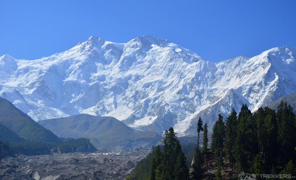
Standing on top of the ninth highest mountain in the world with a view of the far horizon expanding visibility of hundreds of miles on the 8,126-meter mountain has always been a dream of mine that I never thought I would accomplish. But somehow, I ended up on a plane with my friends, on our way to Islamabad, towards the majestic Nanga Parbat!
The trek from Fairy Meadows to Nanga Parbat is one of the best and most breathtaking treks to exist in the world. The endless, strikingly beautiful landscapes of Gilgit Baltistan along the way keep you hooked. And then an epic view of the Killer Mountain will keep arousing your enthusiasm more and more!
Our exhilarating journey started when we landed in the capital of the Islamic Republic of Pakistan. Our trip there was brief yet memorable as we visited some of the most popular sights of Pakistan. From there, we rented a Jeep to drive to our next destination.
Through Naran via the Mansehra-Naran-Jalkhad, we drove to Chilas via the Babusar Pass. After staying in an elegant hotel for the night, we continued to the Rakhiot Bridge.
Our rented jeeps easily covered the rocky trail of the bridge without any difficulty. The Raikot bridge led us to the stunning Tato Village from where we started our moderately challenging trek. During the 15 km trek, we got to experience the rich culture of the villagers along with the striking scenery. Finally, we reached the Fairy Meadows in approximately 3 hours.

Famous for its blossoming meadows with vibrant flowers and lush greenery, the Fairy Meadows was truly a remarkable sight. The snow-capped mountains, serene lakes, and the ever-present sky created a view that I will never forget. Accurate to its name, the Fairy Meadows has an enchanting and magical ambiance that you will cherish even after the trip ends.
We stayed in huts for a night at the Fairy Meadows. It was surrounded by the spectacular view of Nanga Parbat, standing at 8,125 meters, Rakhiot Peak at an elevation of 7,070 meters, and Ganalo Peak at a height of 6,608 meters. The next morning, my enthusiasm heightened as we trekked to the spot that was the sole purpose of this trek.
The rocky yet breathtaking trek felt short because of the enthralling scenery we got to witness along the way. The mountains and crystal-clear lakes encapsulated us with their surreal beauty. The trail finally led us to the most ravishing sight I have ever laid my eyes on.

The Nanga Parbat base camp had an out-of-this-world view. The naked mountain was surrounded by other majestic peaks like the Rakhiot Peak 7,070 meters, Chongra-I, and Ganalo Peak. Mountaineers know that Nanga Parbat requires impressive mountaineering skills. And thus, this is why they call it the ‘Killer Mountain’ due to its complex ascent.
This fact just enhanced my excitement rather than scared me. Our climb to the mountain turned out to be successful and worthwhile. The view from the top was exceptional as I took in the sights and tried to imprint it in my mind forever. After camping underneath, the starry sky, we resumed our trek.
Our next destination was The Jilper Peak Base Camp, where we had a full day to explore. The picturesque destination was nestled amid tall mountains, offering an unreal view. From Jilper Peak Base Camp, we trekked back to the Fairy Meadows for a day to revel once more in the strikingly beautiful scenery.
We rented a jeep again from the enchanting meadows to drive back to Naran via the Babusar Pass. There we stopped for refreshments and then drove back to Islamabad. In the capital city of Pakistan, we visited the Taxila Museum and some of the historical sites before heading home.
This trek proved to be one of the best treks I have ever trekked on because of the thrilling experience, the exquisite view, and the culture that I got to experience.
So, if you want a life-changing experience to appreciate the beauty of nature, the trek from Fairy Meadows to Nanga Parbat is the way to go.
To read about my detailed experience about the Nanga Parbat Mountain, you can read the arti le mentioned below:


