
When the call of the wild echoes, even seven seas can shrink to a single flight… recalling a heart-pounding leap that took me to Pakistan and propelled me into the wilderness, towards the frozen embrace of Hispar Muztagh.
K2, the savage king, and Karakoram, a vast range of icy giants – these names echo in every climber’s soul, enticing them from corners of the world into its frozen embrace. No true mountaineer can rest without exploring it.
But what’s the point of calling yourself a wilderness wanderer if you have never ventured to the little-known areas of the most imperial mountain range? To be a mountaineer is to yearn for every facet of its icy crown, not just the most obvious diamonds.
This is what flowed into my mind when I was searching for the lesser-known giants of the Karakoram. That’s when I came across the Hispar Muztagh, a sub-range of the extensive Karakoram mountain system.
Hispar Muztagh

Located in the Nagar district of Gilgit-Baltistan, Pakistan, Hispar Muztagh hosts numerous 7000m+ peaks. Its a kingdom of obscure challenges, a paradise for summit seekers.
Not every aspiring climber can conquer ruthless monarchs like K2, Broad Peak and Gasherbrum series on their first mountain battles. So, the Hispar Muztagh can be considered as the playground to practice before the big game against the Titans in Concordia.
For me, it was more about exploring the wilderness of a place with a less crowd of thrill-seekers. Because those mountains may wear a crown of glory, but Hispar Muztagh cradles a different treasure – silence. As someone like me, tired of the hustle and bustles of life, my heart yearned not for the fanfare of summits, but for the secrets whispered by glaciers and the echoes of eagles in unclimbed valleys.
When my friends planned a trip to Pakistan, I included Hispar Muztagh in our itinerary. Either it was the call of the wild or maybe just fate. But I felt an irresistible force pulling me deeper into the Karakoram’s secrets. So, with our bags packed and flights booked, we were all set for this expedition.
According to Wikipedia, Hispar Muztagh is the second-highest sub-range of the Karakoram, besides the highest, Baltoro Muztagh – where the colossal four eight-thousanders dwell. Its top-tier mountains include Distaghil Sar, Khunyang Chhish, and Kanjut Sar. Mathew, the topophilia in our group, kept the flames of anticipation burning with his infectious excitement, showering us with nuggets of Hispar knowledge throughout the flight.
“Kanjut Sar? What does this name mean?” This came from Kristine – the word archaeologist honey-laden with curiosity between us. “Come on, Kris, not here, please. Let’s keep the mountain lore until we get there, not during the flight,” said I, a weary traveler yearning for the silence of the mountains, not the symphony of Mathew’s storytelling. I knew my curious friends would never stop. But, what I didn’t know is that destiny had woven its narrative, the name that sparked our curiosity would become more than just a mystery. It would become our destination.
About the Kanjut Sar
Kanjut Sar is pronounced as Kunjudh Sar in Wakhi, the local language of the town where it nestles. Kunjudh is also the Wakhi name for Hunza. And thus, the name Kunjudh Sar translates to “that which overlooks Kunjudh” or “above Kunjudh.”
“Like an old kingdom obscured above the Hunza, lost in the mountains?” said Kristine, while her eyes mirrored the peak’s icy glint. “Yes, exactly like that”, Mathew replied.
“Oh, here’s an interesting tale for you to hear!” Mathew couldn’t resist without disrupting my peace. “Do you know that Kanjut Sar is actually referred to as the name of its adjacent peak, Yukshin Gardan Sar, and vice versa. This confusion of names prevails in the Shimshal Village, where they deny these mountains’ widely accepted and internationally recognised names.” Mathew gleaned up while highlighting the intriguing details. Now, this caught my interest, too.
He continued the conversation while briefing more Kanjut Sar. “It’s all part of the mountain’s mystique, wouldn’t you say? Well, this is getting more fascinating. There’s not just one, but two Kanjut Sar peaks. Kanjut Sar I is at 7,760 m, and Kanjut Sar II, to the southeast of I, is at 6,831m.” Fueled by Wikipedia’s information, Mathew had woven a spell in us with his tales of Kanjut Sar.
Our Expedition to Pakistan
Anticipation hummed in my veins when I dozed off. And next, the landing gear jolted me back to reality, Pakistan – the land of soaring peaks, breathtaking valleys, vibrant colors and culture. The capital, Islamabad that shimmered with modernity, welcomed us to start our adventure. Our guide for the tour, Sohaib Roomi, waited outside the terminal whilst his four-wheeler was ready to whisk us away into the heart of the city.
Road Journey Covering Gilgit – Hopar – Hispar
The next one-hour domestic flight to Gilgit was all about the thoughts of Kanjut Sar and Hispar Muztagh. There was a melody of excitement inside me. And I couldn’t wait to witness the grandeur of this less-explored area in Karakoram.
A bustling mosaic of bazaars and breathtaking vistas, Gilgit was a fleeting stop-over. After a short stay, we headed towards the Nagar district. The 111km distance was covered in almost 3 hours, bringing us to Hopar Valley – the launchpad for Hispar Muztagh expeditions. We bedded down in the Hunza Serena Inn for PKR 24,000 in a cozy environment, surrounded by idyllic landscapes.
Dawn broke, and with it, Sohaib arrived with a Jeep Wrangler and two porters. I really needed a pinch at this moment because this wasn’t my fever dream, but actually happening. We were heading towards the most peaceful place in the world, the Karakoram ranges!
Three friends, one guide, and two porters, we accelerated towards Hispar village in the four-wheeler. I wished to be a sleeping beauty at this time, sleep and wake reborn in the hushed kingdom of Hispar Muztagh, with no snoring engines, no grinding gears, no hustle of people, just the ethereal whisper of wind. But this was no fairytale.
After a tiring but eye-feasting road trip, we found ourselves in Hispar Village – the last town in the Nagar region. As briefed by our diligent guide, the valley is two kilometers downstream from the 49-kilometer-long Hispar Glacier.
“It can take 2-3 days of trekking from Hispar to reach Kanjut Sar,” Sohaib murmured to prepare us for the challenges. Mathew, his buddy already, bragged about our 10-day trek to Everest base camp and other such expeditions to Sohaib.
Trekking from Hispar Glacier

Without further ado, we set off for our trekking journey towards the Kanjut Sar. Excitement pulsed through my veins as we drew closer to the cold embrace of Hispar Muztagh.
Two nights of sleeping beside crackling campfires, and days spent walking on the Hispar Muztagh, we were just a few miles away from the mystery mountains. The cold winds whispered secrets of the majestic Karakoram and its frozen Kingdom. Throughout the trek, our guide fed us with nuggets of knowledge about the soaring peaks rising on the glacial territory, the valleys around, the ancient tales and the folklore, making it an enlightening experience for all of us.
Witnessing the Kanjut Sar Mountains
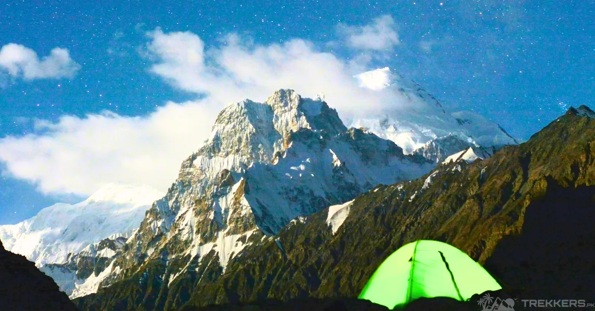
The moment when we witnessed the celestial crown of the glacial throne, Kanjut Sar, it was all worth it.
“What a breathtaking vision!” I was completely flabbergasted. The dazzling peak with a mammoth size of 7,760 m shimmered in the hushed kingdom of Hispar Muztagh. Like some lost wanderers, we seeked it serene majesty and explored the place. We didn’t waste the opportunity and went 7.6km ahead to the southeast, towards the Kanjut Sar II.
Speculating these two twin peaks and catching a glimpse of Kunyang Chhish in the sanctuary of Karakoram made this journey an unforgettable one. I was totally lost in the solitude of the place, where our voices echoed amidst the harsh, freezing winds in the snow-dusted valley.
Conclusion
The journey came to an end when we turned away from Hispar Muztagh. And so, that’s how I was fortunate enough to have my own tale of Kanjut Sar I and II, camping amidst the wilderness of Hispar Muztagh, where a piece of its magic was tucked into the quiet corners of my soul forever.


