
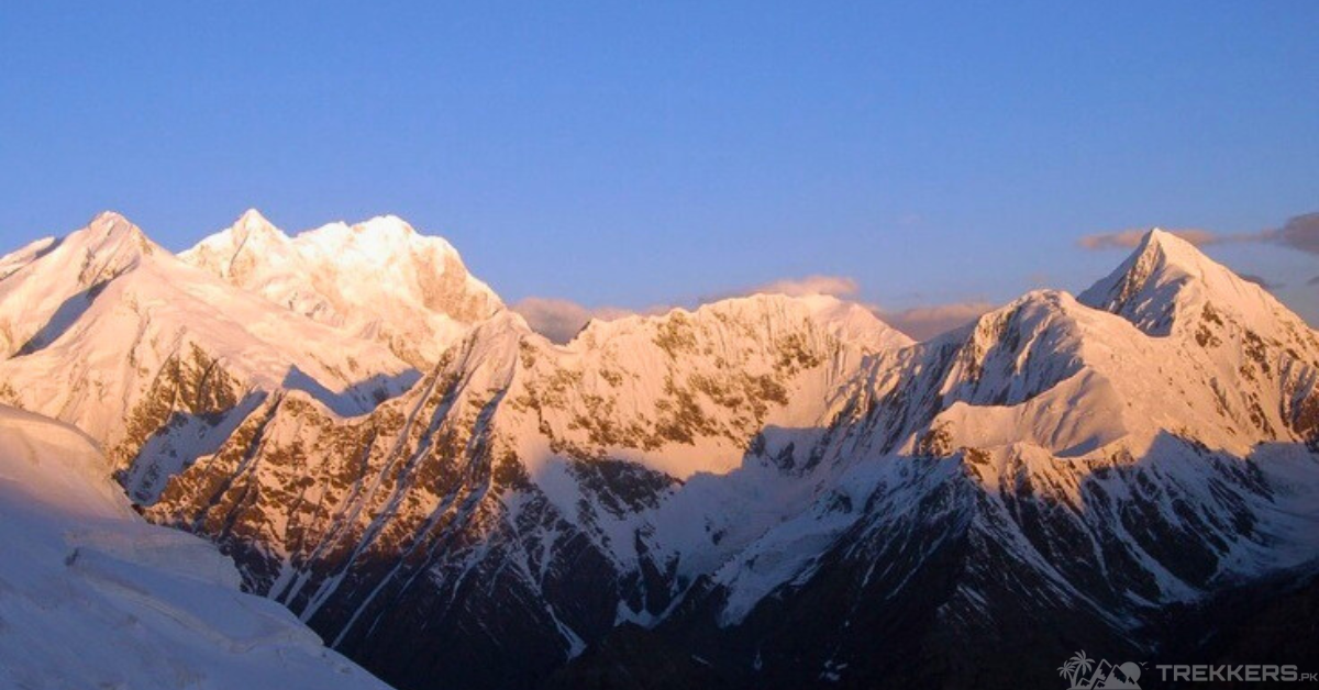
Immerse yourself in a spellbinding journey to Distaghil Sar’s majestic heights.
My interest in mountaineering developed with all due credit to my childhood friend Ann. She is an explorer at heart and always ready to experience something new. If it wasn’t for her constant criticism of my outdoor life I would never have tried Mountain climbing in a million years. She was also the one who initiated the trip to Distaghil Sar.
Preparing for Our Journey to Distaghil Sar:
After our escapade to Rakaposhi, we decided to make a group trip to Distaghil Sar Peak in northern Pakistan. We, along with four other friends, packed our bags and headed to Gilgit Baltistan, a province in Northern Pakistan. Distaghil Sar Peak, in the Karakoram range, holds the title for the highest peak in Shimshal Valley. It is the 7th highest mountain in Pakistan and the 19th globally, reaching 25,869 ft.
Climbing mountains with my friends has been a blast, but tackling a new one makes us all a bit jittery. The mix of excitement and nerves kicks in because of the unknown challenges and unpredictable terrain. It’s like diving into a new adventure together, facing fears while conquering peaks. Each mountain becomes a canvas for shared experiences, making our bonds even stronger.
Initially, we were confused by the strange title that the peak held but upon meeting some locals in Shimshal Valley, we were enlightened with the reasoning behind it. It means “above the inner ranch” in the native language of the people of Shimshal Valley. It’s a word originating from the Wakhi language which is spoken by the Wakhi people residing there.
Though we were advised against climbing the peak due to its challenging and risky routes, we were steadfast in making our trip successful. Distaghil Sar Peak is well known among professional mountaineers and a usual spot for well-trained climbers to come and test their skills.
A Thrilling Alpine Escapade to Distaghil Sar:
Our trip started from Hispar in Nagar Valley and ended at Askole in Shigar Valley. We preferred it over the other route that began from the Biafo Glacier as it was longer and less convenient. The Nagar Valley route is also more sought after as it gives a better view of the peak and its surrounding areas. Later on, we regretted not choosing the Shimshal Pass trek. It is said to be even easier and would be more fitting for newbies like us. At the same time though, it provided us with the opportunity to connect more, as friends, in light of a shared experience and gave us many cherishable memories that we are likely to reflect on throughout our lives.
Even before we began our journey uphill we were stunned by the beauty surrounding the peak. There were several hamlets and small villages spread around it. As we made our way towards the peak we made sure to make many stops along the way to experience the love and care of the natives. We were welcomed with warm food and drinks that were unique to the place. One of the locals invited us to their hut for lunch and served us Shimshal Valley’s local delicacies. Our guide fell in love with Chilpindoke which is a type of flatbread called Chapati filled with cheese, butter, yogurt, and sometimes fruits like apricots. My personal favorite was Garail, which could be compared with pancakes.
Exploring The Heart Warming Culture Along the Journey to Distaghil Sar:
We learned a great deal about their cuisine and the significance of Wakhi culture. They pay deep significance to the spring season and it is celebrated as the “Taghm” festival, which originates from the Wakhi language and translates to “Arrival of Spring”. During this time of good harvest and fertility, people celebrate by preparing traditional foods like Mul, Bath, Pirkiten, etc. Though we missed the culturally significant moment by a few months, we were still content to learn about it.
Departing with cherished parting gifts, we were bid farewell in their traditional way, with raised cupped hands behind us as a sign of respect. Despite some generous offers to guide us to ancient archaeological sites, such as petroglyphs and pictographs, we had to decline with regret due to our tight schedule.
Our Remarkable Ascent to The Peak of Distaghil Sar:

Finally, we started our ascent towards the peak. Along the climb, we discovered the lush flora and distinct fauna surrounding the mountain. Despite the rugged, difficult terrain and harsh weather conditions the peak still has a rich ecosystem. The flora includes alpine and subalpine vegetation. We saw many types of hardy grass, moss, and lichens covering the terrain but found very little variety of flowers. I was pleased to have my botanist friend with us, as they consistently identified various plant varieties during the journey.
As the trek advanced we got more and more accustomed to the rough path. Nevertheless, we were one of those groups that took an excessive amount of breaks to catch our breath. It showed how much we slacked on our physical fitness.
At the summit, our breathlessness wasn’t from exhaustion but from the awe-inspiring view of valleys and nearby peaks. Though the view was hazy because of the clouds and mist, it gave some picturesque quality to the whole thing. We took many pictures to capture the experience but the photographs did not do justice to the actual scene. Internet searches provide views of various peaks, but the reality is never as close as experiencing it firsthand. That is what I find fascinating about mountaineering.
End of the Journey:
Our guide let us choose between extending our journey to Concordia, an intersection of Karakoram peaks, or returning to Nagar Valley. Eager to extend our trek, but a friend’s prior commitments led us to decline the offer. We weren’t disappointed as it allowed us to roam around and explore more of Nagar Valley and its lush greenery.


