
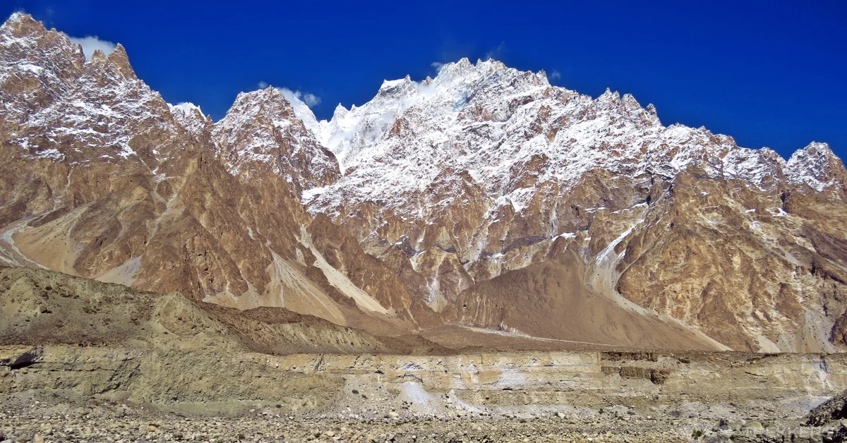
The magnificent Shimshal Village is in Gojal Tehsil of the Hunza District in Gilgit Baltistan Pakistan. Trekking through the trails of Shimshal Minglik Sar base camp trek, one can witness the majestic Minglik Sar mountain of the Karakoram range. It stands proudly at an elevation of 6,050 meters.
I wanted to disconnect from the technology and constant noise of the city. So, my friends and I decided to plan a trekking trip to the beautiful Shimshal Minglik Sar base camp. This specific trek is well-known for being one of the major attractions for the tourists of Hunza. Our journey started when we landed in Islamabad after a tiring flight.
Renting a Jeep Wrangler, we traveled for three days with multiple stops to fuel ourselves, through the beautiful routes of Islamabad, Rawalpindi, Chilas, and Karimabad. And then we finally reached the place that made us plan this trip in the first place; Shimshal Village. Although our stay in these magical cities was brief, but yet it was memorable just the same. It could not match the excitement I felt when I laid my eyes on Shimshal Village.

The striking beauty of Shimshal Village left me in pure awe, with its stunning natural scenery of towering peaks, lush green valleys, and enchanting lakes. The locals living in the village were extremely welcoming and known for their hospitality and rich culture. They treated us like guests, and we had a blissful time staying there for a night.
The next day, we started our trekking journey from the village to Furizin. To reach our next stop we had to cross the crystal-clear Shimshal River to Bandsar Village. After an unchallenging 2-hour trek we reached Pamirthung. There, we had to cross another breathtaking river, the Pamirthung River by a suspension bridge to Garsar. We stayed in Garsar for a while to have lunch with a spectacular view of the Yazghil glacier, White Horn, Dastagil SAR, and many more stunning landscapes.
From Furin we continued our trek to Arbab Parian. The trail through the first hour was steep and rocky but it got easier as we reached the Chichan Bridge. It is named after Mr. Chichan who donated money to build the Pamirthung Bridge. After 2 hours of climbing, we reached Parinsar from where we could see the enthralling view of Maidur Valley, Chashkin (6000 m) Peaks, and even Minglik SAR (6,050 m) mountain. We camped there for the night before moving to Shuijerab.
It took us 5 to 6 hours to reach Shuijerab. It is also a summer settlement of Shimshalies, where shepherds stay with their livestock for 3 to 4 months each year. Watching sheep, goats, and Yaks in the field was a beautiful view. After staying there for a while, we resumed our trek further.
From Shuijerab the trek to Shimshal Pass was quite steep until we reached Gulchinwashk. There were blooming green meadows in our view when we stopped to have lunch in Gulchinwashk. We also laid eyes on two beautiful lakes, Lupwhooyee and Zaklayee. Later in the night, we camped there right next to the extremely beautiful lakes.
The next two days of our trip were spent climbing the majestic Minglik SAR. Usually, if a climber is well acclimatized, they can climb the 6,050-meter-tall mountain in approximately 9 to 10 hours while reaching the summit and back. The climb was quite easy for us because we had the basic mountaineering skills. When we reached the top, the view was beyond any description I could ever form with words. We could even see the mighty K2, Veijarab Valley, Yashkun Garden, Shimshal Mountains, Baraldu Valley, Mustagh ranges, Pamir and Kanjut SAR. The two days that we spent there were glorious, from the view to the climbing experience, everything was perfect.
After climbing the mountain and reveling in the stunning beauty of Gilgit we trekked down back to Shimshal in four days and rented a four-wheeler again to drive to Karimabad. In Karimabad, we spent our day visiting the ancient Altit (900 years old) and Baltit (700 years old) forts. We also visited the beautiful Duiker Valley before heading to Naran via the Babusar Pass. From Naran, we drove back to Islamabad and then flew back home.
The breathtaking landscapes, the warm hospitality of the Wakhi people, the easy trek, and the unique experience set the Shimshal Minglik SAR base camp different from others. This trip will forever be etched in my brain because of the unreal scenery I got to witness, and I will certainly trek this route again or as much as I will be able to.
Read our yet another stirring expedition to Shimshal from Chafchingol Trek here: Shimshal Chafchingol Trek: A Journey To Remember


This Post Has One Comment