
Pakistan isn’t just a country; it’s a breathtaking landscape painted on Earth’s canvas. Towering mountains pierce the sky, vast deserts stretch as far as the eye can see, and tranquil rivers snake through verdant valleys. But beyond these iconic destinations lie hidden gems waiting to be discovered. One such gem is the remote Burzil Pass.
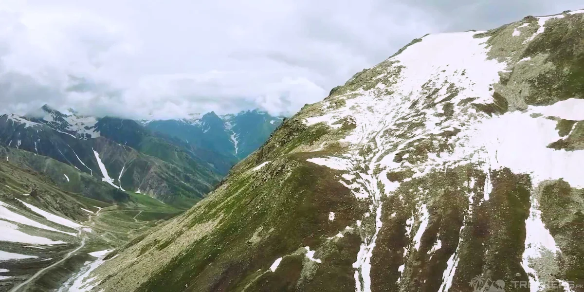
Often overlooked, this mountain passage nestled in Gilgit-Baltistan is more than just a scenic wonder. Burzil Pass is located in the Northern Pakistan region, Gilgit Baltistan. It is a mountain pass of a stupendous height of 4,100 m (13,451 ft) adorned with layers of snow.
The pass lies some 30 kilometres north of the Line of Control (LoC) and serves as the de facto border between the longstanding rivals Pakistan and India. But Burzil Pass holds more than just geopolitical weight. It is a vital link between Skardu and Gilgit (a city in Gilgit Baltistan). It is recognized as the sole route connecting 61 villages within the region.
Ready to explore what makes Burzil Pass a significant destination? Join us in an adventure of exploring the captivating beauty and intriguing history of this unique landmark.

En Route to Burzil Pass:
Travelling is packing, unpacking and repacking all the stuff again and again which can be quite frustrating. But in the middle of all this boredom, we have the support of our tour guide Asad Kareem. Asad effortlessly turns our moments of frustration into laughs with his distinct style and amusing anecdotes. Lauding his efforts, he made our journey worthwhile in this heavenly mountainous region.
His wit and experience in guiding tourists in the region have gifted us with moments of immense joy. Continuing our journey he kept sharing each account related to every area ranging from folklore to historical and cultural importance.
The pertinent risk while travelling in the region appears in our way was the unpredictable weather conditions. The route was well constructed however the road was mostly covered with huge snowfall rendering it inoperative for half of the year.
Our schedule to travel the region was March, sparing us from this obstacle and allowing us to fully delve into the idyllic views at Burzil Pass.
Arrival at Burzil Pass:
In the outer limits of Minimerg, a town near Burzil Pass, you see a zig-zag pattern road en route travellers to the mountain pass. Seemingly in a way, the mountains paved a road to call the visitors to come there. As we approached it was revealed to us that the Pakistan Army is overseeing this area majorly due to its geostrategic location bordering with India.

Our time at the Burzil Pass was limited but after multiple requests, we got permission to stay there for half an hour however we managed to extend it up to an hour. The army personnel were very courteous of our desire to experience this remote and pristine location. Acknowledging that these places are unusual for urban dwellers and granting us ample time to inhale the fresh breeze of this snow-blanketed region.
Our witty guide Asad told us that Burzil Pass is the ancient route for merchants to travel in the country. Horses and ponies were used to take travellers across. In the 20th century, a hut was built at the apex of the mountain pass to exchange mail and couriers – serving as the medium of communication.
Exploring the Surroundings:
Along with strategic and historic distinction, Burzil Pass adds its name to the beautiful destinations of the world as well. Enhancing the beauty of this mountain pass, the Astore River originates from its western side, penetrating its way ahead in the region. The raw beauty of nature attracts visitors to come, witness the allure of this scene and immerse into a soul therapy session.

Due to security reasons, our brief stay at Burzil Pass let us explore more but less time means fewer photography opportunities. I had to choose between capturing these mesmeric views or letting myself enjoy this moment more.
I opted for the latter. Yes! Because taking pictures will become an account of visiting the place but the feeling of immersing myself in the moment will remain with me forever.
As a photography enthusiast, I made the harder choice but I knew I would never regret this decision. Travelling should be living the journey within rather than telling a story to the masses every time. Though the decision was difficult, I trust that I will find solace in the richness of inhaling this experience.
Reflections & Recommendations for Future Travelers:
Burzil Pass is a breathtaking beauty. The 5-6 ft heap of ice on the sides of the road feels like the grand guards are welcoming visitors throughout the route. Not only this, as much as the eyes saw at every corner there was only serenity to feel. The crystal clear water gushing down from the Astore River multiplies the magic of the destination. I was utterly spellbound witnessing this nature’s masterpiece.

As our sojourn is in its final moments, my heart still wants to prolong our stay. But as we already asked for an extension of our allotted time I doubt another plea would be heard. So we humbly move out from the mountain pass. In that instant, I vowed to myself to revisit this soul-stirring landscape. In a nutshell, Burzil Pass is a complete feast for the senses. We bid farewell to this majesty though my spirit whispers “Until we meet again.” Au Revoir!


This article is very interesting and informative! The website is a great source of useful
information.