
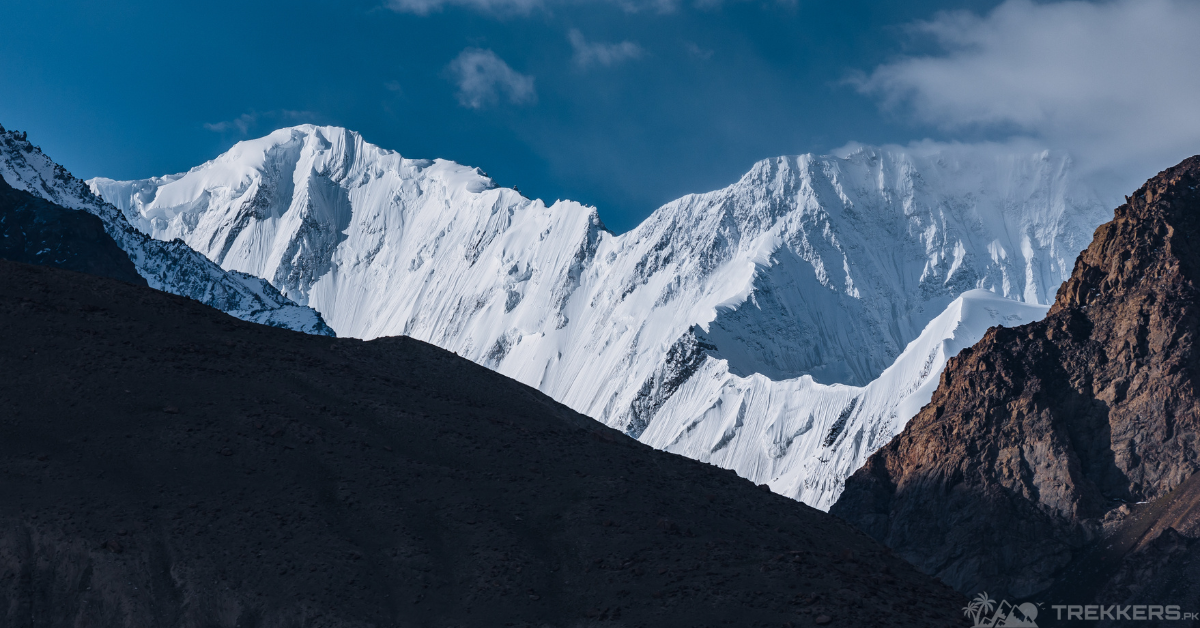
‘To improve is to change, so to be perfect is to have changed often. In the unpredictable tempests of life, preparedness becomes the compass guiding us toward perfection’ -Winston Churchill
Embarking on a mountain ascent to the Hindukush Range (800-kilometre-long) is not a breeze; it is a daring escapade, to where the weather adds its dramatic flair. It requires intensive training, discipline, and resilience. There are many chances of your climbing adventure turning into a disaster if you do not follow the measures or are trained accordingly. Weather is one of the major contributing factors to your ascent going downhill when it comes to conquering the Hindukush range.
This article will help you prepare for the frigid weather of the Hindukush range.
I have been climbing mountains since I have been able to. It is an integral part of my life and the one thing I have learned from my vast experience is to be prepared for everything. Nature can test you in ways you can never imagine. One moment it’s sunny and you are making progress fast, the other moment the temperature drops drastically and you have to make a detour back to a safe spot.
My friends and I have always been intrigued and insanely fascinated by Pakistani mountains’ unique topography and geography. We decided to start our adventure in Pakistan from the breathtaking Hindukush Range.
My experience with climbing mountains helped me navigate quite easily during my trip to Hindukush. Still, there were points where I felt like I wouldn’t be able to make it past that point but I somehow pulled through and accomplished my goals.
Proper planning is extremely essential for a region as vulnerable as Hindukush. Unlike many other mountains, the climate of Hindukush shows great variations as the region experiences rainy or snowy summers from July to September and dry winters. However the central and western Hindukish experiences hot and dry summers. The Chiantar Glacier cloaks the extreme eastern end of Hindukush with the heaviest snow and ice.
Heavy snow and ice cap the higher sections around Mount Tirich Mir and Saraghrar. Forests cover many southern slopes of the eastern and central Hindu Kush, where there is abundant snowfall in the winter and irregular precipitation from the summer monsoon. In the northernmost mountains in Pakistan’s Chitral district and the Gilgit district (Pakistan-controlled Kashmir), precipitation on lower slopes is sparse.
What Can You Face While Being In The Hindukush Range?

It is really necessary to be aware of what you are about to face. Researching about the mountain you are climbing is one of the most integral parts of having a safe and successful journey. Before planning a trip, I read every authentic article I can about the destination In that way, I can be aware of what I am getting myself into.
The severe cold in Hindukush was salvageable because I came prepared for it. Here are some weather calamities you might face while traversing through the Hindukush Range:
Avalanches In Hindukush Range:
The mountainous terrain of Hindukush holds quite a high risk for avalanches. While climbing the Saraghrar Mountain of the range, I managed to dodge an avalanche by mere inches. You need to be as cautious and active as you can be while climbing a mountain to prevent an accident.
Snowstorms In Hindukush Range:
Snowstorms are one of my biggest fears while climbing a mountain. Your vision is one of the most important necessities while making an ascent. Snowstorms often come with heavy snowfall that reduces the climber’s visibility. Snowstorms can also increase the risk of avalanches and slippery surfaces. It is necessary to plan your climb with adequate rest stops or emergency shelters for situations like this.
Rockfalls In Hindukush Range:
While climbing a mountain, it is normal to witness unstable rock formations. While traversing through the Hindukush range, I encountered numerous rockfalls. I ensured a safe journey by consistently wearing a helmet, staying alert, being observant, choosing stable weather conditions for climbing, and having teammates.
Glacial Hazards In Hindukush Range:
Glacial movements can lead to risks like crevasses and serac collapses. It is integral to have the appropriate gear and knowledge when navigating glaciers.
High Winds:
During our journey to the mountains of the Hindukush Range, we experienced gusty winds due to its high altitude and exposure. Influenced by the jet stream, wind patterns vary seasonally, impacting climbing and trekking activities. The winds slowed us down quite a lot.
Altitude Sickness:
Some severe altitude sickness affected some of the friends I climbed Saraghrar mountain with. We promptly brought them back to the base camp before anything serious occurred.
How to Conquer These Natural Calamities:
Severe altitude sickness affected some of the friends I climbed the Saraghrar mountain with. They were promptly brought back to the base camp before anything serious occurred.
To successfully conquer the majestic mountains in the Hindukush Range, the most integral part is thoroughly planning and preparing for what might come your way. Here are some of the tips that can help you survive in the frigid weather of the Hindukush range:
- Appropriate Gear:

Although being trained extensively is necessary, carrying appropriate gear with you is integral too. Investing in high-quality weather-appropriate gear, like waterproof and windproof clothing, reliable footwear, and necessities goes for a long term.
- Acclimatization:
You cannot conquer the perilous mountain routes without acclimatization. Acclimatization ensures a safe and healthy journey to the beautiful summits of the Hindukush Range. Ensuring proper acclimatization to the weather conditions protects against altitude sickness.
- Research Thoroughly About The Mountain You Are Climbing:
Being aware of all the possible routes considering the climate variations and potential risks is one of the most important parts of having a safe journey. Reading travel blogs about other experiences helps people discover trails and routes that aren’t discussed or mentioned as often, providing valuable insights.
Conclusion:
Navigating and thriving in the frigid embrace of the Hindu Kush demands a comprehensive approach to cold weather preparedness. Beyond merely enduring the biting cold, adventurers can transform their experience into a triumph by following key strategies.
Mastering the chilly conditions of the Hindu Kush calls for a well-rounded strategy. Smart planning, getting used to the altitude, keeping a tough mindset, and staying flexible as the weather shifts. When you weave these basics into your prep, it’s not just about dodging hurdles but turning your frosty expedition into a feat of toughness and discovery.
Read more about the Hindukush Range and its mountains in this blog: Hindukush Range: Embarking on a Thrilling Adventure to Hindukush Range, Pakistan.


