
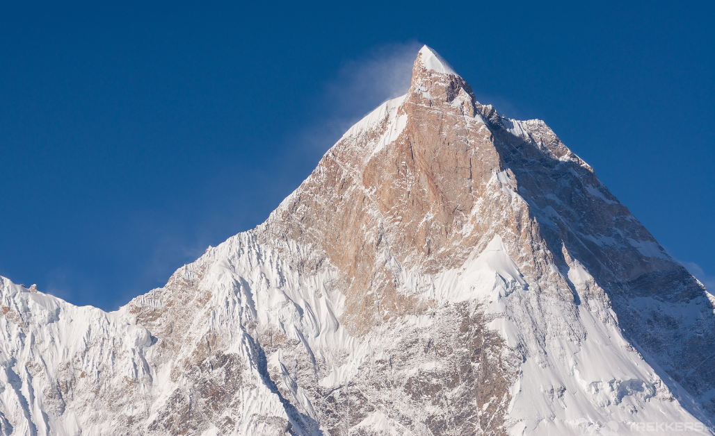
Trekking to Masherbrum (K1) Base Camp can excite anyone’s imagination. It is one of the greatest mountains, with a height of 7,821 m, hidden in a rugged and isolated area in the Gilgit-Baltistan region of Pakistan.
I always dreamed of witnessing this 22nd highest peak in the world, and Pakistan’s 9th highest peak from the closest. So without any further ado, I set off with my husband, Alex, for the journey that led me to the mighty Masherbrum.
Masherbrum Peak lies at the edge of the Hushe Valley, the last settlement of Pakistan. The trek is easily accessible and relatively straightforward. One can imagine the magnificent views while walking into the heart of the Karakoram ranges. I just couldn’t stop fantasizing!
Reaching Islamabad:
Our journey started when we flew from Spain and reached Islamabad, the capital of Pakistan. There, we met our tour guide, Sohaib Roomi, and got introduced to our fellow adventurers accompanying in the trek. After a brief stay, we flew with them to Skardu, a small town in the Gilgit-Baltistan region. The scenic flight with glimpses of Nanga Parbat and the Himalayan ranges kept me hooked throughout.
We rested for a day in the Skardu Hotel and then packed our bags, geared up for the upcoming jeep drive. Our next stop was Hushe Valley, the town from where we began our unforgettable venture. We headed north to Khaplu, passing by Khaney and Kanday villages and finally reaching our destination after a 6-hour drive.

Starting the Journey from Hushe Valley:
“Absolutely breathtaking”!
This was my reflexive reaction to seeing the picturesque village of Hushe. But this was just the beginning, the beginning of an idyllic expedition.
We spent a day here resting and acclimatizing to the altitude. While exploring the heavenly land and meeting the hospitable locals, I got to know more about the Masherbrum. Before the four eight-thousanders (K2, Broad Peak, Gasherbrum I, and II) were discovered, this peak was regarded as the highest peak in the region for a long time. Thus, it has an iconic reputation here, and many major projects are named after the peak.
Trek to Masherbrum:
The trek to Masherbrum base camp from Hushe is about 5 days long. The first few days are relatively easy, as the trail winds through lush forests and past cascading waterfalls. However, the last few days are more challenging, as the trail becomes steeper and more exposed.
When the trek started, I was more than elevated. It was like walking towards my dream place. We crossed the footbridge over the Hushe River and then walked to the west bank, towards the fields. A trek of almost 2-hours led us to our first campsite, Parbisan. It is six kilometers away from Hushe and a beautiful spot for an overnight stay.
The next day, we were more stimulated as we moved closer to our destination. Our this day’s 4-hour trek today turned out to be a bit difficult due to the glacial moraine. The snout of Masherbrum Glacier was visible after we crossed a river bank. The next challenge was to climb to the top of the western lateral moraine of the Masherbrum Glacier. It was a one-hour climb, and it took us 45 minutes to ascend on the lateral moraine covered with flowers and shrubs. Then a gentle descent of 15 minutes got us in a basin called Brumbrama (meaning ‘between mountain and willow bush’) which is at 4050 m in height. Camping here on a sandy area between the willow bushes was an absolute delight.
Pumped up and holding our nerves, this day was all about excitement and buzz as we were finally heading towards Masherbrum base camp, following the trail up the valley heading north while contouring along the lateral moraine of Masherbrum Glacier. After walking on the glacier for 45 minutes, we finally reached the Masherbrum base camp.

The magnificent Masherbrum peak stood all in its glory as we had a glimpse of it. The uniquely shaped summit with snow covers hiding behind the clouds was totally enticing. We relaxed and sunbathed in the meadow with splendid views of Masherbrum in the surroundings.
Conclusion:
It was indeed a journey very close to my heart. The memories I carried while returning from there will be cherished forever. It was a challenge, but also an amazing venture. I would highly recommend this trek to anyone who is looking for an adventure.


