
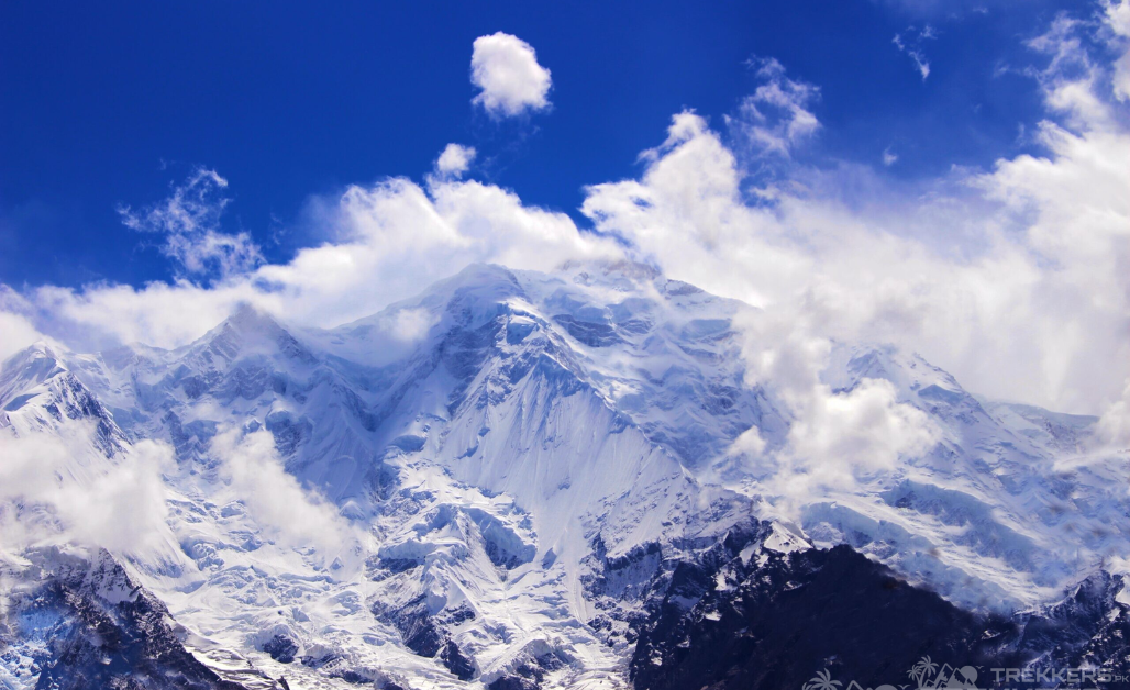
Rakaposhi is a spectacular mountain within the Karakoram range, Gilgit Baltistan, Pakistan. It is situated in the middle of the Nagar Valley and Bagrote Valley. The breathtaking mountain is extremely broad, measuring almost 20 km from east to west. It has an elevation of 7,788 meters and is ranked 27th highest in the world!
The hike to Rakaposhi Base Camp is known to be one of the most beautiful hikes you can do in Pakistan. As a mountain climbing enthusiast, I planned a Rakaposhi Base Camp trek trip with my friends. Trekking to Rakaposhi and witnessing this peak has always been a dream for me. As soon as I got done with my senior year of highschool, my friends, one of them being Ann, were ready to take on this exhilarating journey before parting ways for university.

We landed in Islamabad and hired a tour guide to help us navigate through our journey. With a rented jeep we commenced our road trip. During our captivating drive we passed Rawalpindi and Chilas and witnessed some remarkable monuments and landscapes.
After the enjoyable yet tiring journey and multiple stops, we reached Minapin in approximately ten hours. Our trek started from there. After a break, we took our bag packs and moved towards the destination we wanted to witness oh so eagerly.
Our tour guide suggested we start our trek as early as possible. The hike is approximately 7 hours without any breaks. After camping for a night, we woke up at the rise of dawn and started our trek from Minapan. Trekking for a while along the road, we came across a bridge to a hydro plant. From there, the path got a little rocky as we walked at the side of the mountain. The trail then leveled as we walked through the thick forest.
Walking through the forest, we passed through a local village where we could see the Minapin Glacier from the left, it was truly a sight to behold. After walking for an hour, we ascended up a hill and reached Hapakun campsite.
Trekking from Hapakun to Rakaposhi was thrilling and terrifying altogether. The trail was uphill with a steep climb that zigzags through the alpine forest for almost an hour. We also passed through the beautiful walnut and apricot orchards. The owner of apricot orchards even gave us freshly picked apricots that we ate while basking in the stunning view of the surrounding peaks.
After walking for 60 minutes, the enthralling Rakaposhi mountain came into view. The moment when the mountain appeared, and we witnessed the magical beauty of the place was surreal and full of serotonin.

We continued to climb for a while until we reached the ridge where we got a clearer view of the mountain and the glacier beneath it. I consider myself extremely privileged to be able to witness the Minapin Glacier as it is one of the most magnificent glaciers I have ever seen. The glacier’s psychedelic pattern fascinated me the most on this entire trip. We spent a while there, just basking in the magnificence of the landscape we had before our eyes.
From the ridge our base camp was only 15 minutes away, so we decided to quickly move forward. The base camp is located at an altitude of 4,150 meters. The campsite was beautiful with the view of the mountain and the lush greenery surrounding the area. We set our camps under the starry cold sky and retired for the night.
The next morning, we moved our camps to the Diran Peak Base camp where we had a bonfire. Ann and I decided to part ways here as she wanted to explore the Rakaposhi base camp some more. The environment there was enchanting, we fueled ourselves with food and continued our trek to Minapan. From Minapin we drove for an hour to Karimabad.
In Karimabad, the weather was idyllic we took a stop there for a while then started our 4-to-5-hour trek to the beautiful Ultar meadows. The trail begins just before Baltit fort, following the water channel into the mouth of the canyon. The start of the trek was steep and slippery. After a while, we reached the Shepherd’s huts, which is the Rakaposhi base camp trek of Ultar peaks. The vibrant flowers and the fields were a remarkable sight.
From Ultar meadows we continued our excursion to Hon Pass. Hon Pass (4,257 m) is on a steep ridge above Ultar and has a magnificent view of Hunza valley and the west end of Hisper, Spantik, Sosbun and Rakaposhi-Himalayan ranges. The view there will forever be etched in the brain. After staying for a while, we trekked back to Ultar meadows and then back to Karimabad.
In our last days in Karimabad, we visited some of the local places there like the 700-hundred-year-old Baltit fort and Baltit village. The fort was beautifully built and just experiencing the life of the villagers there and learning their ways was really fascinating. We also visited the Altit village and the women carpenters of Hunza, seeing those women work there inspired me a lot. Then, we stayed a night in Karimabad and then drove to Naran via Babusar pass (4,173 m) and then to Islamabad.
This trip and the scenery I witnessed on this Rakaposhi Base Camp trek and Hon Pass trip were exceptional. Every day surprised us with a new adventure. After our memorable trip, I suggested to some of my friends to go on a trip to the Rakposhi camp as it was truly exhilarating and blissful.
Escape reality and head to the enchanting Rakposhi trek for a magical getaway.
To explore the majestic Rakaposhi Mountain some more, you can check this articles out:
A Helpful Guide To Survive Extreme Cold During Rakaposhi Trek
To read about Ann’s experience at the Rakaposhi base camp, check this article out:


