
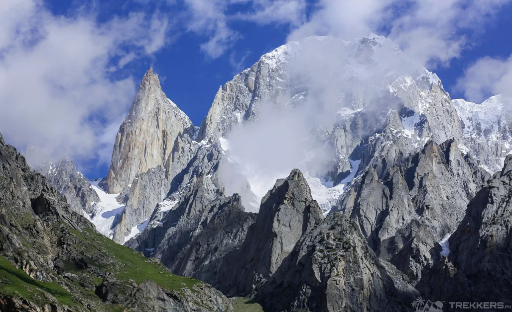
Lady finger Peak, also known as Bublimotin, is part of the magnificent and picturesque range of Karakoram. It is well hidden in the range and boasts a peculiar shape resembling a dainty lady’s finger. The view is exquisite and totally captivating and etches into one’s mind.
From action-packed hikes to the breathtaking view, the experience of traveling to Lady Finger Peak is absolutely riveting! And it will leave you in awe of nature’s wonders.
Bublimotin or The Ladyfinger Peak, lies on the southwest ridge of the Ultar SAR massif, the most south-easterly of the major groups of the Batura Muztagh above the Hunza valley. During my last visit to Hunza, where I had the privilege to explore the breathtaking Rush Lake, I had decided that the Lady Finger Peak was going to be my next destination. Our thrilling and rip-roaring journey to the beautiful mountain started after my family and I fueled ourselves with some breakfast. We embarked on our journey as we landed in Islamabad which was a surreal experience as we got to witness the rich culture there.
From Islamabad, the travel time to Chillas was around 11 to 12 hours via Naran and Babusar Top. The Babusar Top is the highest passage in the Kaghan valley, it was indeed a beautiful and remarkable sight. The exciting journey continued with us reaching Karimabad from Chillas in six hours, on the way there is a junction point where the three majestic mountain ranges i.e., Karakoram, Hindukush, and Himalaya meet. We also went to the famous Baltit Fort there. After Karimabad we started our 4-hour journey to the entrancing Ultar meadows.

From the Ultar meadows, we trekked for almost 3 hours to finally reach our destination, Lady Finger Peak. With a heart full of contempt, I set foot on the path that led us to this majestic mountain. Due to the tiresome journey, we decided to retire to our base camps for the day. In the morning after having our breakfast provided by the staff at our camp, we proceeded for our first hike. It was an awe-inspiring moment when I first laid my eyes upon the magnificent peak for the very first time. The weather was idyllic as the sun was shining upon the tall peaks. It was a sight that I will hold on to forever.
While we visited various locations in between reaching our destination there was something so fascinatingly calming about the multiple hikes we took there. The mountain’s elevation was 6,000 meters. We used to take our snacks there and make our hike more exhilarating.
The tour guides there also briefed us about the folk tale about the peak. A magical prince named Kisar marries princess Bubli. When Kisar’s first wife is kidnapped, he promises Bubli to return when the grain he left with her is finished. She waited for her husband patiently while feeding a chicken with one grain each year, hoping for Kisar’s return. Their love story echoes through time atop the majestic peak. Our camping base was also very pleasant. It had a warm feeling to it and provided us with our every need including other fun activities
As I said farewell to Ladyfinger Peak, my heart was filled with a mixture of bittersweet feelings. The beauty of the towering peaks and the magical tales that encapsulate the mountain will forever hold a special place in memories. The trip was a core memory for all my family members too.
It was super economical as the whole package was only PKR 34,000 with every facility provided with it. Though I left the peak behind, its magic will always remain with me.


