
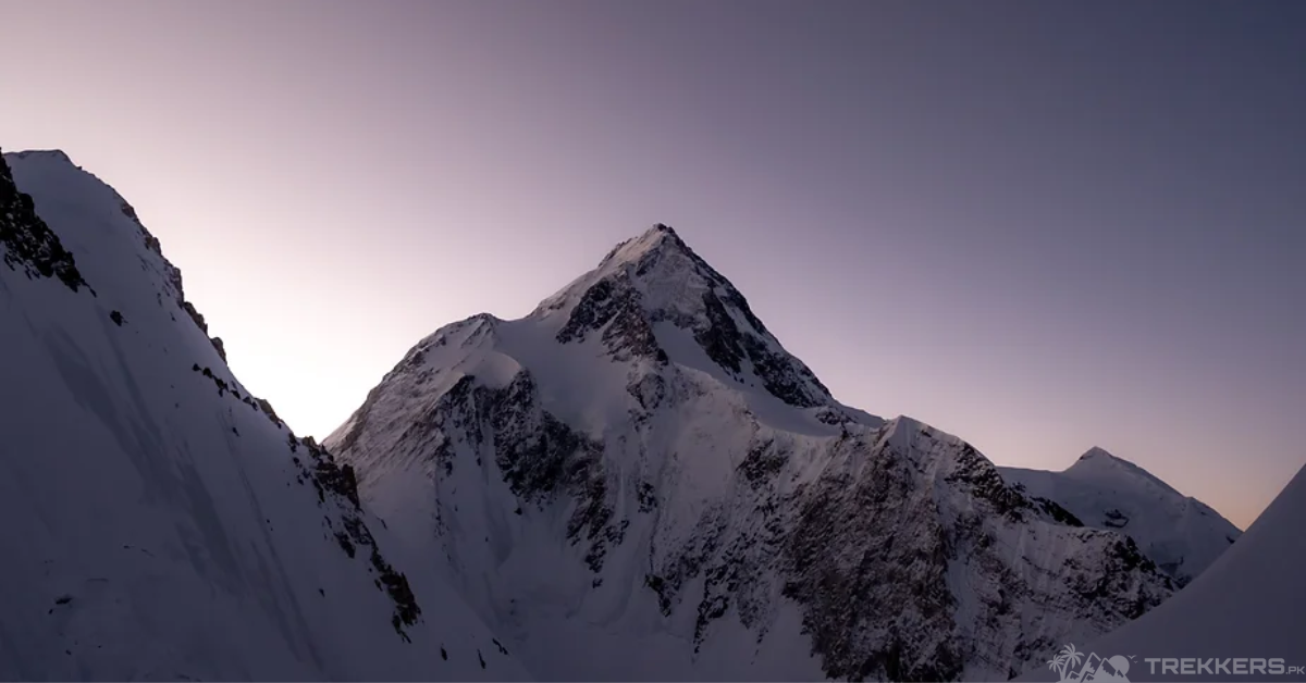
Gasherbrum II aptly can be described as the gentle giant of the Karakoram range. The peak is best for new climbers who aim for the other higher peaks. It offers a beginner’s challenge with its less daunting physical structure and predictable weather conditions. This tests mountaineers’ climbing skills, mental agility, and physical fitness and checks their ability to summit neighboring towering peaks.
This article explores the Gasherbrum II summit and narrates tales about its conquerors, along with essential tips for the aspiring folks heading to climb it.
Gasherbrum II: First Ascent and Exploration:
Dated back in 1856, Thomas George Montgomerie, a member of the British Royal Engineers and Great Trigonometric Survey, labeled the mountain “K4”, meaning the fourth mountain of Karakoram.
Gasherbrum massif were explored in 1909 by Italian mountaineers, Duke of the Abruzzi and Vittorio Sella. By 1934, an international expedition led by Swiss mountaineer G. O. Dyhrenfurth studied possible routes to the summit of Gasherbrum II. The expedition reached an altitude of 6,250 meters on the south face of the mountain. At that time, it was the highest elevation that any climbing party on Gasherbrum II had reached.
In 1956, Austrian climbers Fritz Moravec, Josef Larch, and Hans Willenpart made the first successful ascent of Gasherbrum II via the Southwest Ridge. After establishing Camp I, they were forced to descend. Upon their return, they discovered that an avalanche had buried the camp, along with all of their supplies and food. Despite this, explorers decided to make a summit attempt sooner. Changing their route, they spent the night in a bivouac sack and reached the top the next day.
Gasherbrum, in its local Balti language, means Shining Wall. The Gasherbrum Mountains are located in the Baltoro Glacier, on the bordering plain between Pakistan and China. Gasherbrum II is the third-highest peak of the Gasherbrum massif. As its name suggested by explorers, “K4” is the fourth highest of the Karakoram Range. Its humongous structure manages to accolade it among the world’s eight-thousanders peaks, gaining the position of the world’s 13th-highest standing at 8,035 meters (26,362 ft) above sea level.
Mountaineers try to summit winter ascension on the peak. The athletes Simone Moro, Denis Urubko, and Cory Richards won this title in 2011 when they finally made the record of reaching the summit of Gasherbrum II at the height of 8,035m.

Preparing, & Training Tips for Aspiring Climbers:
Today, Gasherbrum II is considered one of the most convenient eight-thousanders to climb. Many climbers have skied, snowboarded, and parachuted triumphantly after successfully summiting the mountain. According to stats of NASA Earth, Gasherbrum II has a minimal fatality rate of about 2 percent, the second lowest for the 8,000-meter peaks, eventually gaining prominence for the higher successful summit rate.
However, do not underestimate the dangers of climbing, even though it may seem convenient. It still requires you to be physically and mentally fit to undertake the hardships of ascent. All climbers must gear up with necessary gadgets (chargers, batteries, torches, etc.), equipment (like crampons, an ice axe, a helmet, and a climbing harness), and preservatory food supplies before the ascension. You can only achieve the summit push if you are in perfect health.
Meanwhile, it is better to understand the weather conditions to avoid avalanches and falling rocks. For more ease and relief, go with a guide who favors taking the steps closer to the destination. The mighty mountains lure the adventurers to summit the snowy peaks of northern Pakistan.
Conclusion:
Gasherbrum II contributes to the beauty and prestige of the Karakoram range, so mountain climbers should be mindful of sustainable and environmental conservation practices. Under the UN Sustainable Development Goals (SDGs) Chapter 13 – Climate Action, Sustainable Mountain Development is required. This is because mountains are an important source of water, energy, and biological diversity.
When packing for a mountaineering trip, climbers must remember not to harm the biodiversity of the planet or make things worse for indigenous people.


