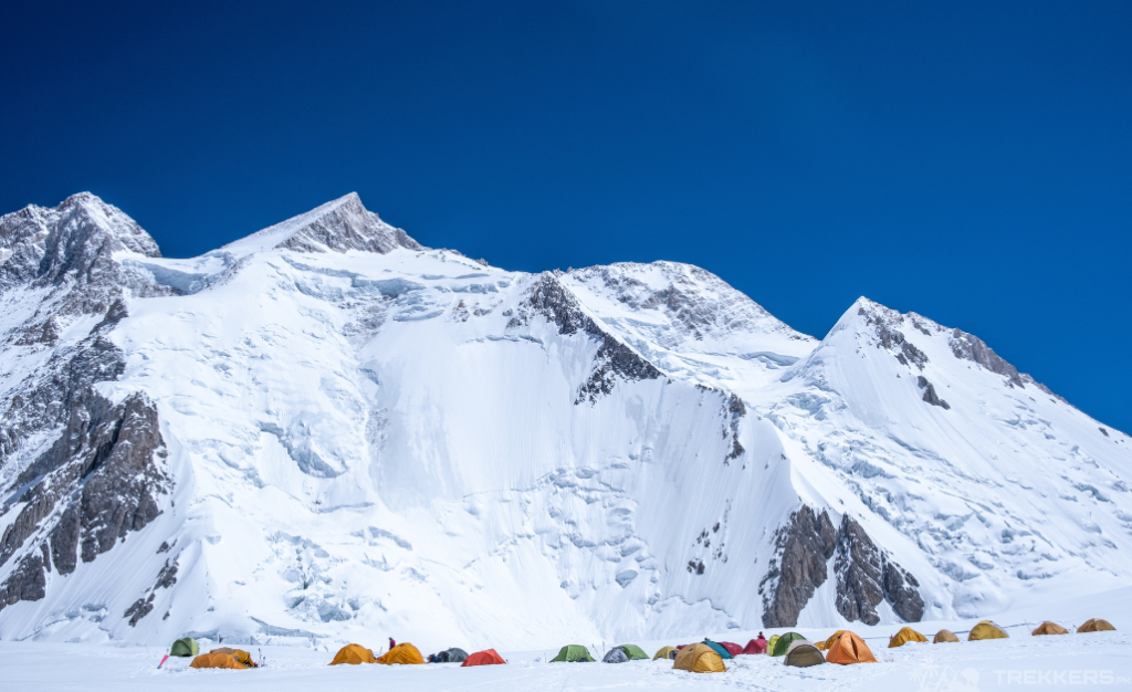
Gasherbrum II, also known as K4, is a prominent mountain located in the Karakoram Range of the Himalayas, bestride on the border between Pakistan and China. As the 13th-highest mountain in the world and the 5th-highest in Pakistan, it stands proudly at an elevation of approximately 8,035 meters (26,362 feet) above sea level.
It is the third-highest member of the Gasherbrum massif, behind Gasherbrum I and Broad Peak. Its breathtaking beauty, challenging terrain, and rich mountaineering history make it a compelling destination for climbers. It is for the adventurers seeking to test their skills and experience the high-altitude splendor of the Karakoram.
If you’re opting to conquer Gasherbrum II, the majestic mountain, this guide is going to be helpful for you throughout the hike!
How difficult is Gasherbrum II?
Gasherbrum II necessitates similar levels of preparation and physical fitness as other towering peaks. The slightly lower altitude of GII compared to giants like K2 somewhat reduces the challenges and hazards.
As NASA Earth reported, by 2012, there had been over 930 successful Gasherbrum II ascents, with a relatively low fatality rate of approximately 2 percent, thus the second-lowest fatality rate among the 8,000-meter peaks.
GII is characterized by less unpredictable weather, primarily harsh winds, milder freezing conditions, and a lower risk of avalanches. Eventually, making it an appealing choice for those aspiring to summit an 8,000-meter peak.
Gasherbrum Expedition History:
In 1956, an Austrian team headed by Fritz Moravec achieved the first successful ascent of Gasherbrum II. They conquered the summit on July 8, 1956, with Josef Larch and Hans Willenpart becoming the inaugural individuals to stand atop the mountain.
Since then, numerous successful expeditions have been recorded, but Gasherbrum II remains a challenging climb. Gasherbrum II continues to lure adventurers worldwide due to its captivating beauty. The enduring challenges ensure its status as a destination for mountaineers for years to come.
Gasherbrum Guide:
Including Gasherbrum, the other 8K wonders of Baltoro glacier journey starts from the northern city of Skardu. It is the jumping-off point to arrange and pack up all last-moment essentials. From travelling to the picturesque routes after Skardu, the pathway progressed to Askole, the town of Gilgit Baltistan. It is from Askole that all the trekkers reach Concordia, a converging place of the adjoining mountains of the Baltoro Glacier (Broad Peak and K2 and Gasherbrum series).
Summer is the perfect season for mounting on GII. It is the ideal eight-thousander for a greenhorn before making its way toward high-altitude peaks. The estimated distance from Concordia to the Base Camp of Gasherbrum II is approximately 12 to 15 km (7.5 to 9.3m). People often cover this distance on foot, and all in all, it can take several hours to complete.
Base Camp (Approximately 5,100 meters):
The expedition embarks from the Base Camp. Here, the mountaineers acclimatize themselves to the high altitude by spending several days at the Base Camp, making short hikes to higher elevations.

Camp I (Approximately 5,900 meters):
Ascending to Camp I, located on the glacier, it is necessary to carry useful gear and supplies for a safe hike.
Camp II (Approximately 6,400 meters):
Camp II, which is situated on a relatively flatter section of the glacier, serves to rest and restore your energies. Trekkers have to adapt to the weather conditions and continue the journey ahead.
Camp III (Approximately 7,000 meters):
Camp 3 is tough, as climbers claim. Because they are loaded with fuel and food for days, plus rope for fixing the section just below camp.
Gasherbrum II Summit (Approximately 8,035 meters):
Making the final push to the GII peak pays off all your tedious walk and hardships as your footprints touchdown at a height of 8,035 meters (26,362 feet). The rocky terrain is as arduous as the other mountains, but the challenges here are more predictable.
Descent:
When descending by retracing the same route, it is crucial to remain vigilant about weather conditions. Each step downward requires mindfulness and attention. A minor miscalculation can consequently lead to significant hardship or danger.
The tour guide provides an overview of the typical route and camps used for ascending Gasherbrum II. It’s important to note that climbing this peak is highly challenging and requires proper training, equipment, and experienced guidance. Hence, you must closely monitor safety, acclimatization, and weather conditions throughout the expedition.
